|
KV 19 (Mentuherkhepeshef)
General Site Information
Structure: KV 19
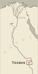
Location: Valley of the Kings, East Valley, Thebes West Bank, Thebes
Owner: Mentuherkhepeshef
Other designations: 11 [Champollion], 13 [Hay], 19 [Lepsius], 5
[Belzoni], S [Burton]
Site type: Tomb
Description
KV 19 is cut into the end of a short
spur projecting from the cliffs between KV 20 and KV 43, at the head
of a southeast branch of the southeast wadi. It lies on a
northwest-southeast axis. Except for the royal tombs of Rameses VII,
Rameses VIII, and Rameses IX, no tombs have entrances or corridors
as wide as those in KV 19. Texts on the reveals of gate B state that
the owner was a prince. Representations of the deceased in front of
various deities and hieratic texts of the Book of the Dead are
painted in corridor B, and enigmatic compositions occur on gate B.
The quarrying of the tomb was abandoned after the start of the
second corridor C. A rectangular pit just inside gate C may have
served for a burial, perhaps that of Mentuherkhepeshef or a later,
intrusive one.
Noteworthy features
This tomb may have originally been
intended for Rameses VIII, but was abandoned. A pit was cut in the
floor at the beginning of corridor C. The well-preserved painted
plaster decoration depicts the prince alone before deities.
Site History
KV 19 was originally intended for Prince Rameses Setherkhepeshef,
who later became Rameses VIII. It was taken over and decorated for
Prince Rameses Mentuherkhepeshef, a son of Rameses IX. When KV 19
was discovered by Belzoni in 1817, it contained an unspecified
number of intrusive burials, probably dating to Dynasty 22. The
mummy of the prince was never found.
Dating
This site was used during the following period(s):
New Kingdom, Dynasty 20, Rameses
IX
New Kingdom, Dynasty 20, Rameses VIII
Third Intermediate Period, Dynasty 22
History of
Exploration
Belzoni, Giovanni Battista (1817): Discovery
Belzoni, Giovanni Battista (1817): Excavation (conducted for Henry
Salt)
Burton, James (1825): Excavation (re-opening of entryway A and
discovery of rubble cross-wall)
Lane, Edward William (1826-1827): Visit
Franco-Tuscan Expedition (1828-1829): Epigraphy
L'Hôte, Nestor (1840): Visit
Lepsius, Carl Richard (1844-1845): Epigraphy
Carter, Howard (1903): Excavation (conducted in entryway A)
Ayrton, Edward Russell (1905-1906): Excavation (complete clearance
of tomb for Theodore M. Davis)
Weigall, Arthur E. P. (1908): Visit
Conservation
- Conservation history: The Supreme Council of
Antiquities has installed glass paneling, a wooden walkway and a
metal gate.
- Site condition: The painted plaster
decoration is in relatively good condition, although some damage has
occurred to the scenes closest to the entrance. During the 1994
floods, water entered the tomb but did not reach the level of the
painted decoration.
|

Printable Tomb Drawings
Axis in degrees: 135.47
Axis orientation: Southeast
Site Location
Latitude: 25.44 N
Longitude: 32.36 E
Elevation: 188.43 msl
North: 99,547.781
East: 94,279.512
JOG map reference: NG 36-10
Modern governorate: Qena (Qina)
Ancient nome: 4th Upper Egypt
Surveyed by TMP: Yes
Measurements
Maximum height: 3.79 m
Minimum width: 2.74 m
Maximum width: 3.69 m
Total length: 38.68 m
Total area: 132.83 m²
Total volume: 240.13 m³
Additional Tomb Information
Entrance location: Base of sheer cliff
Owner type: Prince
Entrance type: Ramp
Interior layout: Corridors
Axis type: Straight
Decoration
Painting
Categories of Objects Recovered
Architectural elements
Clothing
Human mummies
Jewellery
Vessels
Written documents
|