|
December 15, 2015 from JPL-NASA Website
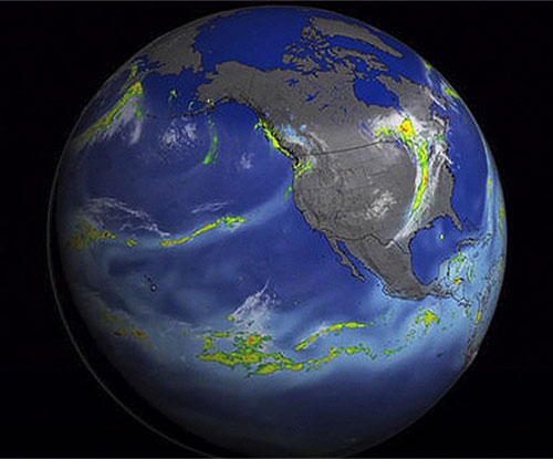
across the Pacific to California Oct. 25 to Nov. 2, 2014. White colors are clouds, light blues water vapor, and green to red precipitation.
Credit: NASA
New NASA satellite observations are beginning to show scientists its impact on the distribution of,
...around the globe.
New results presented Tuesday, Dec. 15, at the American Geophysical Union meeting in San Francisco show that atmospheric rivers, significant sources of rainfall, tend to intensify during El Niño events, and this year's strong El Niño likely will bring more precipitation to California and some relief for the drought.
Atmospheric rivers
are short-lived,
narrow streams of wind that carry water vapor from the tropical
oceans to mid-latitude land areas.
The increased ocean surface temperatures
influence air and moisture movement around the globe. Approximately
15 years of observations by NASA's fleet of Earth-observing
satellites show how El Niño affect multiple interconnected Earth
systems.
These concentrated rain bands account for 40 percent of California's water supply.
Their results suggest the number of atmospheric rivers California receives will remain the same, at an average of 10 per year, but they will be stronger, warmer and wetter.
It's the strength of the El Niño that determines its impact on total rainfall in California, said Martin Hoerling, a research meteorologist with the Earth Systems Research Laboratory at the National Oceanic and Atmospheric Administration in Boulder, Colorado.
His group ran a statistical analysis of the relationship between past El Niño strength and precipitation.
El Niño's elevated sea surface
temperatures shift rain patterns by affecting the temperature of the
air above the ocean, which alters how winds and air masses circulate
air around the planet.
Tropospheric ozone exists in the atmospheric layer closest to the surface and comprises ozone produced naturally and from human pollution. Ozone in the troposphere is a greenhouse gas and a health hazard.
Understanding El Niño's influence on
ozone concentration is important for understanding the atmosphere's
response to natural variation and distinguishing natural changes
from human causes.
Previous work showed that El Niño events cause a strong change in ozone in the tropics.
Olsen's new work uses satellite data, combined with a computer model, to show that a smaller but still significant effect occurs in the mid-latitudes.
Ozone in this region tends to decrease where El Niño-driven changes to local wind circulation patterns cause them to draw air upward.
According to Olsen, it's a large enough
influence that El Niño does need to be considered if you want to
attribute causes of ozone concentration changes and long-term
trends.
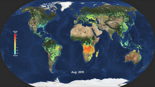
During El Niño, the number and size of fires increases in tropical forests across Asia and South America.
Fires in tropical forests also accelerate carbon dioxide buildup in the atmosphere and reduce air quality.
Indonesia, for example, has carbon-rich peatlands that ignite as soon as the rain stops, which is what happened this fall, Randerson said.
Meanwhile, Southeast Asia, Central
America and the southern Amazon have very high fire risk for 2016.
El Niño tends to reduce rainfall in their wet seasons, and less rain
means drier vegetation and drier air, which make forests vulnerable
to dry season burning.
The agency freely shares this unique
knowledge and works with institutions around the world to gain new
insights into how our planet is changing.
|


