|
PART FOUR
SEARCHING FOR THE FOUNTAINHEAD
17 - Megalithic England: The Atlantean Dimensions
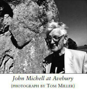
A Conversation with John Michell
J. Douglas Kenyon
Among those who have argued in their writings that there was once a
great and shining. albeit forgotten-to-history. fountainhead of civilization whose ghosts even now
continue to haunt us. few have been more eloquent than John Michell.
The author of more than a score of works on ancient mysteries.
sacred geometry. UFOs. unexplained phenomena. and the like. Michell
is familiar to American readers primarily through his visionary
classic The View Over Atlantis (a revised and rewritten version of
this book. published in 1995. is entitled The New View Over
Atlantis).
The Earth Spirit comprises Michell's profusely
illustrated essays on the ways. shrines. and mysteries of the subtle
animating forces of the planet and their near universal celebration
since the dawn of time.
Michell argues that across much of the earth are ancient earthworks
and stone monuments built for an unknown purpose. and that their
shared features suggest they might be part of a worldwide system
that he believes served the elemental science of the archaic
civilization that Plato called Atlantis.
Michell suggests. in this
connection. that the most significant modern discovery is that of
leys. a mysterious network of straight lines that link the ancient
places of Britain and have their counterparts in China. Australia.
South America. and elsewhere.
In The New View Over Atlantis, the Cambridge-educated scholar's
vision of a high megalithic civilization with a mastery of
principles far beyond present-day understanding is so thoroughly and
beautifully worked out that it becomes difficult, if not impossible.
to credit orthodox notions that the sources of our megalithic
heritage were but Stone Age hunter-gatherer societies with little on
their primitive minds but survival and procreation.
In detailed
descriptions of phenomena such as the precise terrestrial and
celestial alignments of ancient monuments long
ley lines,
advanced ancient sciences of numbers and sacred geometry. and
sophisticated prehistoric engineering.
Michell paints a picture of a
vast and coherent worldwide order beyond anything imaginable today.
"We live within the ruins of an ancient structure," he wrote in the
first edition of The New View Over Atlantis, "whose vast size has
hitherto rendered it invisible."
Emerging from current research is
the awesome image of an ancient structure so great that its outlines
have heretofore escaped understanding, one patiently awaiting our
ascent to a sufficient height whence its masterful design, stretched
out beneath us, can at last be appreciated.
Colin Wilson described The View Over Atlantis as,
"one of the great
seminal books of our generation - a book which will be argued
about for generations to come."
In an interview with Atlantis
Rising, Michell was asked if he had been keeping up with the new
research by Graham Hancock, Robert Bauval, and others into celestial
alignments of the monument of Egypt's Giza plane with the
constellation Orion and other stars.
He has, and hears an echo of
evidence he has found in British sites in "much older stone," where
alignments with significant stars also indicate the route of the
soul after death.
"Everywhere in the ancient world you see this terrific obsession
with death, reflected in the orientation of monuments," he observes.
To him it seems plain that the ancients possessed a kind of science
of immortality along the lines that Graham Hancock has suggested.
Unlike Colin Wilson, who theorizes that the ancients possessed
advanced psychic faculties but had no technology as we understand
the term, Michell believes it is very clear that they did.
He sees
it in their elaborate work of sitting and constructing monuments well
before the pyramids, and he sees it in their highly developed
sciences of numbers and geometry.
"It's truly just extraordinary that so many numerical harmonies are
put into basically very simple structures," he marvels, "and how
they designed others to concentrate on the long term. In this very
beautiful pattern is implied the kind of philosophy that says we can
construct, here on Earth, the path to the heavens."
He cites the
frequent use of the number 12, as in the twelve tribes of Israel and
a connection with the twelve signs of the zodiac, hinting at an
attempt to order life on Earth according to the pattern of things in
the heavens.
The question of technology becomes more pressing, but even more
difficult to answer, when one considers how the giant stones of
ancient sites were actually cut, tooled, and moved.
"It is a
mystery, actually," he concedes, "this incredible precision. And
again in megalithic times, the extraordinary weights involved -
raising blocks of one hundred tons or more, transporting them, and
setting them up. They used terrific labor ingenuity and, no doubt,
principles that aren't recognized today."
Could such principles have included some kind of levitation?
"There
are very persistent references from the Classical writers to the
power of sound," he says, "of the use of song and music and tone to
make things lighter, work songs where there's a rhythm got up, where
you can move things without a lot of
effort."
Whatever lost secrets the ancients may have possessed, Michell
believes that we can recover them and, in fact, will, when the time
is right.
"Human ingenuity is such that we can do anything we want.
If [the ancient knowledge] was actually needed, then it would return
again. There's no doubt about that," he says.
As to the suggestion
that we may have been left hidden caches of records such as the
legendary Hall of Records in Egypt, he thinks it very likely that
such treasure troves exist, but is not certain we will recognize
them when we see them.
"Plato went on about a certain canon of law possessed by the ancient
Egyptians by which numerical proportions and musical harmonies.
which dominate a society. enable it to continue on the same level
for literally thousands of years," he explains.
"Ancient
civilization lasted far longer than we can conceive of today, so it
seems to me that the whole society was based upon an understanding
of the harmonies by which the universe is laid. And acting upon
these by corresponding rituals. and that sort of thing. could hold
the society together through crises."
However, he concedes, being
sufficiently developed to appreciate the wisdom of such laws may be
another matter.
The possibility that we may have begun. at least in some quarters.
to resonate in harmony with the ancient chords of wisdom could open
the door to a return of ancient wisdom. In religious stories such as
the Revelation of Saint John. Michell sees the description of a "New
Jerusalem" coming down ready-made through a parting of the heavens
as the manifestation of an awakening and a wholesale change from the
patterns of a previous age.
Such a revelation comes, he believes, from nature, and "it is
invoked," he says.
"When we need it. we ask for it and it comes.
Today. when people are so uncertain. I think we are looking for a
truth and understanding that is beyond this world of chaos - of
secular theories. and of all the scientific theories that follow one
after the other but never establish anything - we're looking for the
higher truth that is always there. When we ask for that, we'll get
that."
In a chaotic world where dissonance and dissonant music apparently
reign supreme. there seems little hope that such a force can be
overcome, but Michell remains optimistic.
"It will overcome itself,"
he says.
"Certainly it has always been recognized that music is the
most powerful of the arts. As Plato said. forms of government
eventually follow the forms of music. That's why the ancients were
very careful in controlling music - no cacophony was allowed.
The
same music was heard at festivals every year and people were held
under a kind of enchantment [whereby] the mind was held under one
influence.
"Music is by far the most powerful means for therapy. Certainly the
music - and the other art forms too - that we see now threatens
chaos in society. It's a vessel that not only reflects what happens
but also actually determines what will happen.
As to what will come
about. I have no idea. I think more and more it's in the hands of
God and that there is now working out an alchemical process and that
changes come about through nature - through the natural process of
cause and effect.
Things are chaotic and we have a reaction and a
yearning for a source of order - there's a quest for that and an
invocation of that, and then there follows a revelation'"
Can the hoped-for change come without cataclysm?
"Every man-made
thing. every created thing comes to an end sooner or later," Michell
says.
"It's as inevitable as tomorrow's sunrise that all these
fruits shall have lain down. That which is artificial does not last
long. Look at the fall of Communism. It seemed so assured. so
completely in control. and it vanished practically overnght.
destroyed by its own inherent contradictions. People just couldn't
stand it anymore. It's so like the description of the fall of
Babylon [in Saint John's Revelation].
One day it's going with all
its wealth. parading its splendor. and the next day it's as if it
never had been. There is no doubt that all the institutions we know
will collapse. As to how orderly this process will be? The further
we go into megalomania and dependence on artificial systems. the
more drastic will be the reaction."
Michell sees a clear parallel between the destruction of Babylon
described in the Book of
Revelation and Plato's description of the fall of Atlantis, and he
believes the story is a warning about the danger in certain
ordering:
"Plato made it very clear he's
describing a geometrical pattern. the ground plan of Atlantis.
which is actually not adequate - like a man-made thing - based
on the number 10. where his ideal city was based on the number
12. He saw in Atlantis the mortal element prevailed and it
collapsed...
"It is about an error in the foundation law." Michell says. "which
became more and more exaggerated and eventually led to the downfall
of the whole thing. Life is bringing us through this process of
revelation what was not even conceivable one hundred years ago or
less - the idea of there being a cosmological pattern expressible
numerically. geometrically. beautifully. which is the best possible
reflection of the cosmos. That process establishes perfect patterns
in one's own mind and then later on becomes the pattern for society.
"Then. of course. again over many generations. what began as a
revelation becomes the iron law and becomes unjust and leads to that
process whereby the ideal turns into Babylon and is fit for
destruction. The best possible cosmological pattern that is kept up
in the institutes of society will enable the society to last for a
very long time. but no material thing lasts forever. Eventually it
turns into dust."
But the good news, says Michell, is that human nature will always
outlive any system of tyranny imposed upon it and, like the phoenix,
will rise again.
Today, he believes, we are living like
bats in the ruins of a haunted house among the relics and ruins of
the past. not just physically but also mentally, caught in outmoded
forms of thought. If one is going to free oneself from the age-old
spells, Michell says, one must challenge the dominant myths as he once did,
with the most dominant theory of biology, evolution.
"It's not exactly that they are wrong." he explains.
"It's that they
are partial and arbitrary. That's the way they teach in school and
college. You have to challenge them to get anywhere near adjusting
your mind to the reality of things. If you take to heart anyone's
scientific explanation, you will have an uneasy life: for, as you
know, the theories that are portrayed as certainties are always
changing.
If you believe what they tell you in school now, by the
time you get to be my age you'll be very old-fashioned indeed."
18 - Plato, the Truth
How Does the Credibility of the Best-Known Chronicler of Atlantis
Stand Up?
Frank Joseph
The Egyptian legend of Atlantis also current in folk-tale along the
Atlantic seaboard from Gibraltar to the Hebrides and among the
Yorubas in West Africa is not to be dismissed as pure fancy.
ROBERT GRAVES
THE GREEK MYTHS
As the only surviving report from antiquity
describing Atlantis.
Plato's account is the single most
important source of its kind at the disposal of investigators
pursuing the lost civilization.
His version continues to attract the
attention of both skeptics seeking to debunk Atlantis. and true
believers who contend that every word is quite literally factual.
However. an impartial reading of Plato's account as it is
matter-of-factly presented in his dialogues. the Timaeus and the
Critias. leaves most readers impressed that the events described so
plainly might just as well be found in the more easily verified
writings of Herodotus or Thucydides.
To be sure, gods, goddesses, and Titans are employed, as one may
expect. to stand for the powers of nature. fate. and the remote
past. just as they were called upon to do in virtually every other
Greek history.
As such. the myths were metaphors more than actual
religious personages. But this is largely the story of men and
events well within the realm of Mediterranean experience. and does
not overly tax our imagination.
The story as it stands seems far less fabulous than factual. if only
for its straightforward. unadorned rendering.
As William Blackett
wrote in his book Lost History of the World in 1881.
"The case is
put very differently by Plato. Divested of the simplicity of
story-telling. and free from the concealment of mysticism and fancy.
his account of the occurrence takes the form of a great historical
event."
The most common argument against the validity of the existence of
Atlantis as presented in the Timaeus and the Critias is that Plato
meant them to be understood merely as fictional recapitulations of
his ideal state.
While he obviously admires its high culture.
Atlantis was not a mirror image of the society described in The
Republic. There are very significant. nay. fundamental. differences
between the two. His authoritarian ideal of a regime ruled by
philosopher-kings was a single. race-conscious state. not a
far-flung confederation of various peoples under the old system of
monarchs constrained from wielding absolute power by a counsel of
royal equals.
Even if Atlantis had been tailored after his work The Republic
(which it was not). the addition of unnecessary, unphilosophic
material (lengthy descriptions of architecture, racetracks, etc.)
could not have illustrated any ideas that were not already
thoroughly covered in The Republic, and would have therefore been so
much superfluous repetition. something unparalleled in any of the
man's writings.
Moreover, Atlantis grows corrupt, the reason for its punishment by
the gods, hardly the fate of a society Plato hoped to immortalize as
his ideal.
His story achieves a more proper perspective when we
understand that it was not intended to stand alone as some kind of
an anomaly among his other philosophic works. but was rather the
first part of an unfinished anthology concerning the major events
that most shaped the history of the world until his time. It would
have been. by its very nature. an interpretive history, another work
on philosophy.
The Timaeus deals with the creation of the world. the nature of man.
and the first civilized societies.
The Critias, which survives only
in draft form. was to be a full account of the Atlanto-Athenian war
and its aftermath; its final section was to describe the critical
events of the recent past. up to the fourth century B.C.E. So. the
Atlantis story was intended as part of a far greater project. but
essentially no different in character from the rest of Plato's
writings.
More significant. if his account was pure invention. it
would not correspond as well as it does with accessible history. nor
go on to logically fill so many gaps in our knowledge of
pre-Classical antiquity by bridging such a great deal of otherwise
disconnected. isolated information.
But Plato's accuracy as historian could not be verified until our
own century. His description of a holy spring that ran through the
Acropolis was deemed entirely mythical until the discovery of
Mycenaean potsherds from the thirteenth century B.C.E. showing a
fountain in the midst of the Acropolis led some researchers to
reconsider his account.
Then, in 1938. renewed excavations revealed
that earthquake activity had closed an underground spring beneath
the Acropolis precisely where Plato said it had been.
During the
1950s. joint teams of Greek. German. and American archeologists
found their reconstruction of fifth-century-B.c.E. Athens matched
Plato's description of the city with unexpected exactitude.
We have,
therefore, every reason to assume his description of Atlantis is
just as accurate. Both his identification of the fountain at the
Acropolis and his precise knowledge of Athens reflect favorably on
his historical reliability.
There is also some evidence that Plato's account was not altogether
unknown to the Greeks in Classical times before he set it to paper.
At the Panathenaea Festival, held every year in Athens, women wore a
peplum, a kind of skirt, embroidered with symbolic designs
commemorating the goddess of their city.
Some of the peplum
depictions represented Athena's victory over the forces of Atlantis,
not a particularly remarkable fact in itself, except that the Panathenaea was founded 125 years before Plato's
birth.
T he Voyage to Atlantis, rediscovered and tragically lost in modern
times. was another earlier source. composed 150 years before Plato's
time by Dionysus of Miletus. A few other tantalizing fragments still
exist. singed scraps from the incinerated Great Library of
Alexandria. such as a fleeting reference to the second-century Roman
writer Elianus, whose Historia Naturalis described how the rulers of
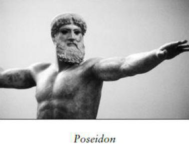
Atlantis dressed to demonstrate their descent from Poseidon.
The
story was given special credence by another philosopher. Proklos.
who told how Krantor. an early follower of Plato. seeking to
validate the legend of Atlantis. in 260 B.C.E. personally journeyed
to the Egyptian temple at Sais.
There he discovered the original
tablets. which confirmed the account. Translated. they paralleled
Plato's narrative detail for detail.
Krantor was a prominent scholar at the Great Library of Alexandria.
the center of Classical learning. where the story of Atlantis was
generally regarded as a credible episode in history by the leading
minds of the age, including the chief chronicler of the Roman
Empire, Strabo.
Long before its destruction. the Great Library
apparently contained a good deal of supportive materials that almost
universally convinced its researchers that Plato had described an
actual city in the "outer ocean."
It was only after the success of the Christian revolution that the
facts concerning Atlantis. like most
of "pagan" civilization, were lost. The story was condemned as
heresy because it was not found in the Bible and because it
supposedly predated God's creation of the world in 5508 B.C.E., a
date arrived at by the curious chronology of Christian theologians.
The subject remained closed until the discovery of America, when so
many mysterious parallels between the New World and the Old reminded
scholars of Plato's Atlantic empire.
Among the first was a
sixteenth-century explorer and cartographer, Francisco Lopez de Gomara, who was struck by descriptions of an "opposite continent"
(America) in the Timaeus. But the Alexandria of Classical antiquity
was, after all, only seventy-five miles from Sais, and any
investigator who wished to verify the details of Plato's account did
not have to travel far to read the tablets at the Temple of Neith.
According to the Roman historian Marcelinus (330-395 C.E.), scholars
at the Great Library knew of a geologic convulsion that,
"suddenly,
by a violent motion, opened up huge mouths and so swallowed up
portions of the Earth, as in the Atlantic sea, on the coast of
Europe, a large island was swallowed up."
The historiographer Theopompus believed Plato's story, as did the famous naturalist
Pliny the Elder.
The original source materials they once possessed,
lost since the collapse of Classical civilization, and the
fragmentary evidence remaining to us argue consistently on behalf of
Plato's credibility.
As Zadenk Kukal, a modern critic of the dialogues, has written,
"It
is probable that even if Plato had not written a single line about
Atlantis, all the archeological, ethnographic, and linguistic
mysteries that could not be explained would lead to some primeval
civilization located somewhere between the cultures of the Old and
New Worlds."
R. Catesby Taliaferro writes in the foreword to the Thomas Taylor
translation of the Timaeus and the Critias,
"It appears to me to be
at least as well attested as any other narration in any ancient
historian. Indeed, he [Plato], who proclaims that 'truth is the
source of every good both to gods and men,' and the whole of whose
works consist in detecting error and exploring certainty, can never
be supposed to have willfully deceived mankind by publishing an
extravagant romance as matter of fact, with all the precision of
historical detail."
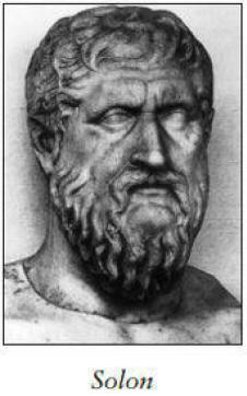
Plutarch, the great Greek biographer of the
first century C.E., wrote in his Life of Solon that the Greek
legislator cited in Plato's story,
"had undertaken to put into verse
this great history of Atlantis, which had been told to him by the
wise men of Sais."
The city itself played an important role in the Atlantis epic.
It
was one of the oldest major settlements in Egypt and served as the
first capital of the Lower Nile after the unification, which was
around 3100 B.C.E. - in other words, at very start of dynastic,
historic Egypt. As an indication of its and the Atlantean tablets'
antiquity, the Temple of Neith - where they were enshrined, was
established by Pharaoh Hor-aha, the first dynastic king of a united
Egypt.
Even Sonchis, the obscure character who told the story to Solon, was
a historical figure whose very name contributes to the authenticity
of the legend.
Sonchis is a Greek derivation of the Egyptian god
Suchos, known in his Nile homeland as Sebek. Sebek was a water deity
who, appropriately enough, worshiped at Sais - where the Atlantis
report was recorded - with his mother, Neith. It was in her temple,
Plato wrote, that the tablets were preserved.
Neith was one of the very oldest of predynastic figures, the
personification of the Waters of Chaos from which the Primal Mound,
the First Land, arose. She was known as the keeper of the most
ancient histories of both gods and men. The Minoan Mother Earth
goddess and the Greek Athena are later manifestations of Neith. She
fell into almost complete neglect after the passing of the Old
Kingdom.
But the First Birth-Giver experienced a popular revival
during the Saite Period of the twenty-sixth dynasty, when her temple
and its oldest records were restored - precisely the time Plato said
Solon visited Egypt. Herodotus wrote that Pharaoh Ahmose had just
finished refurbishing the Temple of Neith when Solon arrived in
Sais.
It is difficult to believe that Plato went to such lengths of mythic
and historic detail to create a mere fable. It is no less unlikely
that he suspected any connections among the priest Sonchis; the god
Sebek; his mother, the goddess Neith; and their intimate relation to
the story of Atlantis recorded so appropriately and unearthed in so
timely a fashion at Sais.
Another point worth noting: Krantor said the story was inscribed on
tablets mounted on a pillar in the Temple of Neith, while the
Critias tells that the royal proclamations in Atlantis were
inscribed on tablets posted to a column in the Temple of Poseidon:
The one seems to reflect and memorialize the other.
There are many unquestionably authentic touches throughout the
narrative.
For example, the Critias tells us that each of the
wealthy leaders in Atlantean society was required to provide for the
national armaments, including,
"four sailors to make up a compliment
of twelve ships."
Although it fell out of use in Plato's more
"democratic" times, in Periclean days and for some centuries before,
wealthy men known as Trierarchoi each had to undertake the funding
of a warship, complete with crew and weapons.
Of course, many more of those fragments still existed, even in
Classical times, when the story was generally accepted as a
historical event. One of those believers was the geographer
Poseidonous of Rhodes (130 to 50 B.C.E.), who conducted his studies
at Cadiz - the Gades in the Critias - in the Atlantean kingdom of
Gadeiros.
Strabo wrote of him,
"[H]e did well in citing the opinion
of Plato that the tradition concerning the island of Atlantis might
be received as something more than fiction."
Modern critics are less
generous. They continue to demean the story as nothing more than a
fabulous allegory intended to dramatize principles already laid out
in The Republic, with no basis in actual history except perhaps for
a sketchy reference to Minoan Crete.
In 1956, however, Albert Rivand, professor of classical history at
the Sorbonne, declared that both the Timaeus and the Critias
embodied ancient, historic traditions, and contained results of the
latest contemporary research carried out in Plato's day.
As Ivan Lissner wrote,
"That a distinguished French scholar who had spent
decades studying the Platonic texts should reach this conclusion is
most significant, because it invests the geographical and
ontological allusions in the two books with greater weight."
Standing alone, Plato's account is simple enough. But background
information on the principles in the narrative should raise it above
the level of a dry report and lend the reader a feeling of living
history.
More famous in his day than the author of the Timaeus and the
Critias was their chief character, Solon, one of the Seven Sages,
who "grew old ever learning new things" and whose name became
synonymous for a wise lawgiver. Timaeus, born in Locris, in southern
Italy, was an explorer and Pythagorean astronomer.
Critias the
Younger was an orator, statesman, poet, philosopher, and one of the
leaders of the Thirty Tyrants. He was also a first cousin of Plato's
mother. A vigorous man, he died on the battlefield at Aegospotamis,
in the Piraeus, in 403 B.C.E. as he approached his ninetieth
birthday.
Solon's unfinished manuscript was passed on to his brother Dropides,
the great-grandfather of Critias, and through succeeding generations
it became something of a family heirloom.
Though these leading
characters were real enough flesh-and-blood figures who related the
tale with great accuracy (as mentioned above, Krantor verified
Plato's version by comparing it with the original Egyptian tablets),
the Timaeus and the Critias are not stenographic records of
word-for-word conversations, but rather speeches organized to
illustrate ideas by ordering arguments into the most logically
convincing presentation, a standard exercise in the Classical
schools of high rhetoric.
So when Critias says he hopes he has not
forgotten all the details of the Atlantis story, the integrity of
the whole narrative does not hang by the memory of an old man.
Instead, Plato uses a standard rhetorical device to present his
description.
More likely than not, he had Solon's unfinished manuscript in front
of him as he wrote out the speeches.
He hints as much when he has Critias say,
"My great-grandfather, Dropides, had the original
writing, which is still in my possession."
It is even possible Plato
saw the original tablets at the Temple of Neith, as many scholars
are sure he traveled to Egypt himself on at least one occasion. His
narrative gains additional credence in the high standing of the men
involved. No fictional improvisations, their lives were linked to
the preservation of the account.
The Critias also differs from the rest of Plato's work, not only
because of its incompleteness, but also, unlike in the other
dialogues, Socrates does not interrupt the narrative with questions,
a sign, judging from his behavior in The Republic, of agreement. Of
course, he may have been saving his questions for later, but that
would not have been like him.
We, however, should continue to
question the story for more answers.
19 - The Aegean Atlantis Deception
Was Plato's Grand Tale Nothing More Than the Saga of an
Insignificant Greek Island?
Frank Joseph
Although Atlantis has been generally associated by most
investigators with the Atlantic Ocean. as a
preponderance of the evidence suggests. fringe theorists have
occasionally assigned the island to sometimes bizarre locations.
almost always for ulterior reasons.
The latest of these eccentric
interpretations gained some acceptance among professional
archeologists and historians. probably because it did not disturb
their modern bias against transoceanic voyages in pre-Classical
times.
The theory originally belonged to a pre-World War I writer for the
Journal of Hellenic Studies. K. T. Frost. who moved Atlantis from
the Atlantic Ocean to the Mediterranean island of Crete. Since then.
his hypothesis has been expanded by (perhaps not surprisingly)
mostly Greek scholars (Galanopoulas. Marinatos. et al.) to include
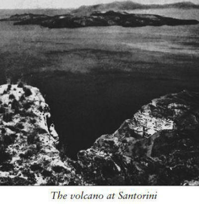
the Aegean island of Santorini. anciently known as Thera.
Their advocation of a Greek identity for Atlantis was the latest in an
unfortunate chauvinist tendency on the part of some Atlantologists
to associate their own national backgrounds with the lost
civilization.
Such extra-scientific motivations for conveniently finding Plato's
island in the investigator's own homeland have not done the search
much credit. But the ulterior motives currently driving professional
scholars of all nationalities (mostly Americans these days) to
insist that Crete or its neighboring island and Atlantis are one and
the same are more harmful. It is important. therefore. to understand
why they want to explain away Atlantis in what has come to be known
as the Minoan Hypothesis.
Thera was part of the Minoan commercial empire. and excavation on
Santorini (its modern name) uncovered a high level of early
civilization that once flourished there. The small island was
actually a volcanic mountain that exploded in much the same way as
the eruption at Krakatoa. and quite literally plunged into the sea.
The resulting two-hundred-foot-high wall of water that swept over
Crete wrecked havoc among its coastal ports. while accompanying
earthquakes badly damaged the inland capital. Knossos.
The Minoans
were knocked so off balance by this natural disaster that they could
not organize an effective resistance to Mycenaean aggression. and
their civilization disappeared. absorbed in part by invaders from
Greece. Seizing upon these events more than a thousand years before
his time, Plato, it is suggested, modeled Atlantis directly after
Crete and/or Thera as an analogy for his ideal state.
Although Thera is only a fraction of the size of his Atlantis and
lies in the Aegean Sea instead of the Atlantic Ocean, which he
specified. and was destroyed 7.800 years after the destruction
described in the dialogues, these apparent discrepancies are handily
dismissed by the assumption that Plato simply inflated his account
by a factor of 10.
He did so. it is claimed. deliberately - to
make for a grander tale. his figures were mistranslated from the
original Egyptian.
Both Atlanteans and Minoans. it is argued. built great palaces and
powerful cities. operated thalassocracies (seaborne empires).
practiced a pillar cult. traded in precious metals. and had
elephants roaming about. This interpretation is not without
supporting details. Eumelos. cited by Plato in the Critias as the
first Atlantean king after Atlas. is echoed in the Minoan island of
Melos and. in fact. is mentioned on an inscription of archaic Greek
at Thera itself bearing his name.
The Minoan theorists go on to argue against the Atlantic Ocean as
the correct site for Plato's island because only in the Aegean Sea
have relatively small tracts of land ever suddenly disappeared
beneath the surface, such as the city of Helice, in the Gulf of
Corinth.
The Azores, too, are ruled out as a possible location;
supposedly no islands in the area are known to have sunk over the
past 72,000 years. The numerous early-flood legends, particularly
the Babylonian Epic of Gilgamesh, are cited as literary evidence for Thera's destruction.
Even the concentric arrangement of the Atlantean capital, as described by Plato, may to this day be seen in
the waters of Santorini Bay.
It is true that, like Atlantis, Thera was a volcanic island and part
of an advanced thalassocracy, which vanished after its chief
mountain exploded and sank into the sea. But move beyond this
general comparison and the Minoan Hypothesis begins to unravel.
Thera was a minor colony of Minoan civilization, a small outpost,
not its capital, as the dialogues have Atlantis.
Mycenaean
influences from the Greek mainland did supplant Minoan culture on
Crete, but the transition appears to have been largely, if not
entirely, nonviolent, certainly nothing resembling the scope of
Plato's Atlanto-Athenian war that raged across the Mediterranean
World.
The Minoans never made a move to occupy Italy or Libya, nor did they
threaten to invade Egypt, as the Atlanteans were supposed to have
done. From everything scholars have been able to learn about them,
the Minoans were an extremely unwarlike people more interested in
commercial than military conquests, while the Atlanteans are
portrayed as aggressively bellicose.
As Kenneth Caroli, a leading
writer on the subject, concludes,
"Thera's candidacy as Atlantis
rests largely on its cataclysmic destruction alone, while Plato's
story had far more to do with a war between two antagonistic peoples
than with the disaster that later overwhelmed them both."
A CASE OF MISTAKEN IDENTITY
The Minoans operated a dynamic navy to combat piracy and keep open
the sea routes of international trade, but their Cretan cities were
not ringed by high walls or battlements of any kind; compare Knossos
or Phaistos with the armed towers and defense-in-depth of the walls
surrounding Atlantis.
Moreover, these leading cities of Minoan Crete
were laid out in the architectural canon of the square grid, unlike
the concentric circles upon which Atlantis was built.
Some theorists
claimed to have actually seen such a concentric arrangement
underwater, within the bay created when Thera's volcanic mountain
collapsed into the sea.

But Dorothy B. Vitaliano, a prominent geologist specializing in
volcanology with the U.S. Geological Survey, reports that the
subsurface topography at Santorini,
"was not in existence before the
Bronze Age eruption of the volcano; it has been created by
subsequent activity which built up the Kameni Islands in the middle
of the bay, to which a substantial amount of land was added as
recently as 1926.
Any traces of the pre-collapse topography would
long since have been buried beneath the pile of lava whose highest
portions emerge to form these islands."
Clearly, a recent geological feature has been mistaken for an
ancient city. Structures designed in concentric circles prevailed,
not in the Mediterranean World, but in the Atlantic, such as the
circular temples of the Canary Islands and Britain's Stonehenge.
Caroli points out that,
"the Atlantean capital lay on a substantial
plain surrounded by high mountains on a large island."
Thera does
not fit this description.
The Cretans and Therans did not plate floors, walls, and columns
with metal, as Plato says the Atlanteans did.
Plato's description of
Poseidon's temple implies a structure with metal-covered walls,
decorative pinnacles, and at least two pillars that were
metal-plated. All this sounds like a Bronze Age Phoenician temple.
Atlantis featured interconnecting canals and lay close to the sea;
Phaistos and Knossos are inland and have no canals. Nothing of the
kind existed at Knossos or any other Minoan city. Neither of these
Aegean locations had a harbor, because their lightweight ships could
be hauled up on the beach, unlike the oceangoing Atlantean ships,
which required the deep-water ports mentioned in the Critias.
In any case, the harbor arrangement described by Plato was
impossible in the eastern Mediterranean Sea, because its main
channel would have been fouled by stagnation without the ebb and
flow of tides that do occur "beyond the Pillars of Heracles."
This
point alone is sufficient to prove that he was describing a real
place in the Atlantic Ocean, not in the Aegean.
Melos, the Minoan island associated with the king Eumelos of Plato's
dialogues, is so tiny that it could never have supported the capital
of an allied kingdom. Actually, we learn in the Critias that Eumelos
ruled over that region closest to the Pillars of Heracles called
Gades, today's Cadiz, on the Atlantic coast of Spain.
That much in
Plato is certain. It takes quite a stretch of the imagination, to
say nothing of the facts, to relocate Eumelos in the Aegean.
Although it is the only name mentioned in the dialogues that does
indeed appear in the eastern Mediterranean, no other Atlantean king
finds a correspondence in that part of the world.
The island of Atlantis was supposed to have been rich in precious
metals; Crete and Thera have few. Then there is the self-evident
fact that Crete did not sink into the sea, as Atlantis was alleged
to have done. Thera's volcanic mountain did collapse beneath the
Aegean, but its island survives to this day; in the Critias, both
city and island were utterly destroyed.
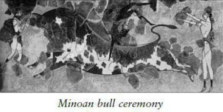
That rituals involving bulls were practiced by both Atlantean and
Minoan civilizations proves nothing, because the animal was
similarly venerated in mainland Greece, Egypt, Assyria, the Hittite
empire, and Iberia, as far back as Neolithic and even Paleolithic
times.
AN OCEAN OF SUNKEN ISLANDS
Contrary to the Minoan theorists, who assert that no sizable
territories have sunk into the Atlantic Ocean, as recently as 1931
the Fernando Noronha Islands were points of contention between Great
Britain and Portugal, until they sank after one week of seismic
activity.
Nor was Atlantis the only island-city to have
gone under the Atlantic.
The Janonius Map of 1649 identified Usedom.
formerly a famous mart. which was swallowed up by the waves of the
sea. The same island was mentioned five centuries earlier by the
Arab cartographer Edrisi.
Actually, the town in question was Vineta
on the northwest corner of the island of Usedom, near Rugen Island
in the North Sea. The North Frisian island of Rungholt, although not
as large as Usedom, was likewise once inhabited before it sank at
about the same time.
Of course. none of these islands may be identified with Atlantis.
but each does demonstrate that an Atlantean event was by no means
beyond the geologic purview of the Atlantic Ocean.
A LABYRINTH OF MISINFORMATION
As for the flood legend common to
the Epic of Gilgamesh, the Old
Testament. and early myth. it cannot have resulted from the
destruction of Thera. because the deluge myth prominent in Middle
Eastern civilization traces back to Sumerian origins. predating the
downfall of Minoan Crete by more than a thousand years.
The Greek
tradition of Theras. the mythic founder of Thera. has no elements in
common with Plato's story. nor does it hint of anything remotely
Atlantean.
The Minoan Hypothesis was so much in vogue among archeologists
during the 1970s that the famed oceanographer Jacques Cousteau spent
the better part of his time. energies. and nearly two million
dollars provided by the government of Monaco searching the depths
around Santorini.
Lured to the Aegean by a fashionable theory
designed to dismiss Plato, not explain him.
Cousteau turned up
nothing resembling Atlantis.
A CONFUSION OF DATES
While at first glance and from a distance the Minoan Hypothesis may
appear tenable, it begins to disintegrate the closer one approaches
it.
Practically point for point. an Aegean Atlantis does not match
Plato's straightforward account and is uniformly contradicted by the
evidence of geology. history. and comparative mythology. As a
last-ditch effort to save something of their excuse for a Cretan
interpretation. its advocates claim that Plato merely used the
general outline of events at Thera as a vague. historical framework
on which to present his notion of a consummate culture in the
fictionalized guise of Atlantis.
But here too they err because the dialogues define Atlantis as the
enemy of Plato's idealized state. So often has it been repeated that
he invented Atlantis to exemplify his "ideal society."
In any case. the ideal city Plato
does describe, Megaera, is square, not
circular.
But only one piece of evidence is required to invalidate the Minoan
Hypothesis in a single stroke. The cornerstone its supporters
depended upon was the date for the collapse of Thera's volcano into
the sea. because it was this disaster. they argued. that brought
down Minoan civilization in 1485 B.C.E.
The attendant tsunamis that
crashed along the shores of ancient Crete. and the earthquakes that
toppled her cities. were compounded by Greek armies who took
advantage of the natural catastrophe to wage war on the disorganized
Minoans. plunging them into a dark age from which they never
reemerged.
The pivotal date was arrived at by a process of ice-core drilling.
Caroli explains:
"Ice cores reveal 'acidity peaks' at the times of
major eruptions. because ash falls on the ice caps and affects their
chemistry.
Long cores by hollow pipes used as drills (some hundreds
of feet in length) taken from both
Greenland and Antarctica have been examined to determine the past
climate of the Earth.
"By analyzing the chemistry of these cores, 'acidity peaks' can be
found," he says, "many of them visible to the naked eye as dark
streaks in the ice made by the ash that fell long ago.
Some of these
cores, mainly those from Greenland, have annual layers, like tree
rings, or sedimentary glacial deposits at lake bottoms. These can
and have been counted back for thousands of years. The oldest of
these 'long cores' was drilled in 1963 at Camp Century in
north-central Greenland.
For years, it was the only core that went
back far enough and had been studied in sufficient detail to
potentially reveal the timing of Thera's eruption."
It is now understood that Thera erupted between 1623 and 1628 B.C.E.,
almost 150 earlier than the Minoan theorists believed.
The
significance of this discrepancy renders their entire interpretation
invalid, because Minoan civilization did not disappear in the wake
of a natural disaster.
"By all indications," Caroli points out, "the
Minoans not only survived the eruption, but reached their peak after
it."
Proponents of an Aegean Atlantis call upon Egyptian history for
corroboration, but here too they find contradiction to their
assertion that Minoan civilization was shattered by Thera's
eruption.
Pharaoh Amenhotep III dispatched an embassy to the cities
of Crete and found them still occupied nearly a century after their
supposed destruction. The Egyptian records were confirmed in the
late 1970s when excavators around Knossos discovered evidence for
the final occupation by the Minoans in 1380 B.C.E.
This was one
hundred years later than even the original, incorrect date for the
eruption of Thera and its assumed destruction of Aegean
civilization, the alleged source for Plato's story of Atlantis.
Caroli's assessment seems conclusive:
"And so the Minoan hypothesis
is left with no war, no maritime civilization destroyed by
catastrophe, the wrong kind of disaster, the wrong date, and no
comparable dark age as a result. What does that leave us? To my
mind, not much."
20 - Atlantology
- Psychotic or Inspired?
Media Stereotypes Aside. What Kind of Person Pursues Knowledge of a
Forgotten Civilization?
Frank Joseph
A mainstream archeologist interviewed about Atlantis on a recent
special for The Discovery Channel
declared that the only people who believe in such garbage are
cranks. fools. and charlatans.
His assessment is shared by
conventional scientists who insist that no one of any intellectual
worth would demean him- or herself by seriously considering any
sunken civilization. True. virtually no university-trained
researchers today are willing to risk the wrath of conservative
academics not above sabotaging the careers of independent-minded
colleagues.
But contrary to the establishment's defaming characterization of
those interested in the historical possibility of Atlantis, the
subject has for centuries attracted some of the best brains in the
world, Solon, one of the Seven Wise Men of Greece, introduced social
reforms and a legal code that formed the political basis of
Classical civilization. He was also the first great poet of Athens.
In the late sixth century B.C.E. the great law-giver traveled to
Sais, the Nile Delta capital of the twenty-sixth dynasty. where the
Temple of Neith was located.
Here a history of Etelenty was preserved in hieroglyphs inscribed or
painted on dedicated columns, which were translated for him by the
high priest Sonchis.
Returning to Greece, Solon worked all
the details of the account into an epic poem, Atlantikos, but was
distracted by political problems from completing the project before
his death in 560 B.C.E.
About 150 years later. the unfinished
manuscript was given to Plato. who formed two dialogues, the Timaeus
and the Critias, from it.
As one of the very greatest historical figures in Classical Greek
history. Solon's early connection with the story of Atlantis lends
it formidable credibility. But neither he nor Plato was the only
towering figure of Classical antiquity to embrace the reality of
Atlantis. Statius Sebosus was a Greek geographer and contemporary of
Plato mentioned by the Roman scientist Pliny the Elder for his
detailed description of Atlantis.
All the works of Statius Sebosus were lost with the fall of
Classical civilization. Dionysus of Miletus. also known as
Skytobrachion. for his prosthetic leather arm. wrote A Voyage to
Atlantis around
550 B.C.E.. predating not only Plato. but also Solon.
A copy of
Dionysus's manuscript was found among the personal papers of the
historical writer Pierre Benoit. Tragically. it was lost between the
restorers and borrowers who made use of this valuable piece of
source material after Benoit's death.
Another Greek historian. Dionysus of Mitylene (430 to 367 B.C.E.).
relying on pre-Classical sources. reported that "from its
deep-rooted base, the Phlegyan isle which stern Poseidon shook and
plunged beneath the waves with its impious inhabitants."
The volcanic island of Atlantis is suggested in the fiery (Phlegyan)
isle destroyed by the sea god.
Tragically. this is all that survives
from a lengthy discussion of Atlantis in the lost Argonautica.
mentioned four hundred years later by the Greek geographer Diodorus
Siculus as one of his major sources for information about the
ancient history of North Africa. Interestingly. Dionysus was a
contemporary of
Plato.
A utopian novel written by Francis Bacon in 1629,
The New Atlantis,
was the first written discussion of Atlantis since the fall of
Classical civilization and probably sparked Athanasius Kircher's
interest in the subject; he published his own scientific study of
Atlantis in The Subterranean World thirty-six years later. Although
a work of fiction.
The New Atlantis came about through excited
discussions in contemporary scholarly circles of reports from
travelers to America. They said that the indigenous peoples had oral
accounts of a land comprising numerous points in common with Plato's
sunken civilization; they even called it Aztlan. which paralleled a
native version of the Greek Atlantis.
The New Atlantis actually
incorporates some Atlanto-American myths Bacon heard repeated in
London.
A German polymath of the seventeenth century, the Jesuit priest, Athanasius Kircher was a pioneering mathematician, physicist,
chemist, linguist, and archeologist. He was the first to study
phosphorescence and he was the inventor of numerous futuristic
innovations including the slide projector and a prototype of the
microscope. The founding father of scientific Egyptology, he led the
first serious investigation of temple hieroglyphs.
Kircher was also
the first scholar to seriously investigate the Atlantis legend.
Initially skeptical. he cautiously began reconsidering its
credibility while assembling mythic traditions about a great flood
from numerous cultures in various parts of the world.
"I confess for a long time I had regarded all this," he said of
various European traditions of Atlantis, "as pure fables, to the day
when, better instructed in Oriental languages. I judged that all
these legends must be, after all, only the development of a great
truth."
His research led him to the immense collection of source
materials at the Vatican Library, where, as Europe's foremost
scholar, he had at his disposal all its formidable resources.
It was
here that he discovered a single piece of evidence that proved to
him that
the legend was actually fact.
Among the relatively few surviving documents from Imperial Rome,
Kircher found a well-preserved, treated-leather map purporting to
show the configuration and location of Atlantis. The map was not
Roman, but had been brought in the first century C.E. to Italy from
Egypt, where it had been executed. It survived the demise of
Classical times and found its way into the Vatican Library. Kircher
copied it precisely (adding only a visual reference to the New
World) and published it in The Subterranean World.
His caption
describes it as a map of the island of Atlantis, originally made in
Egypt after Plato's description, which suggests it was created
sometime following the fourth century C.E., perhaps by a Greek
mapmaker attached to the Ptolemys.
More probably, the map's first
home was the Great Library of Alexandria, from which numerous books
and references to Atlantis were lost, along with another
million-plus volumes, when the institution was burned by religious
fanatics.
By relocating to Rome, the map escaped that destruction.
Similar to modern conclusions forced by current understanding of
geology in the Mid-Atlantic Ridge, Kircher's map depicts Atlantis
not as a continent but as a large island about the size of Spain and
France combined. It shows a tall, centrally located volcano, most
likely meant to represent Mount Atlas, together with six major
rivers, something Plato does not mention (the Critias speaks of
large rivers on the island of Atlantis, but we are not told how
many).
Although the map vanished after Kircher's death in 1680, it
was the only known representation of Atlantis to have survived the
Ancient World. Thanks to his research and book, it survives today in
what is considered to be a close copy of the original.
Kircher was the first to publish such a map, probably the most
accurate of its kind to date.
Curiously, it is depicted upside down,
contrary to maps in both his day and ours. Yet this apparent anomaly
is proof of the map's authenticity, because Egyptian mapmakers, even
as late as Ptolemaic times, designed their maps with the Upper Nile
Valley (located in the south; "Upper" refers to its higher
elevation) at the top, because the river's headwaters are located in
the Sudan.
Olof Rudbeck (1630-1702) was Sweden's premiere scientific genius:
professor of medicine (Uppsala), discoverer of the lymph glands,
inventor of the anatomical theater dome, leading pioneer of modern
botany, designer of the first university gardens; initiator of Latin
as the lingua franca of the scientific world community; historian of
early Sweden.
A brilliant scholar fluent in Latin, Greek, and
Hebrew, Rudbeck possessed a grasp of Classical literature that was
nothing less than encyclopedic.
Combining his vast knowledge of the
ancient world with personal archeological research in his own
country, he concluded during a long, intense period of investigation
(1651 to 1698) that Atlantis was fact, not fiction, and the greatest
civilization in prehistory.
He believed that Norse myths and some physical evidence among his
country's megalithic ruins showed how a relatively few Atlantean
survivors may have had an impact on Sweden, contributing to its
cultural development, and laid the foundation (particularly in ship
construction) for what would much later be remembered as the Viking
Age (the ninth to twelfth centuries C.E.).
Critics have since misrepresented Rudbeck's work by claiming he
identified Sweden with Atlantis itself, but he never made such an
assertion. In their sloppy research they have confused him with
another eighteenth-century scholar, the French astronomer Jean
Bailey, who concluded (before being executed during the French
Revolution) that Spitzbergen, in the Arctic Ocean, was all that
remained of Atlantis.
Born in Kraljevic, Austria, on February 27, 1861, Rudolf Steiner was
a university-trained scientist, artist, and editor who founded a
Gnostic movement based on comprehension of the spiritual world
through pure thought and the highest faculties of mental knowledge.
This was the guiding principle of anthroposophy, knowledge produced
by the higher self in man, as he defined it, a spiritual perception
independent of the senses. Such instinctual awareness of the divine
energies that interpenetrate the entire universe is not new; on the
contrary, it was exercised by our ancestors during the deep past,
when they more freely and fully participated in the spiritual
processes of life.
A gradual attraction to vulgar materialism
through development of the high cultures in the ancient world
increasingly diminished their innate sensitivities, which eventually
atrophied but did not die out.
To awaken these faculties dormant in all men and women required,
Steiner believed, training their consciousness to look beyond mere
matter. These concepts were developed in his 1904 book, Cosmic
Memory: Prehistory of Earth and Man.
He maintained that before
Atlantis gradually sank, in 7227 B.C.E., its earliest inhabitants
formed one of mankind's root races, a people who did not require
speech but instead communicated telepathically in images, not words,
as part of their immediate experience with
God.

According to Steiner, the story of Atlantis was dramatically
revealed in Germanic myth, wherein fiery Musplheim corresponded to
the southern, volcanic area of the Atlantic land, while frosty
Niflheim was located in the north.
Steiner wrote that the Atlanteans
developed the first concept of good versus evil and laid the
groundwork for all ethical and legal systems. Their leaders were
spiritual initiates able to manipulate the forces of nature through
control of the life force and development of etheric technology.
Seven epochs comprise the "post-Atlantis period," of which ours, the
Euro-American epoch, will end in C.E. 3573.
Cosmic Memory goes on to
describe the earlier and contemporary Pacific
civilization of Lemuria, with stress on the highly evolved clairvoyant powers of its
people. Steiner defined Atlantis as the turning point in an ongoing
struggle between the human search for community and our experience
of individuality.
The former, with its growing emphasis on materialism, dragged down
the spiritual needs of the latter, culminating eventually in the
Atlantean cataclysm. In this interpretation of the past, Steiner
opposed Marxism.
To him, spirit, not economics, drives history.
Steiner's views of Atlantis and Lemuria are important if only
because of the educational Waldorf movement he founded, which still
operates about one hundred schools attended by tens of thousands of
students in Europe and the United States.
He died on March 30, 1925,
in Dornach, Switzerland, where he had founded his school of
spiritual science twelve
years earlier.
James Lewis Thomas Chalmers Spence, born on November 25. 1874. in
Forfarshire. Scotland. was a prominent mythologist who inherited
Ignatius Donnelly's position as the world's leading Atlantologist of
the early twentieth century.
An alumnus of Edinburgh University.
Spence was made a fellow of the Royal Anthropology Institute of
Great Britain and Ireland. and elected vice president of the
Scottish Anthropology and Folklore Society.
Awarded a Royal Pension
for services to culture, he published more than forty books.
Many of
them, such as the Dictionary of Non-Classical Mythology coauthored
with Marian Edwards, are still in print and widely regarded as the
best source materials of their kind.

His interpretation of the
Maya's Popol Vuh (Book of Consul) won
international acclaim, but he is best remembered for,
-
The Problem of
Atlantis (1924)
-
Atlantis in America (1925)
-
The History of Atlantis
(1926)
-
Will Europe Follow Atlantis? (1942)
-
The Occult Sciences
in Atlantis (1943)
During the early 1930s, he edited a prestigious
journal, The Atlantis Quarterly.
The Problem of Lemuria (1932) is
still probably the best book on its subject.
Lewis Spence died on March 3. 1955. and was succeeded by the British
scholar Edgerton Sykes. Trained as an engineer. Sykes was a foreign
correspondent for the British press. invaluable because of his
quadrilingual fluency.
During his long life in the diplomatic
service and as a fellow of the Royal Geographical Society, he
published an estimated three million words in numerous books and
magazine articles, many of them devoted to a rational understanding
of the Atlantis controversy.
Sykes's erudite journals and encyclopedias of comparative myth went
a long way in sustaining and expanding interest in Atlantis
throughout the mid-twentieth century.
He died in 1983. just before
his ninetieth birthday. but a legacy in the form of his large
library of Atlantis-related material is preserved in its own room at
Edgar Cayce's Association for Research and Enlightenment in Virginia
Beach. Virginia.
Contrary to mean-spirited characterizations by conservative
archeologists, it says something for the credibility of Atlantis
that many of the greatest thinkers in the history of Western
civilization have been among its most prominent advocates.
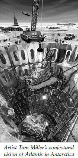
21 - Atlantis in Antarctica
Forget about the North Atlantic and the Aegean, Says Author Rand
Flem-Ath
J. Douglas Kenyon
In the not-too-distant future, Atlantis-seeking archeologists may
have to trade in their sun hats and scuba
gear for snow goggles and parkas.
If a rapidly growing body of
opinion proves correct, instead of the bottom of the ocean, the next
great arena of exploration for the fabled lost continent could be
the frozen wastelands at the bottom of the earth. And before
scoffing too vigorously, proponents of probable locations for
Atlantis - such as the North Atlantic Ocean and the Aegean Sea, as
well as other candidates - would be well advised to give the
new arguments for Atlantis in Antarctica a fair hearing.
Already enlisted in the ranks of those who take the notion very
seriously are such luminaries as John Anthony West and Graham
Hancock.
Founded on a scientific theory developed by the late Dr.
Charles Hapgood in close interaction with no less a personage than
Albert Einstein, the idea appears robust enough to withstand the
most virulent attacks expected from the guardians of scientific
orthodoxy.
At any rate, it will not take a wholesale melting of the
ice cap to settle the question. A few properly directed satellite
pictures and the appropriate seismic surveys could quickly determine
whether or not an advanced civilization has ever flourished on the
lands beneath the ice.
Leading the charge of those betting that such evidence will soon be
forthcoming are Canadian researchers Rand and Rose Flem-Ath, the
authors of When the Sky Fell: In Search of Atlantis, a book that
contains the couple's painstaking synthesis of Hapgood's theory of
Earth's crust displacement and their own groundbreaking discoveries.
The result has already won many converts.
Graham Hancock believes the Flem-Aths have provided the first truly
satisfactory answer to the question of precisely what happened to
Plato's giant lost continent. Since devoting a chapter in his
best-selling Fingerprints of the Gods: The Evidence of Earth's Lost
Civilization to the work of the Flem-Aths, Hancock continues to
discuss in media appearances the importance of their Antarctic
theories.
Flem-Ath himself talked about his ideas on the February
1996 NBC Special "The Mysterious Origins of Man."
To get to the bottom of all the excitement, if not the planet,
Atlantis Rising interviewed Rand Flem-Ath at his home on Vancouver
Island in British Columbia.
The author has not forgotten how his own interest in Atlantis began.
In the summer of 1966, while waiting for an interview for a
librarian's position in Victoria, British Columbia, he was working
on a screenplay involving marooned aliens hibernating in ice on
Earth for 10,000 years.
Suddenly, on the radio, came pop singer
Donovan's hit "Hail Atlantis."
"Hey, that's a good idea," Flem-Ath
thought.
"I wanted ice, so I thought, 'Now where can I have ice and
an island continent?' and I thought of Antarctica."
Later, researching the idea, he read everything he could find on
Atlantis, including Plato's famous account in the Timaeus and the
Critias, where Egyptian priests described Atlantis - its features,
location, history and demise - to the Greek lawgiver Solon. At first
the story didn't work for Flem-Ath, but that
changed when he made a startling discovery - unmistakable
similarities between two obscure but remarkable maps.
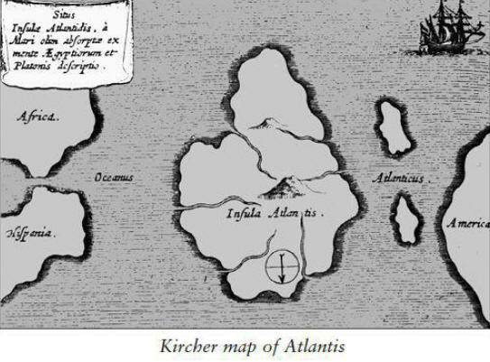
A 1665 map by the Jesuit scholar Athenasius Kircher, copied from
much older sources. seemed to have placed Atlantis in the North
Atlantic but. strangely. had put north at the bottom of the page.
apparently forcing study upside down.
The
1513 Piri Ri'is map, also
copied from much more ancient sources. demonstrated that an ice age
civilization had sufficient geographic knowledge to accurately map
Antarctica's coast as it existed beneath an ice cap many millennia
old (as pointed out by Charles Hapgood in Maps of the Ancient Sea
Kings: Evidence of Advanced Civilization in the Ice Age).
What
seemed obvious to Flem-Ath was that both maps depicted the same
landmass.
Suddenly Antarctic Atlantis "stopped being a science-fiction story," Flem-Ath says.
The revelation had dawned that it might be "something
that could have been real." Further study of Plato yielded even more
clues.
"I noticed that the description is from Atlantis." he
recalls.
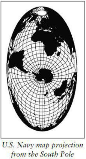
Soon, armed with a U.S. Navy map of the world as seen from
the South Pole, he discovered a new way of understanding Plato's
story and a new way of looking at Kircher's map.
Viewed from this
southern perspective. all of the world's oceans appear as parts of
one great ocean. or as what is described in Plato as "the real
ocean." and the lands beyond as a "whole opposite continent."
Sitting in the middle of that great ocean. at the very navel of the
world. is Antarctica.
Suddenly, it was possible to understand Kircher's map as drawn, with north at the top, Africa and Madagascar
to the left, and the tip of South America on the right.
The term "Atlantic Ocean," Flem-Ath soon realized, had meant
something quite different in Plato's time. To the ancients, it
included all of the world's oceans.
The idea becomes clearer when
one remembers from Greek mythology that Atlas (a name closely
related to Atlantis and Atlantic) held the entire world on his
shoulders.

The "whole opposite continent," which surrounded the "real ocean" in
Plato's account, consisted of South America, North America, Africa,
Europe, and Asia, all fused together in the Atlantean worldview as
though they were one continuous landmass.
And, in fact, these five
continents were at that time (9600 B.C.E.) one landmass in the
geographic sense.
Flem-Ath would render Plato's account to read:
"Long ago the World
Ocean was navigated beyond the Straits of Gibraltar by sailors from
an island larger than North Africa and the Middle East combined.
After leaving Antarctica you would encounter the Antarctic
archipelago (islands currently under ice) and from them you would
reach the World Continent which encircles the World Ocean.
The
Mediterranean Sea is very small compared to the World Ocean and
could even be called a bay. But beyond the Mediterranean Sea is a
World Ocean which is encircled by one continuous landmass."
A common mistake in most readings of Plato, Flem-Ath believes, is
the inappropriate attempt to interpret the ancient account in the
light of modern concepts.
Another example is the familiar reference
to the Pillars of Hercules. beyond which Atlantis was said to
reside. Though it is true that the term sometimes referred to the
Straits of Gibralter, an equally valid interpretation is that it
meant "the limits of the known world."
For Flem-Ath. the world as seen from Antarctica matched perfectly
the ancient Egyptians' account of the world as seen from Atlantis.
The ancient geography was, in fact, far more advanced than our own.
which made sense if Atlantis was, as Plato argued, an advanced
civilization.
Platonic theories notwithstanding. the most difficult challenge -
explaining how Atlantis might have become Antarctica - remained. How
could land currently covered with thousands of feet of ice have once
supported any kind of human habitation. much less a great
civilization on the scale described by Plato? For the Flem-Aths. the
answer, it turned out, had already been worked out - thoroughly,
convincingly, and published in the Yale Scientific Journal in the
mid-1950s.
In his theory of Earth crust displacement. Professor Charles Hapgood
had - citing vast climatalogical. paleontological. and
anthropological evidence - argued that the entire outer shell of the
earth periodically shifts over its inner layers. bringing about
major climatic changes. The climatic zones (polar. temperate. and
tropical) remain the same because the Sun still shines from the same
angle in the sky. but as the outer shell shifts. it moves through
those zones.
From the perspective of earth's population. it seems as
though the sky is falling. In reality. the Earth's crust is shifting
to another location.
Some lands move toward the tropics. Others shift. with the same
movement. toward the poles; yet others escape great changes in
latitude. The consequences of such movements are. of course.
catastrophes. as throughout the world massive earthquakes shake the
land and enormous tidal waves batter the continental shelves. As old
ice caps forsake the polar zones. they melt. raising sea levels
higher and higher.
Everywhere. and by whatever means possible.
people seek higher ground to avoid an ocean in upheaval.

The Flem-Aths corresponded with Hapgood from 1977 until his death in
the early eighties, and though he differed with them about the
location of Atlantis (his candidate was the Rocks of Saint Peter and
Saint Paul), he praised their scientific efforts to buttress his
theory.
In the summer of 1995, Flem-Ath was allowed to read
Hapgood's voluminous, 170-page correspondence with Albert Einstein,
wherein he discovered a much more direct collaboration between the
two men than had been previously supposed.
Upon first hearing of the research (in correspondence from Hapgood).
Einstein responded:
"very impressive... have the impression that
your hypothesis is correct."
Subsequently, Einstein raised numerous
questions that Hapgood answered with such thoroughness that Einstein
was eventually persuaded to write a glowing foreword for Hapgood's
book Earth's Shifting Crust: A Key to Some Basic Problems of Earth
Science.
Earth crust displacement is not mutually exclusive with the
now widely accepted theory of continental drift.
According to Flem-Ath,
"they share one assumption. that the outer crust is mobile
in relation to the interior. but in plate tectonics the movement is
extremely slow."
Earth crust displacement suggests that over long
periods of time, approximately 41.000 years. certain forces build
toward a breaking point.
Among the factors at work: a massive
buildup of ice at the poles. which distorts the weight of the crust;
the tilt of the earth's axis. which changes by more than three
degrees every 41.000 years (not to be confused with the wobble that
causes the precession of the equinoxes); and the proximity of the
earth to the Sun. which also varies over thousands of years.
"One of the common mistakes," says Flem-Ath, "is to think of the
continents and the oceans as being separate, but really the fact
that there's water on certain parts of the plates is irrelevant.
What we have in plate tectonics are a series of plates that are
moving very gradually in relationship to each other.
But what we
have in Earth crust displacement is that all of the plates are
considered as one single unit, as part of the outer shell of the
earth, which changes place relative to the interior of the earth."
The theory. says Flem-Ath. offers elegant explanations for such
phenomena as the rapid extinction of the mammoths in Siberia. the
near universal presence of cataclysmic myths among primitive
peoples. and many geographic and geological anomalies left
unexplained by any other theory.
Most of the evidence usually cited
to support the idea of an ice age serves the theory of Earth crust
displacement even better. Under the latter. some parts of the planet
are always in an ice age; others are not. As lands change latitude.
they move either into or out of an ice age.
The same change that put
western Antarctica in the ice box also quick-froze Siberia but
thawed out much of North America.
Although many establishment geologists insist that the Antarctic ice
cap is much older that the 11,600 years indicated by Plato, Flem-Ath
points out that the core sampling on which most of the dating is
based is taken from Greater Antarctica, which was indeed under ice,
even during the time of Atlantis.
The suggestion here is that a
movement of about 30 degrees or about two thousand miles occurred
within a relatively short span of time.
Before such a movement, the Palmer peninsula of Lesser Antarctica
(the part closest to South America and whose sovereignty is
presently disputed by Chile, Argentina, and Great Britain) would
have projected an area the size of western Europe beyond the
Antarctic circle into temperate latitudes reaching as far as
Mediterranean-like climes.
In the meantime, Greater Antarctica would
have remained under ice in the Antarctic circle.
"An area such as that described by Plato," says Flem-Ath, "would be
the size of Pennsylvania, with a city comparable to modern-day
London" - not a bad target for satellite photography.
Concentric
circles or other large geometric features should be easily
discernible through the ice.
Flem-Ath believes that in most areas, Plato should be taken at his
word, though he does suspect that there may have been some
fabrications in the story.
The war between the Atlanteans and the
Greeks, for example, he believes may have been cooked up to please
the local audience. In regard to the scale of Atlantean achievement,
however, he takes Plato quite seriously and is very impressed.
"The
engineering feats described," says Flem-Ath, "would have required
incredible skill, more so than even what we have
today."
As for the notion that Plato's numbers should be scaled down by a
factor of ten - a frequent argument used to support claims that
Atlantis was really the Minoan civilization in the Aegean - he
doesn't buy it.
"A factor of ten error might be understandable when
you are using Arabic numbers, with a difference between one hundred
and one thousand of one decimal place, but in Egyptian numbering the
difference between the two numbers is unmistakable."
For him the
argument is similar to the one for a North Atlantic location, in
which a modern concept has been inappropriately superimposed upon an
ancient one.
So far Flem-Ath's ideas have been largely ignored by the scientific
establishment, but he believes that at least Hapgood's arguments may
be getting close to some kind of acceptance.
"Quite often new ideas
take about fifty years to be absorbed," he says, "and we're getting
close to the time."
If, in fact, satellite photography and seismic surveys produce the
indications that Flem-Ath expects, what next?
"The ice in the region
that we are talking about is relatively shallow," he says, "less
than half a kilometer, and once we've pinpointed the area, it should
be relatively easy to sink a shaft and find something."
That "something" could be among the finest and most dramatic
artifacts ever discovered - quick-frozen and stored undisturbed for
almost 12,000 years. Is this a prospect hot enough to melt the
hearts of even the most hardened skeptics?
We shall see.
22 - Blueprint from Atlantis
Doments of Ancient Monuments Have Something to Tell Us about the
History of Earth's Shifting
Crust?
Rand Flem-Ath
In November 1993 I received a fax from John Anthony West that
started me on a four-year quest.
The
article that slipped through the fax machine that day had been
written by an Egyptian-born construction engineer by the name of
Robert Bauval. Little did I suspect that Bauval would soon become
known for his revolutionary theory that the pyramids of Egypt were a
mirror image of the constellation of Orion. Bauval discusses this in
his book. coauthored by Adrian Gilbert, The Orion Mystery: Unlocking
the Secrets of the Pyramids.
However. in the article I read that
day. Robert Bauval had taken his idea even further. He revealed that
not only the pyramids but also that most famous of all sculptures.
the Sphinx. were oriented to the constellation of Orion as it
appeared in 10.500 B.C.E.
This he discusses in another book. cowritten with Graham Hancock, entitled
The Message of the Sphinx: A
Quest for the Hidden Legacy of Mankind.
John followed up his fax with a telephone call; this was to be one
of our earliest conversations. He had read the original manuscript
of our book When the Sky Fell: In Search of Atlantis and had
volunteered to write an afterword.
Our theory that Antarctica could
hold the remains of Atlantis was framed by the concept of a
geological phenomenon known as Earth crust displacement. about which
I had spent years corresponding with Charles Hapgood.
I had concluded. based on extensive research into the origins of
agriculture and the late Pleistocene extinctions. that 9600 B.C.E.
was the most probable date of the last displacement.
After
discussing details about the afterword for When the Sky Fell, John.
in his usual direct manner. asked me:
"If Bauval is right that the
Sphinx points to a date of 10.500 B.C.E.. how do you reconcile that
date with your time period of 9600 B.C.E.. for the last displacement
of the earth's crust?"
John had put his finger on a very important point.
If the Sphinx had
been built before the crustal displacement. as Bauval's data
indicated. then the monument's orientation would have been changed
as the earth's crust shifted. resulting in a misalignment.
But the
fact remains that the Sphinx and. indeed. the whole Giza complex are
precisely aligned with the earth's cardinal points.
"Either Bauval's
calculations of the astroarcheology are incorrect or your date of
9600 B.C.E. is wrong." John said. "How sure are you of that date?
Could you be wrong by nine hundred years?"
"John." I replied. "a host of archeological and geological
radiocarbon dates indicate unequivocally that the last catastrophe
occurred in 9600 B.C.E. I'm sticking with that. Perhaps the ancient
Egyptians were memorializing an earlier date that was tremendously
significant to them. not necessarily the date that the Sphinx was
carved."
In October 1996. Robert Bauval and I continued the friendly debate
at a conference in Boulder, Colorado.
I was convinced that the
Sphinx was constructed immediately after 9600 B.C.E. and I explained
why. Imagine. I began. that an asteroid or giant comet hit the
United States today. utterly destroying the continent and throwing
the whole culture back to the most primitive of living conditions.
Then imagine that a team of scientists, perhaps safely under the
ocean in a submarine, survived the cataclysm and decided to
commemorate their nation and leave a message for the future by
constructing a monument aligned to the heavens.
What date would they
choose to mark the memory of the United States of America? Would it
be 1996, the year that their world ended? I don't think so. I
believe that they would orient their monument to 1776: the date that
the nation was born. And in the same way, I think that although the
Sphinx was created around 9600 B.C.E., it is oriented to 10,500
B.C.E. because that date was significant to their culture.
Now, it happens that inconsistencies and puzzles in science are like
oxygen to my blood! My entire philosophy of science is predicated on
the motto that anomalies are gateways to discovery. I usually
conduct my research in a methodical and painstaking (some might say
obsessive) manner.
However, over the past twenty years of
investigating the problem of Atlantis and the earth's shifting
crust, I have discovered again and again that chance plays a
critical role in discovery.
Between writing novels, my wife, Rose, works part time at the local
university library, and her serendipitous approach to research
ideally balances my own meticulous methods. I can't begin to count
the number of times that she has brought home a book that turned out
to be exactly what I needed. So when she presented me with
Archaeoastronomy in Pre-Columbian America, I eagerly flipped it
open.
Written in 1975 by Dr. Anthony F. Aveni, one of the leading
astroarcheologists in the world, the book dropped right into my lap
a critical piece of the puzzle that I was trying to solve. It
appears that almost all of the major megalithic monuments of
Mesoamerica are oriented east of true north. Aveni wrote that the
people of Mesoamerica did tend to lay out many of their cities
oriented slightly east of true north. Fifty of the fifty-six sites
examined east of north.
However, I found Aveni's explanation for this alignment wanting. He
believes that the Street of the Dead, the famous avenue at
Teotihuacan (near Mexico City), is the key to the whole mystery of
why the monuments are strangely misaligned. This street, which runs
directly toward the Pyramid of the Moon, is misaligned fifteen and a
half degrees east of north.
Because it points within one degree to
the Pleiades constellation (a set of stars important to Mesoamerican
mythology), Aveni views this skewed alignment as a kind of template,
a master plan, for the rest of the megaliths throughout Mesoamerica.
While this is true for Teotihuacan's Street of the Dead, it is not
true for the other sites that Aveni lists in his book.
His argument
that the other forty-nine sites are merely inadequate copies of the
holy alignment of Teotihuacan rang hollow.
I had a different idea, a theory based on the science of geodesy,
which is the study of the measurement of the shape and the size of
the earth. In addition to astronomical observatories, what if these
Mesoamerican sites were part of a vast geographical survey? My study
of ancient maps had convinced me that the Atlanteans had mapped the
world.
What if the orientations of the most ancient cities of Mexico
were remnants of a lost science, the science of geography? What if
the alignment of the ancient cities was a stone stencil, a precise
blueprint of a prediluvian Earth?
Teotihuacan lies upon the longitude of 98:53 west. If we subtract
the 15:28 degrees that it is misaligned, we get a location of 83:25
west, less than half a degree off Charles Hapgood's location of the
North Pole prior to 9600 B.C.E.
In other words, the Street of the
Dead was fifteen and a half degrees west of the longitude that Hapgood had calibrated for the old pole.
When I made this discovery. I was naturally very excited. Could it
be that the ancient monuments of Mexico were orientated to the pole
before the last Earth crust displacement? The implications were
profound. Such an orientation would point to the existence of a
civilization that must have held scientific knowledge of the earth's
geography. They also must have possessed sophisticated surveying
methods that they put to use in America before the earth's crust
shifted.
I soon discovered that several important Mesoamerican sites (Tula.
Tenayucan. Copan. and Xochicalco. for instance) matched my geodetic
theory. Each of their misalignments. when subtracted from their
current longitude. yielded the longitude of the North Pole before
the last Earth crust displacement (83 degree west). What if. I
wondered. there were other sites in the Old World that were
orientated to the old pole?
I began to research sites in Iraq. cradle of the most ancient
civilizations. Unlike in Mesoamerica. these sites had not been
studied in relation to their misalignment to the earth's cardinal
points. I had to piece together the evidence from site to site. from
author to author. But the tedious task was worth the startling
result obtained. I soon discovered that many of the oldest sites in
the Middle East are west of today's North Pole. Like the ancient
sites of Mesoamerica. they were oriented to the old pole.
In the ancient city of Ur. its ziggurat (a stepped pyramid
symbolizing a sacred mountain) and its shrine to the Moon god. Nanna.
are oriented west of north (toward the old pole in the Hudson Bay).
Without control of the holy city of Nippur. no ruler could
rightfully claim to be the king of Sumeria. The remains of the city
lie south of Baghdad. where some of the most famous tablets in
archeology were unearthed at the turn of the twentieth century.
The
tablets disclosed the Sumerian belief in the existence of a
long-lost island paradise called Dilmun. The myth of Dilmun. which
we show in When the Sky Fell, is remarkably similar to the mythology
of the Haida people of British Columbia. and relates how the island
paradise was destroyed by the god Enlil in a Great Flood.
Enlil's
incredible power is honored at Nippur with a temple and a ziggurat
that is skewed west of north. The ziggurat and White Temple of the
Sumerian city of Uruk also point to Hudson Bay rather than true
north.
The more I looked. the more ancient sites I found in the Middle East
that pointed to the North Pole before the last Earth crust
displacement. Perhaps the most poignant is Jerusalem's Wailing Wall.
the only remains of Herod's Temple. built upon the site of Solomon's
Temple.
I now knew that I was looking at a unique geodesic phenomenon that
demanded exploration. My next step was to calculate the former
latitudes of the key megalithic and sacred sites of the world. If
the latitudes were located at significant numbers. I could be sure
that I was really on to something.
The first site I measured was. of course. the eternally compelling
Great Pyramid at Giza. I calculated its coordinates against 60
degrees N 83 degrees W (Hudson Bay pole). Giza had been 4.524
nautical miles from the Hudson Bay pole, which meant its latitude
was at 15 degrees north prior to 9600 B.C.E.
I found it odd that
Giza, which today lies at 30 degrees north (one third of the
distance from the equator to the pole), should have been so neatly
at 15 degrees north (one sixth the distance) before the last Earth
crust displacement.
So I decided to study Lhasa. the religious
center of Tibet, because I knew that this city, like Giza, lies at
30 degrees north today.
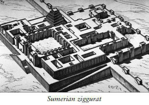
Lhasa's coordinates are 29:41N 91:10E, which calculated at 5,427
nautical miles from the Hudson Bay pole.
The distance from the
equator to the pole is 5,400 nautical miles (90 degrees times 60
seconds = 5,400), so Lhasa had rested just twenty-seven nautical
miles (less than half a degree) off the equator during the reign of
Atlantis.
This was getting spooky. The Earth crust displacement had
shoved Giza from 15 degrees to 30 degrees while moving Lhasa from 0
degree to 30 degrees. Was this coincidence?
The coincidence started to become extreme when I compared the
location of Giza and Lhasa (and a host of other ancient sites) with
the position of the crust over three Earth crust displacements. I
was amazed to discover that latitudes like 0 degree, 12 degrees, 15
degrees, 30 degrees, and 45 degrees came up again and again. Each of
these numbers divides the earth's geography by whole numbers.
This seemed way beyond chance, so I christened them "sacred
latitudes." Most of these sites will be familiar to anyone who takes
an interest in archeology or the sacred sites of the world's major
religions. All of these places are within thirty nautical miles (a
day's walk) from sacred latitudes, and are thus more accurately
aligned geodesically than Aveni's astronomical calculations.
The careful reader will note that several of these sites show up in
more than one table. They are actually situated at the crossing
points of two (even three) sacred latitudes. For example, Giza lies
at the intersection of 15 degrees (Hudson Bay pole) and 45 degrees
north (Greenland Sea pole) and today is at 30 degrees north.
Lhasa,
which today is near 30 degrees north, was at the equator during the
Hudson Bay pole and only thirty-two nautical miles from 30 degrees
north during the Greenland Sea pole.
So what was going here?
I believe that sometime before the devastating Earth crust
displacement, scientists in Atlantis recognized that the increasing
earthquakes and rising ocean level that they were experiencing were
a warning of a coming geological catastrophe. Trying to preserve
their civilization from this unavoidable disaster, they became
obsessed with discovering exactly what had overtaken the globe in
the remote past.
Teams of geologists fanned across the planet with a mission to gauge
the former positions of the earth's crust. If they could determine
exactly how far the crust had shifted in the past, they might have
some idea of what they could expect to face in the future. In the
process of their investigations, they left geodesic markers at the
points they considered critical to their calculations.
After the earth crust displacement that destroyed Atlantis, the old
calibrations were rediscovered by survivors who knew nothing of that
forgotten and desperate geographic survey.
They naturally believed
that these marvelous geodesic markers, from those who had gone
before, were messages from the gods. The sites became sacred and
cities were built around them (it's no accident that Teotihuacan is
an Aztec term meaning "Place of the Gods"), and their very practical
purpose was lost.
Further generations continued to worship at these huge shrines, but
eventually the winds of time began to erode the original structures.
New altars were built on top of the remnants of the artifacts left
by the surveyors from Atlantis. But during each reconstruction,
whispers from the past compelled the new architects to preserve the
original orientations that pointed to the Hudson Bay pole at the
time when Atlantis thrived.
The secrets buried beneath the slowly crumbling cities remained
hidden for thousands of years. Eventually, some intrepid souls in
Egypt, Mesopotamia, India, China, and America had the courage to
begin excavations.
The story of the remarkable discoveries uncovered
by those who dared to dig under holy sites is only now emerging. The
secret mission of the Knights Templar in Jerusalem and the
sophisticated devices that Moses took from Egypt are but two of
these fascinating accounts.
I believe we can explain the enigmatic location of the ancient
megaliths in a way that finally makes sense of their puzzling
misalignments. These sacred sites, which we sense contain clues to
our true history, continue to draw visitors who marvel over their
awesome construction feats and wonder at the intelligence and vision
of our anonymous ancestors.
But my explanation covers only the tip
of a very deep iceberg. There are many more sites that can be
discovered using simple calculations derived from latitude changes
after crustal displacements, not the least of which are sites on
Atlantis itself, the island continent of Antarctica.
I never thought to find another adventure to compare with my
eighteen-year search for Atlantis. But the unique placement of the
earth's most sacred sites has emerged as a mystery that compels me
with the same kind of fascination as that journey did.
23 - Japan's Underwater Ruins
Have Remains of Ancient Lemuria Been Found?
Frank Joseph
In March 1995, a sport diver unintentionally strayed beyond the
standard safety perimeter near the south shore of Okinawa.
A
battleground for the last land campaign of World War II, the island
was about to become the scene of another kind of drama. As the diver
glided through unvisited depths some forty feet beneath the clear
blue Pacific, he was suddenly confronted by what appeared to be a
great stone building heavily encrusted with coral.
Approaching it, he could see that the colossal structure was black
and gaunt, a sunken arrangement of monolithic blocks, their original
configuration obscured by the organic accretion of time. After
encircling the anonymous monument several times and taking several
photographs of it, he rose to the surface, reoriented himself, and
kicked for shore.
The next day, photographs of his find appeared in
Japan's largest newspapers.
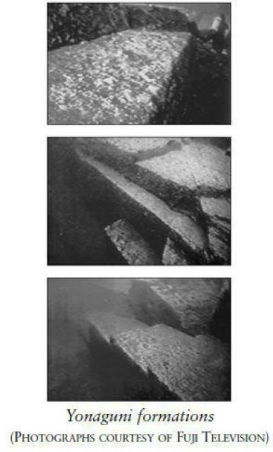
The structure sparked instant controversy and attracted crowds of
diving archeologists, newsmedia people, and curious
nonprofessionals, none of whom was able to ascertain its identity.
They could not even agree on whether or not it was man-made, let
alone ancient or modern. Was it the remnant of some forgotten
military coastal defense from the war? Or could it possibly date
back to something entirely different and profoundly older?
Already there were whispers of the
lost culture of Mu, preserved in
legend as "the Motherland of
Civilization," which perished in the sea long before the beginning
of recorded time.
But Okinawa's drowned enigma was hermetically
locked within too thick an encrustation. The structure looked
anciently man-made.
Nature, however, sometimes made her own forms appear artificial. The
popular and scientific debate concerning its origins went back and
forth. Then. in late summer of the following year. another diver in Okinawan. waters was shocked to see a massive arch. or gateway. of
huge stone blocks. beautifully fitted together in the manner of
prehistoric masonry found among the Incan cities on the other side
of the Pacific Ocean. in the Andes Mountains of South America.
This time there was no doubt. Thanks to swift currents in the area.
coral had been unable to gain any foothold on the structure. leaving
it unobscured in the hundred-foot visibility of the crystal-clear
waters. It was certainly man-made and very old.
It seemed nothing
short of miraculous, an unbelievable vision standing in apparently unruined condition on the ocean floor.
But its discovery was only the first of that summer's undersea
revelations. Fired by the possibility of more sunken structures in
the area. teams of expert divers fanned out from the south coast of
Okinawa using standard grid-search patterns. Their professional
efforts were soon rewarded. Before the onset of autumn. they found
five subsurface archeological sites near three offshore islands.
The locations varied from depths of one hundred to twenty feet. but
are all stylistically linked. despite the great variety of their
architectural details. They comprise paved streets and crossroads,
huge altarlike formations, grand staircases leading to broad plazas,
and processional ways surmounted by pairs of towering features
resembling pylons.
The
sunken buildings apparently cover the ocean bottom (although not
continuously) from the small island of Yonaguni in the southwest to
Okinawa and its neighboring islands - Kerama and Aguni - 311 miles
away.
If ongoing exploration reveals more structures linking Yonaguni with
Okinawa. the individual sites may be separate components of a huge
city lying at the bottom of the Pacific.
The single largest structure so far discovered lies near the eastern
shore of Yonaguni at one hundred feet down. It is approximately 240
feet long. 90 feet across. and 45 feet high. All the monuments
appear to have been built from granitic sandstone. although no
internal passages or chambers have been found. To a degree. the
underwater structures resemble ancient buildings on Okinawa itself.
such as Nakagusuku Castle.
More of a ceremonial edifice than
a military installation, Nakagusuku dates back to the early centuries of the first millennium
B.C.E., although its identity as a religious habitation site is
older still. Its builders and the culture it originally expressed
are unknown. although the precinct is still regarded with
superstitious awe by local Okinawans.
Other parallels with Okinawa's
oldest sacred buildings are found near Noro. where burial vaults
designed in the same rectilinear style are still venerated as
repositories for the islanders' ancestral dead.
Very remarkably. the Okinawan term for these vaults is moai. the same word Polynesians of
Easter Island. more than six thousand miles away. used to describe
the famous large-headed. long-eared statues dedicated to their
ancestors!
Possible connections far across the Pacific may be more than
philological. Some of the sunken features bear even closer
comparison to the heiau found in the distant Hawaiian Islands. Heiau
are linear temples of long stone ramparts leading to great
staircases surmounted by broad plazas. where wooden shrines and
carved idols were placed. Many heiau still exist and continue to be
venerated by native Hawaiians.
In terms of construction, the Okinawan examples comprise enormous single blocks; the heiau are
made up many more. smaller stones.
They were first built. according to Hawaiian tradition. by the
Menehune. a red-haired race of master masons who occupied the
islands long before the arrival of the Polynesians. The original
inhabitants left. unwilling to intermarry with the newcomers.
Okinawa's drowned structures find possible counterparts at the
eastern limits of the Pacific Ocean. along Peruvian coasts. The most
striking similarities occur at ancient Pachacamac, a sprawling
religious city a few miles south of the modern capital of Lima.
Although functioning into Incan times (as late as the sixteenth
century). it predated the Incas by at least 1.500 years and was the
seat of South America's foremost oracle. Pilgrims visited Pachacamac
from all over the Tiawantisuyu (the Incan empire) until it was
sacked and desecrated by the Spaniards under Francisco Pizarro's
high-spirited brother. Hernando. with twenty-two heavily armed
conquistadors.
Enough of the sun-dried. mud-brick city remains. with
its sweeping staircases and broad plazas. to suggest parallels with
the sunken buildings around Okinawa.
Two other pre-Incan sites in the north. just outside Trujillo.
likewise have some leading elements in common with the overseas.
undersea structures. The so-called Temple of the Sun is a terraced
pyramid built two thousand years ago by a people known as the Moche.
More than 100 feet high and 684 feet long. the irregularly stepped
platform of unfired adobe bricks was formerly the colossal
centerpiece of a city sheltering 30.000 inhabitants. Its resemblance
to
the structure found at Yonaguni is remarkable.
On the other side of the Pacific, the first emperor of Japan was
remembered as Jimmu. whose immediate descendant was Kamu. among the
"legendary" founders of Japanese society. Another ancestral emperor
was Temmu. who was said to have committed to memory the Kojiki
("Records of Ancient Matters") and the Nihongi ("Chronicles of
Japan").
In northern Japan runs a river deemed sacred because it
carried the first semi-divine beings into the country; it is called
the Mu River. In Japanese. the word mu means "that which does not
exist or no longer exists." just as it does in Korean. Does it
harken back to a land that "no longer exists"?
In ancient Rome, the Lemuria was a ritual conducted by the head of
each household to appease the spirits of the deceased who returned
annually. Lemuria was also the Roman name for a huge island kingdom
that the Romans believed once lay in "the Far Eastern Sea."
sometimes imagined to have been the Indian Ocean. It vanished to
become "the abode of troubled souls."
The Lemurian ceremony was instituted by Romulus in expiation for the
murder of Remus. Here, too, we encounter Mu in relation to the
founding of a civilization. as the brothers were accepted as the
progenitors of Rome.
In Latin, their names are pronounced with the
accent on the second syllable:
RoMUlus and ReMUS.
In the early nineteenth century, when English biologists were in the
process of mammal classification. they applied the ancient term
lemur to describe primitive tree primates first found in
Madagascar, because the creatures possessed large, glaring eyes,
just like the ghostly lemures described in Roman myth. When lemurs
were discovered outside Africa, in such widely separated locations
as southern India and Malaya, scientists theorized that a continent
in the Indian Ocean may have connected all these lands before it
sank beneath the waves.
Oceanographers have since established that
no such continent ever existed.
But collectors of oral traditions throughout the island peoples of
the Pacific were perplexed by recurring themes of a vanished
motherland from which ancestral culture bearers arrived to replant
society's seeds. On Kaua'i, the Hawaiians told of the Mu (also known
as the Menehune mentioned earlier) who arrived in the dim past from
a "floating island."
The most important ancestral chant known to the Hawaiians was the "Kumulipo,"
which recounts a terrific flood that destroyed the world long ago.
Its concluding lines evoke some natural catastrophe in the deep
past:
"Born the roaring, advancing and receding of waves, the
rumbling sound, the earthquake. The sea rages, rises over the beach,
rises to the inhabited places, rises gradually up over the land.
Ended is the line of the first chief of the dim past dwelling in
cold uplands. Dead is the current sweeping in from the navel of the
Earth. That was a warrior wave. Many who came vanished, lost in the
passing night."
The survivor who escaped the "warrior wave" was Kuamu.
Despite an abundance of folk traditions spanning the Pacific, all
describing a sunken homeland, the first accurate, sonar-generated
maps of the ocean bottom revealed nothing resembling a lost
continent. But archeological enigmas supporting the myths still
exist at such remote locations as tiny Malden Island, where a road
of paved stones leads directly into and under the sea. The
uninhabited island is also home to forty platform pyramids.
A provocative architectural theme, linking South America to Japan
through Polynesia and suggesting a lost intermediary culture, is the
sacred gate. The aesthetic focus
of Tiahuanaco, a great ceremonial
city high in Bolivia's Andes near Lake Titicaca, is two ritual
gates.
One is above the sunken court at the entrance and
dramatically frames the twelve-foot-tall statue of a god or man; the
other, at the far end of the complex, is the famous Gateway of the
Sun, oriented to various solar phenomena.
Out across the Pacific in the Polynesian island of Tonga stands the
Haamonga-a-Maui, "the Burden of Maui," a fifteen-foot-high stone
gate weighing 109 tons and aligned with sunrise of the summer
solstice. Japan is covered by many thousands of such gates, most of
them wooden but all used to define a sacred space.
Known as torii,
the same word appears in ancient Indo-European languages and
survives in the German word for gate: "Tor." An outstanding feature
of the sunken structures in the vicinity of Okinawa is an
unconnected gate of massive stonework.
The Romans, who celebrated a Lemuria festival every May, ornamented their empire with
free-standing ceremonial gates.
These intriguing parallels, combined with a wealth of archeological
evidence and descriptive native traditions, convinced investigators
that some powerful, centrally located "X-culture" indeed existed in
the Pacific, from which civilizing influences spread in both
directions.
Their conclusion seemed borne out with recent
discoveries among the Ryukyu Islands, where architectural features
of the sunken structures bear tell-tale affinities to pre-Incan
structures in Peru and ancestral burial vaults on Okinawa. But the
sunken buildings provoke more questions than they answer.
How old
are they? Why are they under water? Who built them? For what
purposes?
The evidence that has been collected thus far suggests that the site
did not succumb to a sudden geologic catastrophe. Aside from one or
two monuments leaning at irregular angles. none of them displays any
structural damage. no cracks or fallen stones. Instead they appear
in unruined. virtually pristine condition. They were either
overwhelmed by rising sea levels or sank with a slowly collapsing
landmass. or some combination of both.
Most researchers opt for the last scenario. as oceanographers tell
us that sea levels rose from one hundred feet 1.7 million years ago.
Even so. the Japanese sites must be very old. They are constantly
being swept clean by strong currents. so radiocarbon-dating material
is not available.
The purposes for which they were made appear less difficult to
understand. because their strongest resemblance to Hawaiian heiau
implies that they were mostly ceremonial in nature. Their expansive
staircases lead up to presently barren platforms. where wooden
shrines and carved idols were probably set up for religious dramas.
Just who their worshippers and builders were suggests a word most
professional American archeologists are unable to pronounce.
But in
view of the numerous accounts from hundreds of cultures around the
Pacific of a flood that destroyed some former civilization, if
Okinawa's sunken city is not the lost Lemuria, then what is it?
24 - West, Schoch, and Hancock Dive into Lemurian Waters
J. Douglas Kenyon
The issue of underwater ruins in the Pacific remains controversial,
even within the alternative science community.
Atlantis Rising has
not taken a stance one way or the other on the issue, desiring
instead to present both sides of the argument in a fair and
even-handed manner.
I will say, however, that those individuals who
believe that these underwater ruins are man-made are supported by
the argument presented by Frank Joseph in the foregoing chapter,
while those who question this supposition may find themselves
agreeing with the positions of Robert M. Schoch, Ph.D., et al., in
the following essay.
- EDITOR
In September 1997, the maverick Egyptologist John Anthony West,
accompanied by the geologist Robert
M. Schoch, Ph.D., and the writer Graham Hancock, visited the island
of Yonaguni in Japan, where a mysterious 160-foot pyramidal platform
had been found under the waters of the ocean at a depth of eighty
feet. In several dives, the three investigated part of what could be
one of the most significant discoveries of the century.
Subsequent
to the trip, West shared with Atlantis Rising his opinion regarding
the site's archeological authenticity.

He and Schoch, it was pointed out, had made the trip predisposed to
believe that here could be the great breakthrough most of us have
been waiting for - the discovery of undeniable proof of the
existence of prediluvian civilization (the area has been under water
for at least 11,500 years).
The photos they had been shown certainly
appeared unambiguous.
And, after all, it was their research that
had, a few years earlier, shaken the academic establishment by
demonstrating that it was water and not windblown sand that had
weathered the Great Sphinx of Egypt, thus establishing that it was
thousands of years older than previously supposed.
After examining
the Yonaguni site, however, both West and Schoch are
of the opinion that it is probably natural in origin, though perhaps
worked over by human hands in some way - maybe to create a
terra-form. Nevertheless, the two continue to believe that even if
the Yunaguni site is of strictly natural origin, the spot remains
one of the most - if not the most - unusual to be found anywhere.
The one thing that West, Schoch, and Hancock agree on unanimously is
the need for much more research and a complete examination of the
site, as they all feel it is far too early to draw any final
conclusions.

In response to West's comments, Atlantis Rising contributor
Frank
Joseph pointed out that West, Schoch, and Hancock visited only one
of eight locations that are spread over a 311-mile area. and added
that the onus is now on Schoch to demonstrate just how
geomorphologic forces could have created the formations, which, if
indeed natural, are unique in the world.
After attending a conference of avant-garde researchers held in
England by Quest Magazine (also attended by West). Joseph reports
that while there is still much controversy and complexity
surrounding the issue. the consensus at the conference. he felt. was
that the formations were of man-made origin.
Joseph also added that
laboratory analysis by Japanese researchers of some of the stone
from the site is consistent with artificial tooling.
25 - India 30,000 B.C.E.
Do the Roots of Indian Culture Lie Drowned beneath the Indian Ocean?
David Lewis
The world is full of mysteries. And given its mystical traditions.
no place in the world remains more mysterious than India. a country
and culture said to be rooted in primordial timelessness.
Westerners have frequently tried to fathom the mysteries of Mother
India.
Western scholars, relative newcomers on the world stage, have
consistently tried to date Indian civilization according to Western
time lines, assuming an intellectual superiority that routinely
dismisses the accumulated wisdom of millennia. including cultural
traditions that speak of humanity's origin, lost continents, and
advanced prehistoric civilizations.
But that wasn't always the case. In the mid- to late nineteenth
century, when scientific ideas about human origins had only begun to
take shape in Europe. many early geologists and archeologists
accepted the idea of the biblical flood and lost continents for
which they found much hard evidence, even a landmass in the Indian
Ocean - the great Southern Continent of the British naturalist
Alfred Russell Wallace.
Today, mainstream science still theorizes
that landmasses such as Gondwanaland and Pangaea must have existed,
although they are relegated to extremely ancient epochs: 180 to 200
million years ago.
MOTHER OF ALL MOTHERLANDS
Lemuria, the term for a lost continent in the Pacific or Indian
Ocean. came to life in the 1860s when geologists found a striking
similarity between fossils and sedimentary strata in India, South
Africa, Australia, and South America.
These geologists surmised that
a great continent or at least a land bridge or series of islands
must have existed in the Indian Ocean. and this landmass was named Lemuria by the
English biologist Philip L. Scalter after the lemurs of Madagascar.
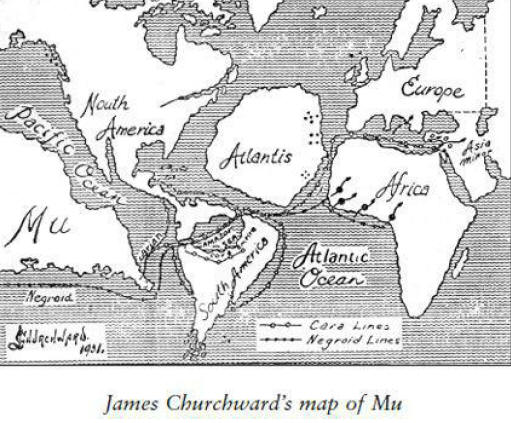
Madame Helene Blavatsky, founder of the Theosophical Society, wrote
extensively in the late nineteenth century of Lemuria and, in the
1920s, Colonel
James Churchward claimed to have discovered certain
ancient tablets in India describing long-lost Mu (Lemuria), a golden
civilization said to have existed in the Pacific.
Churchward devoted
his life and study to
bringing the lost Lemurian culture to life in
a series of books.
Continental drift theory, which proposes the extremely slow drifting
of continents, and then the concept of plate tectonics, did away
with Lemuria in the minds of many, while satisfying one of the
essential tenets of modern scientific thinking about origins.
This
essential tenet is called uniformitarianism, which holds that all
natural developments on Earth come about extremely slowly,
incrementally, and in a more or less uniform fashion.
Great floods,
global cataclysms, and the submergence of continents in recent
prehistory smack of the biblical, and so the anti-biblical
Darwinists of bygone days imposed the doctrine of uniformitarianism
upon the early geologists and archeologists. The idea that
grand-scale cataclysms had anything to do with prehistory, once
considered heretical, only recently came into fashion on the heels
of evidence that a large-impact asteroid struck the Yucatan area,
causing the extinction of the dinosaurs many millions of years ago.
But consider the ancient south Asian traditions that mimic the
findings of early geologists, those that say an inhabited continent
once existed in what is now the Indian Ocean. This is a belief that
thrives, to this day, among peoples of southern India, in Sri Lanka,
and in the islands of the Andaman Sea off Malaysia.
One tradition emerges from the writings of ancient Ceylon that
refers to a lost civilization in the area now occupied by the Indian
Ocean and a landmass that connected the Indian subcontinent with the
island of Sri Lanka - the kind of tradition dismissed as fable by
the modern-day intelligentsia.
"In a former age," an ancient Ceylonese text states, "the citadel of
Rawana (Lord of Lanka), 25 palaces and 400,000 streets were
swallowed by the sea."
The submerged landmass, according to one
ancient account, rested between Tuticorin on the southwest Indian
coast and Manaar in Ceylon, not a landmass of the size once
envisioned by the early geologists. but - if it actually existed - a
submerged portion of the Indian subcontinent just the same.
Another cultural tradition. cited in Allan and Delair's Cataclysm!
Compelling Evidence of a Cosmic Catastrophe in 9500 B.C.E., that of
the Selungs of the Mergui archipelago off southern Burma. also
speaks of a sunken landmass:
"Formerly [the] country was of
continental dimensions. but the daughter of an evil spirit threw
many rocks into the sea... the waters rose and swallowed up the
land . . . . Everything alive perished. except what was able to save
itself on one island that remained above the waters."
One of the Tamil epics of southern India. the Silappadhikaram,
frequently mentions a vast tract of land called Kumari Nadu.
otherwise known as Kumari Kandam (and later identified as Lemuria by
European scholars). stretching far beyond India's present-day coasts
into the Indian Ocean.
Ancient south Indian commentators wrote in
detail of a prehistoric Tamil Sangham. a spiritual academy. situated
in that ancient land. They also wrote of the submersion of two
rivers. the Kumari and the Pahroli. in the middle of the continent.
and of a country dotted with mountains. animals. and vegetation.
The Silappadhikaram tells of a country with forty-nine provinces.
and mountain ranges that yielded precious gems (Sri Lanka and other
parts of India are sources of precious gems to this day).
This Pandyan kingdom. according to tradition. reigned from 30.000 B.C.E.
to 16.500 B.C.E. At least one lineage of modern-day south Indian
mystics claims direct descent from those extraordinarily ancient
times. when their spiritual progenitors achieved extremely long
lives through yogic mastery. walking as virtual gods. This was a
phenomenon said to have been duplicated successively to the present.
carried on in remote regions of the Himalayas.
In addition. India's epic poem the Mahabarata, dated by some
nonanglicized Indian scholars to the fifth millennium before Christ.
contains references that place its hero. Rama. gazing from India's
present-day west coast into a vast landmass now occupied by the
Indian Ocean.
These Indian epics also allude to advanced technology
in
the form of vimana, aircraft that were used to transport the
society's elite and to wage war.
Less celebrated ancient Indian
writings describe these aircraft in detail and at great length.
puzzling both scholars and historians. What's more. the great Indian
epics vividly describe militaristic devastation that can be equated
only to nuclear war.
The Sanskrit scholar and the renowned physicist J. Robert
Oppenheimer. father of the hydrogen bomb. apparently interpreted the
ancient epic as having described a prehistoric nuclear
conflagration.
After the first atomic test in Alamagordo,
New Mexico, Oppenheimer chillingly quoted the Mahabharata, saying.
"I
have become death, the destroyer of worlds."
In a later interview.
when asked if the Alamagordo test was the first time an atomic bomb
had been detonated. Oppenheimer replied that it was the first time
in modern history.
Oppenheimer notwithstanding, are tales of flying machines. lost
continents. and prehistoric nuclear war merely mythical or do these
ancient references provide us with a historical record. long
forgotten and then dismissed by modern science. with its modern
prejudices. as fantasy?
THE KNOWLEDGE FILTER
To begin to answer that question. we must first look at the history
of scholarship as it pertains to India.
Since the nineteenth century. Western scholars have routinely
dismissed the historical significance of the cultural traditions of
ancient peoples. those of southern Asia included. With a decidedly
ethnocentric bias - the intellectual stepchild of Western
colonialism - the experts reinterpreted Eastern history. casting
whole systems of ancient philosophy and science. in the experts'
minds. into the historical dustbin.
This historical dustbin is the
repository of all things conflicting with European models. such as
biblical Christianity and scientific materialism. Here we find the
very inception of the "knowledge filter." now well known to students
of alternative archeology. geology. and other disciplines involved
with the search for lost origins.
India. with her treatment by the West and her acquiescence to that
treatment. typifies the way in which Western intellectualism
conquered the world.
Call it the "West is best" model: a strict
adherence to European doctrines that deny traditions and attempt to
offer decidedly more ancient theories regarding the origins of
civilization than those of the Western scholars.
On top of this, add
a scientific materialism that denies all nonmaterial theories
regarding the origins of man, life, and reality.
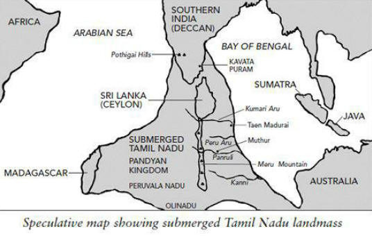
Having found. for example, that root words of India's ancient
Sanskrit turned up almost universally in the world's major
languages.
Western scholars devised an ethnocentric scheme to
explain the phenomenon - one that India's first prime minister.
Jawaharlal Nehru. and many other modern Indian intellectuals came to
accept. A previous European people must have once existed. the
scholars told us. an Indo-European race upon which the world. and
India. drew for its linguistic roots and genetic stock.
The scholars also expropriated the now mythic Aryans of ancient
India to flesh out this scenario. This mythic race. we were told.
derived from Europe and then invaded the Indus Valley. in the north
of India - making Sanskrit and Vedic culture a product. rather than
a progenitor. of Western civilization - and rather young at
that.
But the Aryan invasion theory has since fallen into disrepute. after
being downgraded to a migration theory. James Schaffer. of Case
Western University. a noted archeologist specializing in ancient
India. had this to say on the matter:
"The archeological record and
ancient oral and literate traditions of south Asia are now
converging."
Schaffer recently wrote.
"A few scholars have proposed
that there is nothing in the 'literature' firmly placing the
Indo-Aryans outside of south Asia. and now the archeological record
is confirming this... We reject most strongly the simplistic
historical interpretations, which date back to the eighteenth
century [the time of the British invasion of India]... These
still-prevailing interpretations are significantly diminished by
European ethnocentrism, colonialism, racism, and anti-Semitism."
None of this, of course, speaks well of Western scholarship.
Southern India, a land whose cultural roots are said by some to
stretch into an even more profound antiquity than that of the north,
suffered a similar fate. Speakers of a proto-Dravidian language, the
forerunner of a family of languages spoken in the souths - and some
say of Sanskrit itself - entered India from the northwest, we were
told.
Both theories were necessitated by Western beliefs, at first
about the supremacy of the Garden of Eden theory of origins and
then, with the arrival of the Darwinists, the widely held
"out-of-Africa" theory - the doctrine that man evolved from a more
primitive form in southern Africa and slowly made his way across
Asia, then to the New World, just 12,000 years ago.
But the Aryan invasion theory has been debunked. No skeletal
evidence shows any difference between the supposed invaders and the
indigenous peoples of India. And satellite imagery now shows that
the ancient Harappan civilization of the Indus Valley and
Mohenjo-Daro probably declined and disappeared due to climatic
changes - that is, the drying up of the mythical Saraswati River -
rather than the descent of imaginary Aryan hordes.
Burying the Aryan
invasion theory, however, opens a Pandora's box for orthodox
scholars regarding the prehistory not just of India, but of the
world. If Sanskrit predates the world's other languages, along with
India's genetic stock, how to explain prehistory in conventional
terms?
David Hatcher Childress attributes the demise of Harappa and
Mohenjo-Daro to something far more controversial than climate
change: a prehistoric nuclear conflagration involving aircraft and
missiles (Rama's highly destructive "flaming arrows").
This is a
picture that may seem bizarre on the face of it, but it is
represented convincingly in the ancient writings - as Oppenheimer
observed - and with some geological evidence, according to
Childress.
Meanwhile, even orthodox thinking dates Indian village culture,
thought to be the forerunner
of Mohenjo-Daro and the Harappan
civilization, to an extremely ancient age.
Excavations at Mehgarh,
in modern-day Pakistan, have pushed back that date in India to 6000
B.C.E., before the so-called advent of civilization in the Middle
East. Some orthodox scholars credit India not only with the first
alphabet, but also as the cradle of civilization whence sprang
Mesopotamia, Sumeria, and Egypt.
Linguistic evidence, moreover,
offers intriguing clues: The indigenous languages of places as
distant as Kamchatka and New Zealand bear a similarity to Tamil, the
language of southern India.
Tamil words turn up, furthermore, in the
world's great Classical languages: Sanskrit, Hebrew, and Greek.
But how far does the knowledge filter go? How much of the actual
history of India still lies in the dustbin created by Western
ethnocentrism, colonialism, and scientific materialism?
The demise of the Aryan invasion theory may represent only the tip
of the iceberg of misconceptions about the age and nature of the
ancient Indian subcontinent, its culture, its people, and its
accomplishments. It has long been claimed that Mother India holds a
history that stretches into the dim and forgotten mists of the past,
to a time before all myth began, when great rishis, men of profound
wisdom and phenomenal spiritual attainment, walked the earth.
This ancient India, said to be a product of the gods, dates to the
times out of which grew the epic poems the Ramayana and the
Mahabarata and the ancient traditions of Tamil Nadu in southern
India. This ancient India was a land whose culture was said by some
to predate that of the north, having once existed as part of Kumari
Kandam, a great southern continent thought to have stretched from
present-day Madagascar to Australia and dating to a staggering
30,000 B.C.E.
Obscure texts of the Siddhanta tradition of Tamil Nadu reportedly
say that a great deluge inundated Kumari Kandam.
This is a notion
that is echoed in the writings of Colonel James Churchward and of
W.S. Cerve, both of whom claim knowledge of texts, Indian and Tibetan,
respectively, that speak of a long-lost continent situated in the
East.
WHERE HAVE ALL THE MAMMALS GONE?
While continental drift theory presupposes extremely slow and
regular movement of landsmasses over many hundreds of millions of
years, a great deal of evidence exists that Earth's surface did
indeed change with extreme rapidity and violence in recent
prehistory.
A great, sudden extinction took place on the planet,
perhaps as recently as 11,500 years ago (usually attributed to the
end of that last ice age), in which hundreds of mammal and plant
species disappeared from the face of the earth, driven into deep
caverns and charred muck piles the world over. Modern science, with
all its powers and prejudices, has been unable to adequately explain
this event.
Instead, one might reasonably say, it has tried to explain away the
evidence with ever more cumbersome ice age theories meant to account
for everything and anything of a cataclysmic nature that happened in
recent prehistory.
Gradual glacial movements caused all the death
and destruction. we are told. though such assertions do not account
for much of the worldwide evidence indicating that. on review. a
global cataclysm must have taken place. Indeed. scientists can't
explain why massive glaciers would slide in the first place.
Allan and Delair. in Cataclysm! - a stunning and exhaustive work of
scholarship - amass a formidable quantity of known evidence
corroborating the flood/conflagration legends stored in the world's
mythological record. If we suspend belief in the textbook accounts
of recent prehistory. Allan and Delair fill the void in a most
convincing way. And much evidence centers on southern Asia that
would explain how a continent would have been lost to the sea in
recent prehistory.
Records gathered in 1947 by the Swedish survey ship Albatross reveal
a vast plateau of hardened lava for at least several hundred miles
southeast of Sri Lanka.
The lava. evidence of a severe rupture in
the earth's crust. fills most of the now submerged valleys that once
existed there. The immense eruption that gave off the lava may have
coincided with the downfall of Wallace's Southern Continent (aka Kumari Kandam) for which much zoological and botanical evidence
exists that would give such a landmass a recent date. according to
Allan and Delair.
Amid the troves of evidence compiled by early geologists and
resurrected by Allan and Delair are Asian caves filled with the
bones of numerous and diverse species of recent prehistoric animals
from around the world that could have been driven to their final
resting place only by vast amounts of water. propelled by some
spectacular. cataclysmic force of nature.
In light of Allan and Delair's work. other geographic anomalies.
such as India's Deccan trap. a vast triangular plain of lava several
thousand feet thick covering 250.000 square miles. and the Indo-Gangetic
trough. a gigantic crack in the earth's surface stretching from
Sumatra through India to the Persian Gulf. can be interpreted as
evidence of a fantastic cataclysm that sank Kumari Kandam at the
time of the great extinction. And this Deccan area is geologically
distinct from the Indo-Gangetic plain and the Himalayas of the
north.
The rocks of the Deccan are among the oldest in the world.
with no trace of ever having been under water. and frequently
overlaid with sheets of trap rock or basalt that once flowed over
them as molten lava.
DISTANT LEGACIES?
Other titillating fragments of anomalous evidence suggest a
pervasive if not advanced seafaring or even airborne culture having
once existed in Kumari Kandam: for example. the identical nature of
the Indus Valley script to that found at Easter Island on the other
side of the Pacific Ocean.
According to certain south Indian
researchers. the thought-to-be-indecipherable scripts are written in
a proto-Tamil language. one that would link the culture of distant
Easter Island and its famous megalithic statues with ancient
southern India, or Kumari Kandam - an idea echoed in the lore of
Easter Islanders about a great Pacific continent from which their
people originated.
And continuing eastward to North America. new dating methods have
placed the Spirit Cave mummy - the remains of a forty-year-old
man discovered in 1940 in a cave east of Carson City. Nevada - in
the seventh millennium B.C.E.
Although the remains have been claimed
by modern American Indians, the mummy's facial features appear to be
that of a Southeast Asian man. With a dispute raging over the dating
of the mummified man's lifetime and the uncertainties and biases
regarding the dating of artifacts and fossils in general, the Spirit
Cave mummy may be the remains of an ancient inhabitant of Kumari
Kandam, or perhaps at least an ancestor.
Whether or not the Spirit Cave mummy hails from Kumari Kandam.
actually or genetically, a new look at old research in the field of
human origins and the probability of ancient advanced civilization
having once existed has begun to seriously upset the applecart of
the Western scientific paradigm.
The trouble for "West-is-besters."
and with them dyed-in-the-wool scientific materialists. is that most
cultures of the world offer traditions and a mythological record
that contradict the aggressive assumptions of Western science. its
assertions about prehistory and about the nature of man.
More and
more frequently. incremental revelations in a variety of fields.
from archeology, to the new physics, to near-death studies, support
the ancient traditions.
And even as "West-is-best" assumptions continue to proliferate in
textbooks and universities around the globe, records written in the
earth and in ancient texts quietly reappear like ghosts from the
forgotten past.
The records of Mother India, where those ghosts are
gods, are no exception.
Back to
Contents
|