|
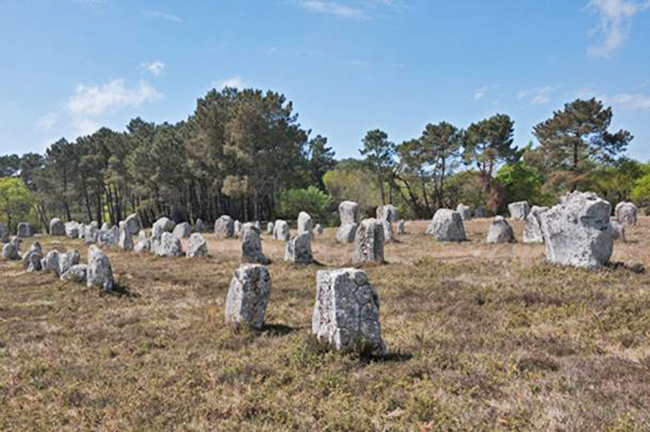
The Carnac Stone Rows
(Wikimedia Commons)
have been one of the most puzzling archaeological artifacts in the world
for hundreds of
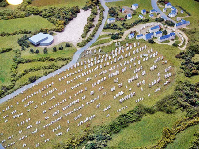
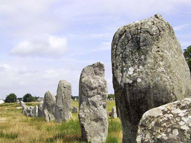
years... These megalithic stones exist around the village of Carnac in Brittany, France.
The stones demonstrate alignments, dolmens and other ancient geometry which is consistent with other prehistoric sites, but which should not have existed in the period in which they were constructed.
All these attempts were destined to fail until an ancient science named Geoglyphology was re-discovered.
Without the protocols that were built into the ancient science, any attempts to decode the Carnac Stones were an exercise in futility.
This stemmed from the
fact that the codes for using the Carnac stones came from
Geoglyphological protocols.
It was learned that geoglyphs were used to outline territories which the culture that made the geoglyph claimed for themselves.
Needless to say,
mastering this ancient science and being able to follow cultures,
and their territories, opened up a whole new window into the history
of the world.
While Carnac uses the same protocols as other geoglyphs, the way they are applied are unique to the Carnac Stones.
While most geoglyphic surveys are done by running lines through, or parallel to tangible objects, Carnac requires that these principles be applied to the spaces between the stones rather than the stones themselves.
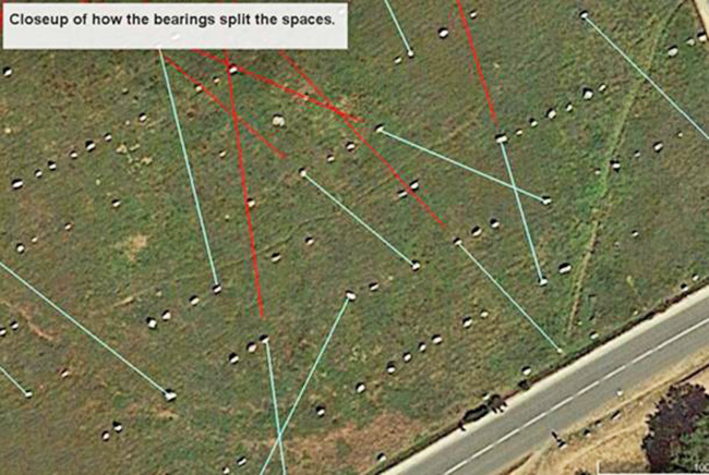
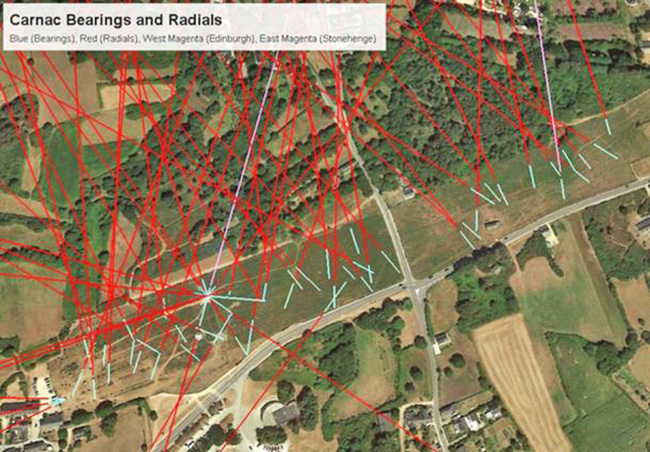
As you see in the following image, the puzzle is solved by running lines through the center of the spaces between the stones in order to decode the puzzle.
There is only one pair of stones that, when a line is drawn between them, will position the line directly in the center of the space.
Once these lines are
determined the rest of the survey continues just as in other
territorial geoglyphs.
(Wikimedia Commons)
(Wikimedia Commons)
Marking Territories
Over the past 10 years of studying geoglyphs, around the globe, it was discovered that pyramids, stone monoliths, and other Geoglyphological geoglyphs were placed on the earth, in addition to several other uses, to map out territories which the builder considered their own.
Ancient Japanese texts
state that these territories were originally designated as the areas
within which ancient scholars would teach man the spirituality and
sciences of the cosmos.
View of Bearings Splitting the Spaces Between the Stones.
Credit: The Faram Research Foundation.
Mapping the Geoglyphs
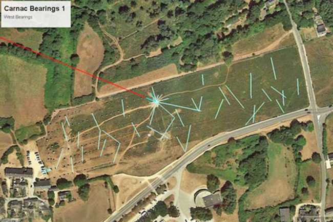
Carnac Bearings West Side.
Credit: The Faram Research Foundation.
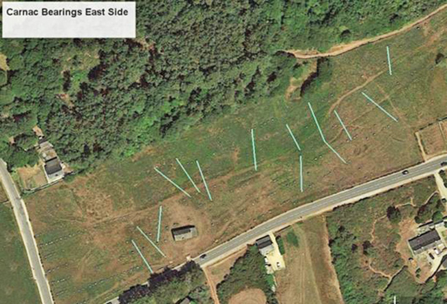
Credit: The Faram Research Foundation.
Credit: The Faram Research Foundation
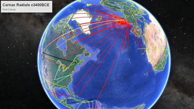
The west radial points to Edinburgh, Scotland and the East Magenta line points to Stonehenge.
Since both endpoints are historically related to the Celts one would have to assume that the Celtic culture had its roots somewhere before 3400BC.
One would also have to
assume that these ancient cultures had a detailed knowledge of the
earth long before history tells us.
Credit:
The Faram Research Foundation
What the original Stonehenge depicted is difficult to say since a portion was destroyed and then later, c1100AD, the existing stones were placed on the ground within the circle.
The new geoglyphs at Stonehenge designate the Celtic Territory which existed at the time the stones were placed.
|


 mmm
mmm