|
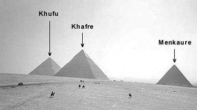
In a recent issue of Archaeology magazine Farouk El-Baz of Boston University suggests that the three major pyramids of the Giza Plateau may have been modeled after the naturally occurring, conical hills found near the Kharga Oasis almost 150 miles west of Luxor.
He also notes that the hieroglyph meaning “desert hills” has a pointed shape. 1
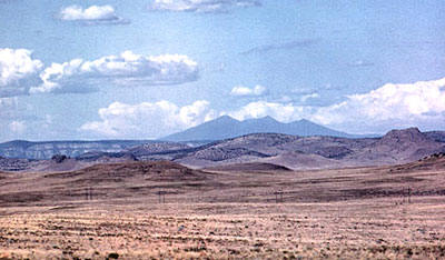
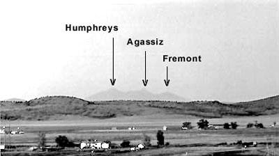
On the other side of the globe on the high desert of American Southwest three great mountains rising out of the San
Francisco Peaks eerily echo the Egyptian triad.
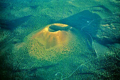
The basaltic cinder cone of Humphreys Peak (12,633 feet in elevation, the highest point in the Arizona) dominates this arid landscape.
The slightly lower Agassiz Peak (12,356 feet) is about a mile and a half due south, while Fremont Peak (11,969 feet) rests a mile further southeast.
These mountains are the winter home of the Hopi kachinas, intercessory spirits (rather than gods per se) that take the form of any object or energy in the universe. Shortly after the winter solstice these divine beings travel to the three Hopi Mesas about 70 miles to the northeast.
There they assist in the germination and growth of corn, squash, beans and other crops during the spring and early summer.
From late April until July Hopi men don kachina masks, not to impersonate these spiritual helpers but to actually become them. Dancing from dawn until dusk in the village plaza under the brutal desert sun, they coax moisture from the few clouds drifting overhead.
Then upon the arrival of the monsoons in mid to late July, the kachinas return to their mountain habitat for the remainder of the year.
The relationship between the Egyptian desert hills and the three monumental pyramids may be similar to that between the volcanic mountains of Arizona and the three major Mesas where the Hopi settled about 900 years ago.
Although the Mesas are natural land forms rather than humanmade structures, the villages built atop them in effect sanctify the surrounding geography.
The center of the Hopi universe, called Tuuwanasavi, is comprised of the First Mesa, Second Mesa, and Third Mesa.
The Egyptian term for the underworld is Duat, whose gateway is Giza. Like the Giza pyramids, the Tuuwanasavi corresponds to the three stars in the Belt of Orion, which is the visual focus and spiritual heart of the constellation. (See my articles regarding the Orion correlation of Arizona in Issue 37 of Atlantis Rising and Volume 7/Number 46 of Ancient American.)
The Mesas function as natural ziggurats, lifting the supplicant even closer to the celestial forces that must be appeased in order to gain the blessing of rainfall.
Scholar Vincent Scully explains the cultural significance of these land forms.
For the Hopi the choosing and finishing of the Mesas is tantamount to the construction of the true pyramids of Egypt or the stepped pyramids of Mesoamerica.
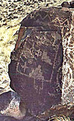
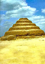
The ancient Hopi petroglyph representing either “mesa” or “rain cloud” is the stepped pyramid, the exact copy of the Egyptian double staircase hieroglyph.
The Egyptian word Aatt means both the necropolis of the pyramid region and the Other World. It is formed by using both the double staircase hieroglyph and the pointed desert hills hieroglyph mentioned above. 3.
The souls of the pharaohs took flight from their pyramids to the stars in the same way that the otherworldly kachinas soar upon terraced storm clouds.
The
Hopi word aatsava means “between” and the related word
atsva means “above”
or “on top,” thereby stressing the verticality of the mesa/pyramid.
Incidentally, the primary Egyptian example of the stepped pyramid is found
at Saqqara. The Hopi word saaqa means “ladder” or “stepladder.”
The Bennu was even instrumental in the creation of the cosmos. The Shu Texts describes “...that breath of life which emerged from the throat of the Benu Bird, the son of Rę in whom Atum appeared in the primeval nought, infinity, darkness and nowhere.” 4.
Rising from the primordial abyss, the hikę (life-breath) is carried in the beak of the sacred bird of rebirth. It is perhaps more than a coincidence that the Hopi word hik’si echoes the Egyptian word hikę both phonetically and semantically.
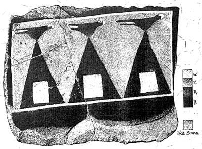
The powerful image of a bird perched on the apex of a pyramid also appears on a Hopi artifact. In the early twentieth century near the present town of Winslow, Arizona the renowned archaeologist Jesse Walter Fewkes unearthed a stone slab covering a grave at Chevelon Ruin. 5. On one side of the painted slab a white rectangular border with black on the outside encloses three isosceles triangles or pyramids of nearly equal size.
On a yellow background each of these black pyramids contains a white square located near the base. A red bird, perhaps a macaw or parrot, is perched atop all three of these pyramids. Each of the stylized birds has a triangular body, the base of which forms its dorsal side. The body’s apex (where its feet would be) touches each pyramid’s apex. Only the bird at the center has eyes.
Facing to the right, they all have bifurcated tails and curving beaks. The four colors used on this slab are the traditional Hopi directional colors: yellow (northwest), black (southwest), red (southeast), and white (northeast). 6.
What is the meaning of these figures? Fewkes suggests that the triangles are simply rain clouds. The white square at the heart of each pyramid signifies inner space, perhaps an Underworld of sorts. The three pyramids possibly designate the three major promontories in the San Francisco Peaks as well as the three Hopi Mesas.
The exotic parrot or scarlet macaw represents the moisture of the tropical jungles far to the southeast, the direction symbolically implied by their redness.
This is also the region of the Mayan stepped pyramids. Used in prayer stick making and other ceremonies, the multi-hued feathers of these birds may symbolize the nadir, the Underworld direction of “many colors.” 7. Whole bodies of both parrots and macaws have been found in burial sites throughout the Southwest.
Fewkes also discovered other grave slabs at Chevelon with circular holes worn into them, ranging in size from a broomstick to an arm’s width. Somewhat condescending vis-ŕ-vis the modern Hopi, he remarks on their purpose:
Given this evidence, the three birds atop their pyramids in Arizona most
likely performed same function as did the journeying soul of the Bennu in
Egypt - the omnipresent quest for immortality.
In addition, the cognate ben-t means “cincture, belt, girdle,” 10. and might refer obliquely to Orion’s Belt.
Alnitak, the
most eastern star of the Belt (corresponding to the Great Pyramid, or
Khufu),
literally means “the Girdle,” while Mintaka, the most western star
(corresponding to Menkaure) is called “the Belt.”
11.
Correlations abound, both on earth and in heaven. To live between the two realms upon this vast desert is to feel deep in one’s bones the hermetic maxim “As above, so below.”
End Notes
|
