|
Chapter Eight
RIDERS OF THE
CLOUDS
"The journey of Gilgamesh in search of Immortality has undoubtedly
been the fountainhead of the many tales, in subsequent millennia, of demi-gods or heroes claiming such a status, who have likewise gone
to search for Paradise on Earth or to reach the Celestial Abode of
the Gods. Without question, the detailed epic of Gilgamesh also
served as a guide book in which the subsequent searchers sought to
find the ancient landmarks by which the Land of the Living could be
reached and the way to it ascertained.
"The similarity between the geographical landmarks, the man-made (or
rather the god-made) tunnels, corridors, air locks and radiation
chambers, and the bird-like beings, or "Eagles," as well as many
other major and minor details - are far too numerous and identical
to be mere accidents. At the same time, the epic tale of the journey
can explain the confusion that reigned millennia later concerning
the exact location of the cherished target, because as our detailed
analysis has shown, Gilgamesh made not one but two journeys - a fact
generally ignored by modern scholars and possible also by past
ones.
"The Gilgamesh journey reached its culmination in the
Land of Tilmun,
an Abode of the Gods and a place of the Shems.
"....But that was not the first destination of
Gilgamesh, and we
ought to follow in his footsteps in the same sequence by which he
himself had embarked on his journey: his first destination on the
road to Immortality was not Tilmun, but the "Landing Place" on the
Cedar Mountains within the great Cedar Forest.
"....From
Tilmun the farthest heavens could be reached.
"....From the Landing Place the gods could "scale the skies" of
Earth.
"....The gods indeed had two types of craft: the
GIRs, the
Rocketships that were operated from Tilmud; and what the Sumerians
called a MU, a "Sky Chamber." It is a credit to the technology of
the Nefilim that the uppermost section of the GIR, the Command
Module - what the Egyptians called Ben-Ben could be detached and fly
in Earth’s skies as a MU."
Mr. Sitchin at this point in his book explains the several graphics
of different symbols of gods and goddesses who flew these craft.
Also the several "visions" or "wheels," "whirlwind," "fiery
chariots" the ancients of biblical import had, could well have been
these kind of craft.
"....Gilgamesh almost made it to the
Landing Place, for he had the
permission and help of Shamash. But the wrath of Ishtar (when he
turned down her advances) completely reversed the course of events."
There is another personality, from the Old Testament who unlike
uninvited to the Landing Place like Gilgamesh was instead permitted
to come to the place:
"....It was the
king of Tyre - a city state on the coast of Lebanon,
a short distance away from the cedar mountains, and the Deity (as
told in chapter 28 of the book of Ezequiel) did enable him to visit
the Sacred Mountain:
Thou have been in Eden, the Garden of God, every precious stone was
thy thicket...
Thou are an annointed Cherub, protected; and I have placed thee in
the Sacred Mountain.
As a god werest thou, moving within the Fiery Stones.
"....The king of Tyre was not only permitted to come to the place,
but evidently was also given a ride in "the fiery stones," flying as
a Cherub. As a result, "a god I am," he said, "in the Abode of the
Deity I sat, in the midst of the waters." For his haughtiness of
heart, the prophet was to inform him, he was to die the death of a
heathen by the hands of strangers.
"Both the Hebrews of biblical times, and their neighbors to the
north, were thus acquainted with the location and nature of the
Landing Place in the Cedar Mountain which Gilgamesh attempted to
penetrate in a previous millennium. It was, as we shall show, not a
"mythological place, but a real one: not only texts, but also
pictorial depictions exist from those ancient days, attesting to the
existence and functions of the place.
On the coast of Lebanon there was Tyre and
Sidon; Ugarit,
was discovered, around 1928, in ruins and under a mount, perhaps the
northernmost outpost of the Canaanites at the border of the Hittite
empire.
"The tablets, whose contents were first presented by
Charles Villoraud over many years in the scientific periodical
Syria,
retrieved from relative obscurity the Canaanites, their life and
customs, and their gods."
"At the head of the Canaanite pantheon was a supreme deity called
El
- a term which in biblical Hebrew was the generic term for "deity"
stemming as it did from the Akkadian word Ilu, which literally meant
"Lofty One."
"....In "olden times," "El was a principal deity of Heaven and
Earth" Later, "....his abode was "in the mountains," at "the two
headwaters."
At this stage it is explained in
Mr. Sitchin’s book that El had
three main children, (among many others) whose names, in later times
gave way to the Greek mythology.
"....The links to Egyptian prehistorical recollections and beliefs
were no less obvious than to those of Greece.
"Scholars have pointed out that all these tales were
echoes, if no
actual versions of the much earlier and original Sumerian tales: not
only of Man’s Search for Immortality, but also of love, death and
resurrection among the gods....
The tales are replete with episodes, details, epithets, and
teachings which also fill the Old Testament - attesting to a common
locale (greater Canaan), common traditions and common original
versions.
"Kalesh, was encompassed in the territory of the biblical Patriarch
Abraham; and the Canaanite tale of Danel is indeed
replete with
similarities to the biblical birth of Isaac, to the aging Abraham
and Sarah."
Danel and his wife were childless, but he was granted a son by the
god Baal (son of El). The child was named Aqhat.
In his youth, and in an argument with his sister Anat over a unique
bow she persuades him to accompany her to the city of "The Father of
the gods, the Lord of the Moon". There she asks Taphan "to sly
Aqhat
for his bow" but then "make him live again."
"....The transfer of action from the mountains of
Lebanon to the
"City of Lord Moon," is also an element found in the
Gilgamesh epic.
Throughout the ancient Midlle East, the deity associated with the
Moon was Sin (Nannar in the original Sumerian). His
Ugaritic epithet
was "Father of Gods."
"....But whereas
Gilgamesh arrived in the region of Sin after a long
and hazardous trek, Anat - like Ishtar - could get around from place
to place in no time - for she neither walked nor traveled on assback;
instead, she flew from place to place.
"This ability "as a bird to fly," also attributed the Canaanite
deities, features in all the epic tales discovered at Ugarit.
"One such tale, in which a goddess flies to the rescue, is a text
titled by scholars "The Legend of King Keret" - Keret being capable
of interpretation as the king’s personal name, or the name of his
city ("The Capital"). The tale’s main theme is the same as that of
the Sumerian epic of Gilgamesh: Man’s striving for Immortality. But
it begins like the biblical tale of Job, and has other strong
biblical similarities."
The Land of
Tyre,
in the Coast of Lebanon where Gilgamesh roamed ...
|
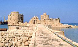
Ruined
Fortification and Pier at Sidon, Mediterranean Sea Port,
Lebanon |
|
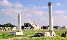
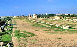
The ruined
Hippodrome |
|
|
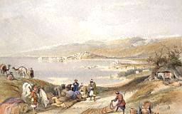
General view
of Sidon looking towards Lebanon |
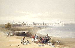
The Citadel
of Sidon |
"Of greater importance
to the understanding of greater events are the several epic tales
dealing with the god themselves. In these, the ability of the gods
to fly about is accepted as a matter of course, and their haven in
the "Crest of Zaphon" is featured as the astronauts’ resting place.
The central figures in these tales are Ba’al and Anat, the
brother-sister who are also lovers. Ba’al’s frequent epithet is "The
Rider of the Clouds" - an epithet which the Old Testament has
claimed for the Hebrew deity.
Of Anat it is said:
She raises wing, the Maiden Anat,
she raises wing and tours about flying,
to the midst of the meadow of Samakh
which with buffaloes abounds.
"Seeing her, Ba’al signaled her to come down; but
Anat began to play
hide-and-seek. Annoyed, Ba’al asked whether she expects him to
"anoint her 'horns'"- a lovemaking expression - "while in flight."
Unable to find her, Ba’al took off "and went up ... in the skies"
unto his throne-seat on the "Crest of Zaphon." The playful
Anat soon
appeared there soon," upon Zaphon in pleasure (to be).
"....In earlier years,
Ba’al engaged in life-and-death struggles
with other contenders for the godly throne, the prize for all these
fights was a place known as Zarerath Zaphon - commonly translated
"The Heights of Zaphon," but especially meaning "The Rocky Crest in
the North."
"....(The fact that Ba’al, who had at least three wives, could not
marry his beloved Anat confirms that she was a full, rather than a
half sister of his).
Ba’al’s plans were to have supremacy over the
Crest of Zaphon, and
through Asherah, who convinces El, it is agreed that
Ba’al will be
allowed to be the master of the Crest of Zaphon: "let him build his
house there."
But Ba’al also desired a Behmtam, commonly translated "house" but
which literally means "a raised platform."
"The
underground silo and raised platform were ready!
Losing no time, Ba’al decided to test the facility:
Ba’al opened the Funnel in the Raised Platform.
the window within the Great House.
In the clouds, Ba’al opened rifts.
His goddly sound Ba’al discharges.
His godly sound convulses the earth,
The mountains quake ...
A-tremble are the ...
In east and west, earth’s mounts reel.
"As Ba’al soared skyward, the divine messengers
Gapan and Ugar
joined him in flight: "The winged ones, the twain, flock the clouds"
behind Ba’al, "bird-like-the twain" soared above the snow-covered
peaks of Zaphon. But with the new facilities the Crest of Zaphon was
turned into the "Fastness of Zaphon," and Mount Lebanon ("The White
One," after its snowy peaks) acquired the epithet Sirion - "The Armoured" Mountain.
"....Now that he had attained these powers and
prerogatives,
Ba’al’s ambitions grew in scope.
"....Pursuing his quest for mastery,
Ba’al with the help of Anat - battled and
annihilated such male adversaries as Lothan, "the
Serpent"; Shalyat, "the seven-headed-dragon,"
Atak "the Bullock," as
well as the goddess Hashat, "The Bitch." We know from the Old
Testament that Yahweh, the biblical Lord, was also a bitter
adversary of Ba’al, and as Ba’al’s influence grew among the
Israelites when their king married a Canaanite princes, the prophet Elijah arranged a contest between Ba’al and Yahweh upon
Mount
Carmel.
"When Yahweh prevailed.... it was for
Yahweh that the Old Testament
claimed mastery over the Crest of Zaphon.
"....As
Ba’al in the Canaanite texts, so was the Hebrew Deity "Rider
of the Clouds."
"....The Hebrews were forbidden to worship, and therefore to make
statues or engraved images. But the Canaanites who must have known
of Yahweh, as the Hebrews had known of Ba’al, left us a depiction of
Yahweh as conceived by them. A fourth century B.C. coin which bears
the inscription Yahu ("Yahweh") depicts a bearded deity seated upon
a throne shaped as a winged wheel.
"It was thus universally assumed in the ancient Near East that
lordship over Zaphon established the supremacy among the gods who
could fly about.
"....Seven years after the Fastness of Zaphon was completed,
Ba’al
faced a challenge by Mot, Lord of the southern lands and the Lower
World. As it turned out, the dispute was no longer about the mastery
of Zaphon, rather, it had to do with "who over all the Earth
dominions shall have."
After plans and engaging in suspicious activities,
Ba’al wanted to
put one lip to Earth and one lip to Heaven.
Ba’al engaged Anat to help him, but in the end of the struggle
Ba’al
was fallen by Mot and Anat, enraged, "with a sword she cleaved
Mot."
The Craftman of the Gods was summoned, and Ba’al was miraculously
resurrected. "But whether he was resurrected physically on Earth, or
in a Celestial Afterlife (as Osiris) one cannot be certain."
"....This then is the evidence bequeathed to us from antiquity.
Millennium after Millennium, the peoples of the ancient Near East
were aware that within the Cedar Mountain there was a large platform
for "moving stones," adjoined by a "great house," within which "a
stone that whispers" was secreted.
"And, if we have been right in our interpretations of ancient texts
and drawings - could it be that this grand and known place had
vanished?
BA’AL
|
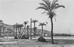
Mount Carmel
rises on the Mediterranean beyond the Town of Haifa
|
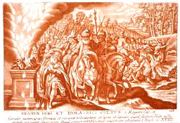
Elijah in
the name of Yahweh competes with the god "Ba’al," on
Mount Carmel |
|
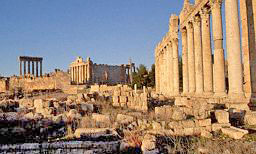
BAALBEK
|
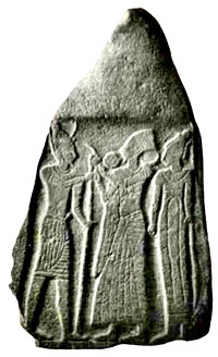
A stele from
Balua in Moab, depicting an ancient ruler of Moab
standing between Ba’al, distinguished by his homed
helmet, and the fertility and war-goddess Anat, wearing
her headdress with ostrich plumes of Osiris. |
|
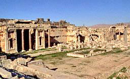
BAALBEK
|
|
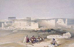
BAALBEK
|
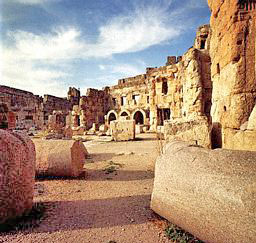
BAALBEK
|
Return
Chapter Nine
THE LANDING
PLACE
"The greatest Roman temple ruins lie not in Rome, but in the
mountains of Lebanon.
"....Emperors and generals came to it in search of oracles, to find
out their fate. Roman legionnaires sought to be billeted near it;
the devout and the curious went to see it with their own eyes: it
was one of the wonders of the ancient world.
"....The site is in the mountains of
Lebanon.... the enclosed squarish area, with some sides almost 2,500 feet long, measured over
five million square feet.
"....The temple proper was only the westernmost (and oldest) part of
a four-part shrine to Jupiter, which the Romans are believed to have
started to build soon after they occupied the place in 63 B.C.
"....From its monumental gateway staircase to its final western
wall, the shrine extended for more than 1,000 feet in length. It
completely dwarfed a very large temple to its south, which was
dedicated to a male deity, some think Bacchus but probably Mercury,
and a small round temple to the southeast, where Venus was
venerated.
"....The Romans considered the site and its great temple as the
ultimate attestations of the almightiness and supremacy of Jupiter.
Calling him Iove (echo of the Hebrew Yehovah?), they inscribed upon
the temple and its main statue the divine initials I.O.M.H. the
legend standing for Iove Optimus Maximus Heliopolitanus: the
Optimal
and Maximal Jupiter the Heliopolitan.
"The latter title of
Jupiter stemmed for the fact that though the
great temple was dedicated to the Supreme God, the place itself was
considered to have been a resting place of Helios, the Sun god who
could traverse the skies in his swift chariot. The belief was
transmitted to the Romans by the Greeks, from whom they also adopted
the name of the place Heliopolis. How the Greeks had come to so name
the place, no one knows for sure; some suggest that it was so named
by Alexander the Great.
"....In fact, the place and its association with certain gods go
back to even earlier times. Archaeologists believe that there may
have been as many as six temples built on the site before Roman
times, and it is certain that whatever shrines the Greeks may have
erected there, they - as the Romans after them - were only raising
the structures atop earlier foundations, religiously and literally.
"....The hold the place had over the beliefs and imaginations of
people throughout the millennia also manifested itself in the
history of the place following its Roman veneration.... circa A.D.
400, Rome was already Christian and the site was already a target of
zealous destruction. No sooner did Constantine the Great (A.D.
306-337) convert to Christianity, than he stopped all additional
work there and instead began the conversion of the place into a
Christian shrine. In the year 440, according to one chronicler,
Theodosius destroyed the temples of the Greeks, he transformed into
a Christian Church the temple of Heliopolis, that of
Ba’al Helios,
the great Sun-Ba’al of the celebrated Trilithon.
"....When the
Muslims gained the area in the year 637, they
converted the Roman temples and Christian churches atop the huge
platform into a Muhammedan enclave. Where Zeus and Jupiter had been
worshipped, a mosque was built to worship Allah.
"Modern scholars have tried to shed more light on the age-long
worship at this place.... and have concluded that a basic triad had
been worshipped throughout the ages.
"....The earliest Triad was headed, it appears, by
Adad, who was
alloted by his father Enlil - the chief god of Sumer - "the
mountainlands of the north." The female member of the Triad was Ishtar. After he visited the area, Alexander the Great struck a coin
honoring Ishtar/Astarte and Adad.
"....The third member of the Triad was the Celestial Charioteer,
Shamash - commander of the prehistoric astronauts. The Greeks
honored him as Helios.
"....Examining the Roman and Greek traditions and beliefs, we have
arrived back at Sumer; we have circled back to Gilgamesh and his
Search for Immortality in the Cedar Forest, at the "crossroads of
Ishtar." Though in the territory of Adad, he was told, the place was
also in the jurisdiction of Shamash. And so we have the original
Triad: Adad, Ishtar, Shamash.
"Have we come upon the
Landing Place?
"....Henry Seyrig, who as director of Antiquities of Syria devoted a
lifetime to the studies of the vast platform and its meaning, found
that the Greeks used to conduct their,
"rites of Mystery, in which
Afterlife was represented as human Immortality - an identification
with the deity obtained by the ascent (heavenward) of the soul."
The
Greeks, he concluded, indeed associated this place with Man’s
efforts to attain Immortality.
"Was then this place the very place in the
Cedar Mountains, to which
Gilgamesh had first gone with Enkidu, the Crest of Zaphon of Ba’al?
Mr. Sitchin explains in detail the colossal platform, built of
stones heavier than 500 tons. The largest ones in the Great Pyramid
of Egypt weigh 200 tons.
 "....The
stones for the Platform and Podium were quarried locally.
Wood and Dawkings include one of these quarries in their panoramic
sketch, showing some of the larger of the stone blocks strawn around
in the ancient quarry
(click image right). But the gigantic blocks were hewn, cut and
shaped at another quarry, situated in the valley some three-quarters
of a mile southwest of the sacred precinct. It is there that one
comes upon a sight even more incredible than that of the Trilithon. Partly buried in the ground, there lies yet another one of the
colossal granite slabs - left in situ by whoever the great quarrier
was.... fully shaped and perfectly cut.... A person climbing upon it
looks like a fly upon a block of ice.... It weighs, by conservative
estimates, more than 1,200 tons. "....The
stones for the Platform and Podium were quarried locally.
Wood and Dawkings include one of these quarries in their panoramic
sketch, showing some of the larger of the stone blocks strawn around
in the ancient quarry
(click image right). But the gigantic blocks were hewn, cut and
shaped at another quarry, situated in the valley some three-quarters
of a mile southwest of the sacred precinct. It is there that one
comes upon a sight even more incredible than that of the Trilithon. Partly buried in the ground, there lies yet another one of the
colossal granite slabs - left in situ by whoever the great quarrier
was.... fully shaped and perfectly cut.... A person climbing upon it
looks like a fly upon a block of ice.... It weighs, by conservative
estimates, more than 1,200 tons.
"....Wherever the leftover colossal stone was intended to be placed,
it serves as a mute witness to the immensity and uniqueness of the
Platform and Podium nesting in the Mountains of Lebanon. The
mind-boggling fact is that even nowadays there exists no crane,
vehicle or mechanism that can lift such a weight of 1,000-1,200 tons
- to say nothing of carrying such an immense object over valley and
mountainside, and placing each slab in its precise position, many
feet above the ground. There are no traces of any roadway, causeway,
ramp or other earthworks that could even remotely suggest the
hauling or dragging of these megaliths from the quarry to their
uphill site.
"Yet in remote days, someone, somehow had achieved the feat....
"But who? Local tradition hold that the place had existed from the
days of Adam and his sons, who resided in the area of the Cedar
Mountains after the expulsion of Adam and Eve from the
Garden of
Eden. Adam, these legends relate, inhabited the place which is now
Damascus, and died not far from there.
After mentioning several other legends
Mr. Sitchin adds:
"....All these local legends, which as all legends contain a kernel
of age-old recollections of actual events, agree that the place is
of extreme antiquity. They ascribe its building to "giants" and
connect its construction with the events of the Deluge. They connect
it with Ba’al, its function being that of a "Tower of Babel" - a
place from which to "scale the heavens."
"....The words and description of the
Hidden Place in the
Epic of
Gilgamesh also keep echoing in our ears. The insurmountable wall,
the gate which stuns whoever touches it, the tunnel to the
"enclosure from where words of command are issued," the "secret
abode of the Anunnaki," the monstrous Guardian with his "radiant
beam."
"And there is no doubt left in our mind that in
Baalbek we have
found Ba’al’s Crest of Zaphon, the target of the first journey of
Gilgamesh.
ROMAN RUINS IN
BAALBEK, LEBANON
|

|
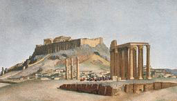
Temple to
Jupiter
|
|
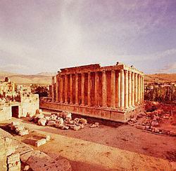
Temple of
Bacchus, Roman ruins in Lebanon |

Coffered
Ceiling of the Temple of Bacchus |
|
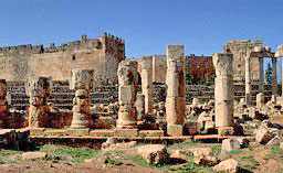
Temple to
Mercury
|
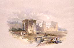
Circular
Temple to Venus |
CONSTANTINE THE GREAT
|
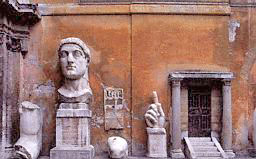
Fragments of
a colossal statue of Constantine the Great
|
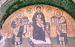
Mosaic of
Mary and Child with Emperors Justinian and Constantine
the Great |
|
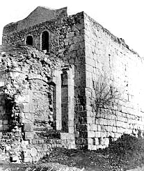
Damascus
Wall. A bricked-up gate in the old City Wall of
Damascus. |
DAMASCUS,
WHERE LEGEND SAYS ADAM WENT AFTER HIS EXPULSION FROM
EDEN.
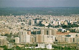
Overview of
Damascus, Syria, in 1965
|
"Were there indeed such
other places on Earth that could serve as Landing Places for the
aircraft of the gods? Were there, besides upon the Crest of Zaphon,
other "stones that whisper"?
"....Explaining the
Egyptian pantheon of twelve gods to his
countrymen, the Greek historian Herodotus also wrote of an "Immortal
whom the Egyptians venerated as "Hercules." He traced the origins of
the worship of this Immortal to Phoenicia, "hearing that there was a
temple of Hercules at that place, very highly venerated." In the
temple he saw two pillars. "One was of pure gold; the other was of
emerald, shining with great brilliancy at night."
"Such sacred "Sun Pillars" - "Stones of the gods" - were actually
depicted on Phoenician coins following the area’s conquest by
Alexander. Herodotus provides us with the additional information
that of the two connected stones, one was made of the metal which is
the best conductor of electricity (gold); and the other of a
precious stone (emerald) as is now used for laser communications,
giving off an eerie radiance as it emits a high powered beam. Was it
not like the contraption set up by Ba’al, which the Canaanite text
described as "stones of splendor"?
"....The construction (or reconstruction) upon the
Crest of Zaphon
of a launching silo and a landing platform for Ba’al was not the
cause of his fatal battle with Mot. Rather, it was his clandestine
attempt to set up a "Stone of Splendor." This device could
communicate with the heavens as well as with other places on Earth.
But, in addition, it was:
A stone that whispers,
Men its messages will not know,
Earth’s multitudes will not comprehend.
"....In a most thorough study of the subject,
Wilhem H. Roscher (Omphalos)
showed that the Indo-European term for these oracle stones -
navel
in English, nabel in German, etc.- stem from the Sanskrit nabh,
which meant "emanate forcefully." It is no coincidence that in the
Semitic languages naboh meant to foretell and
nabih meant "prophet."
All these identical meanings undoubtedly harken back to the
Sumerian, in which NA.BA(R) meant "bright-shiny stone that solves."
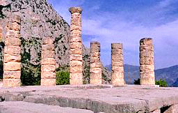
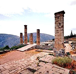
"....Delphi, the site of Greece’s most famous oracle was dedicated
to Apollo ("He of Stone"), its ruins are still one of Greece’s
leading tourist attractions. There too as at Baalbek, the sacred
precinct consisted of a platform shaped upon a mountainside, also
facing a valley that opens up as a funnel toward the
Mediterranean
Sea and the lands on its other shore.
"Many records established that an
omphalos stone was Delphi’s
holiest object. It was set into a special base in the inner sanctum
of the temple of Apollo, some say next to a golden statue of the god
and some say it was enshrined all by itself. In a subterranean
chamber, hidden from view by the oracle seekers, the oracle
priestess in trance-like oblivion, answered the questions of kings,
and heroes by uttering enigmatic answers - answers given by the god
but emanating from the omphalos.
"....How was Delphi chosen as an oracle place, and how did the omphalos stone come to be there? The traditions say that when
Zeus
wanted to find the center of the Earth, he released eagles from two
opposite ends of the world. Flying toward each other, they met at
Delphi whereupon the place was marked by erecting there a
navel
stone, an omphalos. According to the Greek historian Strabo, images
of two such eagles were perched on top on the omphalos at
Delphi.
"....No surprisingly, we find the twin Sacred Stones, accompanied by
the two eagles, also depicted in Egyptian sacred writings, and many
centuries before the Greeks even began to enshrine their oracle
centers, an Egyptian Pharaoh depicted an omphalos with the two
perched birds in his pyramids. He was Seti I, who lived in the
fourteenth century B.C.; and it was in his depiction of the domain
of Seker, the Hidden God, that we have the oldest omphalos to date.
"It was the
communications means whereby messages - "words" - "were
spoken to Seker everyday."
"In
Baalbek, we have found the target of the first journey of
Gilgamesh. Having followed the threads connecting the "whispering"
Stones of Splendor, we arrived at the Duat.
"It was the place where the Pharaohs sought the
Stairway to Heaven for an Afterlife. It was we suggest, the place whereto
Gilgamesh, in
search of Life, set his course on his second journey."
HERODOTUS WROTE ABOUT
HERCULES
|
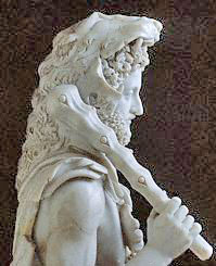
Detail of
an ancient European Statue of Hercules. |
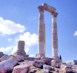
Roman
Temple of Hercules, Amman
|
|
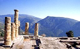
TEMPLE OF
APOLLO, Greece |
TEMPLES OF ZEUS
|
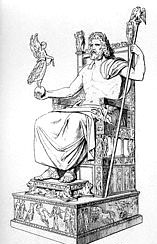
An
antique sketch of the Greek god Zeus seated on a throne.
|
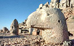
The Head
of a colossal statue of Zeus lies amid the ruins of an
Eagle, at Nemrut Dagi
|
|
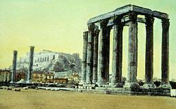
Temple of
Zeus at Athens, Greece |
....and in Egypt....
SETI I, the Pharaoh
who depicted "omphalo" in his Pyramids
|

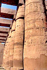
Hall way
in the Temple of Seti I - Some of the 134 carved columns
which stand in the Hypostyle Hall Temple built for Seti
I, El Karmak
.
|
 |
Return
Chapter Ten
TILMUN: LAND
OF THE ROCKETSHIPS
"The goal of Gilgamesh was
Tilmun, the land where the rocketships
were raised up. To ask where he went to reach Tilmun, is to ask
where Alexander went, deeming himself a Pharaoh and a god’s son. It
is to ask: Where on Earth was the Duat? Because all these
destinations, we must conclude, were one and the same. And the land
where they hoped to find the Stairway to Heaven, we shall
conclusively show, was the peninsula of Sinai.
"....The suggestion that the
Pharaoh’s journey to the Afterlife had
indeed taken him to the Sinai peninsula is supported by the fact
that Alexander had emulated not only the Pharaohs, there was a
deliberate effort to emulate the Israelite Exodus from Egypt under
the leadership of Moses.
"....The arena for the
biblical Exodus was the peninsula of Sinai.
The conclusion from all the similarities and footstep-following can
only be that it was toward the Sinai peninsula that Alexander,
Moses
and the Pharaohs set their course as they set east from Egypt. This,
we will show, was also the destination of Gilgamesh.
"To reach
Tilmun on his second and decisive journey Gilgamesh set
sail in a "Ship of Magan," a ship of Egypt. Starting from
Mesopotamia, his only course was to sail down the Persian Gulf.
Then, rounding the Arabian peninsula, he would have entered the Red
Sea (which the Egyptians called the Sea of Ur). As the name of his
ship indicates, he would have sailed up the Red Sea toward Egypt.
But his destination was not Egypt, it was Tilmun. Was he then
intending to land on the western shores of the Red Sea - in Nubia?
On the eastern shore - in Arabia? Or straight ahead, on the
peninsula of Sinai?
"....Just as the Cedar of Lebanon had served as a unique landmark
for determining the first destination of Gilgamesh, so does the
"Sea of the Waters of Death" serve as a unique clue to the
whereabouts of Gilgamesh on his second journey.... It is so called
to this day: the Dead Sea. Its waters are so saturated with salt and
minerals that it is totally devoid of all marine and plant life.
"The city that overlooked the Sea of the Waters of Death was
surrounded by a wall. Its temple was dedicated to Sin, the Moon-god.
Outside the city there was an inn. The hostess took Gilgamesh in,
extending to him hospitality, giving him information.
"The uncanny similarities to a known
biblical tale cannot be missed.
When the Israelite’s forty years of wondering in the Wilderness had
come to an end, it was time to enter Cannan. Coming from the Sinai
peninsula, they circled the Dead Sea from its eastern side until
they reached the place where the Jordan River flows into the Dead
Sea. When Moses stood upon a hill overlooking the plane, he could
see - as Gilgamesh had seen - the shimmering waters of the
"low-lying-sea." In the plain, on the other side of the Jordan,
stood a city, Jericho. It blocked the Israelite’s advance to
Canaan,
and they sent two spies to explore its defenses. A woman whose inn
was at the city’s walls extended to them hospitality, gave them
information and guidance.
"The Hebrew name for Jericho is Yeriho. It literally means "Moon
City" - the city dedicated to the Moon god, Sin....
"It was, we suggest, the very city reached by
Gilgamesh fifteen
centuries before the Exodus.
"Was Jericho already in existence circa 2900 B.C. when
Gilgamesh was
engaged in his searches? Archaeologists are agreed that Jericho has
been inhabited since 7000 B.C., and served as a flourishing urban
center since about 3,500 B.C.; it was certainly there when Gilgamesh
arrived.
Through directions given to
Gilgamesh, he was supposed to arrive to
a city named Itla, Mr Sitchin continues:
"....Itla, it was located some distance from the Great Sea. Beyond
Itla, in the Fourth Region of the gods, lay the
restricted area.
"Was Itla a "City of the Gods" or a
City of Men?
"The events there, described in a fragmented Hittite version of the
Gilgamesh Epic, indicate that it was a place for both. It was a
"sanctified city," with various gods coming and going through or
within easy reach of it. But men too could go there: the way to it
was indicated by road markers.
In the Old Testament it was known as
Kadesh ("The Sanctified") "it
was distinguished from a northern namesake (situated, significantly
on the approaches of Baalbek) by being called Kadesh-Barnea (which
stemming from the Sumer [symbol] (shown on book) could have meant "Kadesh
of the Shiny Stone Pillars").
"....Scholars have advanced many theories regarding the origin of
the peninsula’s name Sinai. For once, the obvious reason - that, as
the name stated, it "Belonged to Sin" - has been among the preferred
solutions.
We can see [shown on book] that the
Moon’s crescent was the emblem
of the deity in whose land the Winged Gate was located. We find that
the main crossroads in the central Sinai, the well-watered place Nakhl, still bears the name of Sin’s spouse.
"And we can confidently conclude that the "Land Tilmun"
was the
Sinai peninsula.
"An examination of the geography, topography, geology, climate,
flora and history of the Sinai peninsula will confirm our
identification, and clarify the Sinai’s role in the affairs of gods
and men.
And indeed it does. Mr. Sitchin gives a quote from texts and gives
an identification with the actual land. The wadis are mentioned as part of the identification:
"Typical to most of the peninsula are the
wadis.... The bulk of the
peninsula’s rainwater is drained northward into the Mediterranean
Sea, via the extensive Wadi El-Arish and its myriad tributaries,
that look on a map as the blood vessels of a giant heart. In this
part of the Sinai, the depths of the wadis that make up this network
may change from a few inches to a few feet, the width - from a few
feet to a mile and more after a sizable rain.
"The Bedouin (local nomads), as other seasoned travellers in the
Sinai, can duplicate the miracle (of Moses), if the soil making up
the wadi’s bed is right. The secret is that in many places the rocky
bed lies above a layer of clay soil that captures the water as it
quickly seeps through the rocks. With knowledge and luck, a little
digging in a completely dry bed uncovers water only a few feet below
the surface.
"Was this normal art the great miracle performed by the
Lord? Recent
discoveries in the Sinai throw a new light on the subject. Israeli
hydrologists (associated with the Weizman Institute of Science) have
discovered that, like parts of the Sahara Desert and some deserts in
Nubia, there is "fossil water" - the remains of
prehistoric lakes
from another geological era - deep under the central Sinai. The vast
underground reservoir, with enough water (they estimated) to suffice
for a population as large as Israel’s for almost one hundred years,
extends for some 6,000 square miles in a wide belt that begins near
the Suez Canal and reaches under Israel’s arid Negev.
"....Could the
Nefilim, with their space-age technology have missed
this knowledge? Was this, rather than a little water in a dry wadi
bed, the water that gushed forth after Moses had struck the rock, as
indicated by the Lord?
As the tale of Moses in the
Old Testament, striking the rock in the
desert, and water poured forth for all the Israelites and their
livestock; there is a similar Sumerian tale.
A tale of bad times in Tilmun caused shortage of waters.
"....Ninsikilla, spouse of
Tilmun’s ruler Enshag, complained to her
father Enki:
The city which thou has given....
Tilmun, the city thou has given....
Has not waters of the river....
Unbathed is the maiden....
No sparkling water is poured in the city.
Father Enki answered Ninsikilla, his daughter....
"Let divine Utu position himself in the skies....
A missile let him tightly affix to his "breast"
and from high direct it toward the earth.....
From the source from whence issues Earth’s waters,
let him bring thee sweet water from the earth."
"Could a missile shot
from the skies pierce the earth and cause potable water to come up?
Anticipating the incredulity of its readers the ancient scribe
affirmed at the tale’s end: "Verily, it was so." The miracle, the
text went on, did work: Tilmun became a land "of crop raising fields
and farms which bear grain;" and Tilmun-City "became port city of
the land, the site of quays and mooring piers."
"The parallels between
Tilmun and Sinai are thus double affirmed:
first, the existence of the subterranean water reservoir, below the
rocky surface; secondly, the presence of Utu/Shamash (the
Spaceport’s commander) in the proximity.
The Sinai peninsula can also account for all the products for which
Tilmun was renowned,
gemstones akin to bluish lapis lazuli
blue-green gemstone turquoise
blue-green mineral (malachite).
"....Indeed the Egyptian name for turquoise
mafka-t (after which
they called the Sinai "The Land of Mafkat), stems from the Semitic
verb meaning "to mine, to extract by cutting." These mining areas
were in the domain of the goddess Hathor, who was known both as
"Lady of Sinai" and "Lady of Mafkat." A great goddess of olden
times, one of the early sky gods of the Egyptians, she was nicknamed
by them "The Cow." Her name Hat-Hor spelled hieroglyphically by
drawing a falcon within an enclosure, has been interpreted by
scholars to mean "House of Horus,"
(Horus having been depicted as a falcon). But it literally meant:
"Falcon House," which affirms our conclusions regarding the location
and functions of the Land of the Missiles.
"According to the
Enciclopaedia Britannica, "turquoise was obtained
from the Sinai peninsula before the fourth millennium B.C. in one of
the first world’s important hard-rock mining operations." At the
time the Sumerian civilization was only beginning to stir, and the
Egyptian one was almost a millennium away. Who then could have
organized the mining activities. The Egyptians said it was Thoth,
the god of sciences.
"In this and in the assignment of the Sinai to Hathor, the
Egyptians
emulated Sumerian traditions. According to Sumerian texts, the god
who organized the mining operations of the Anunnaki was
Enki, the
God of Knowledge; and Tilmun, the texts attested, was alloted in
pre-Deluvial times to Ninhursag, sister of Enki and Enlil. In her
youth she was a smashing beauty and the chief nurse of the Nefilim,
but in her old age, she was nicknamed "The Cow" and as the goddess
of the Date Palm, was depicted with cow’s horns.
The similarities between her and
Hathor, and the analogies between
their domains, are too obvious to require elaboration.
"The Sinai was also a major source of
copper, and the evidence of
this is that the Egyptians relied mostly on raiding expeditions to
obtain it.... A Pharaoh of the Twelfth Dynasty (the time of Abraham)
left us these comments of his deeds:
"Reaching the bounderings of the foreign lands with his feet,
exploring the mysterious valleys, reaching the limits of the
unknown." He boasted that his men lost not a single case of the
seized booty.
"....(Beno Rothenberg, Sinai Explorations 1967-1972) "We could
establish the existence of a fairly large industrial metallurgical
enterprise .... There are copper mines, miner’s camps and copper
smelting installations, spread from the western parts of southern
Sinai to as far east as Elat at the head of the
Gulf of Aqaba."
"....The tribe into which Moses married when he escaped from Egypt
into the Sinai was that of the Qenites. Their name literally meant
"smiths, metallurgists."
R.J. Forbes (The Evolution of the Smith) pointed out that the
biblical term Qain ("smith") stemmed from the Sumerian
KIN
("fashioner").
"Pharaoh Ramses III, who reigned in the century following the
Exodus, recorded his invasion of these coppersmiths’ dwellings and
the plundering of the metallurgical center of Timna-Elat.
"....It was to spend the rest of his life in the mines of
Tilmun
that the gods had sentenced Enkidu, and so it was that Gilgamesh
conceived the plan to charter a "Ship of Egypt" and take his comrade
along - since the Land of Mines and the "Land of Missiles" were both
part of the same land. Our identification matches the ancient data.
"....A persistent school of thought, one of whose early advocates
was P.B. Cornwall (One the Location of Tilmun), identifies
Tilmun
(sometimes transcribed "Dilmun") as the island of Bahrein in the
Persian Gulf."
"....There are several flows in this interpretation. First, it could
well be that only the capital city of Tilmun was on an offshore
island: the texts leave no doubt that there was a land Tilmun and a
Tilmun-city. Secondly, other Assyrian inscriptions which describes
cities as being "in the midst of the sea" apply to coastal cities on
a bay or a promontory, but not on an island (as, for instance, Arvad
on the Mediterranean coast). Then, if the "sea where the sun rises"
indicates a sea east of Mesopotamia, the Persian Gulf does not
qualify, since it lies to the south, not to the east, of Mesopotamia
"....Another major problem arising from a Bahrein-Tilmun
identification concerns the products for which Tilmun was
renowned.... Bahrein had none of these, except for some "ordinary
dates."
Mr. Sitchin continues with more prove about the location of
Tilmun.
Of special importance is the explanation of the misunderstanding of
some scholars:
"....In view of the proximity of
Tilmun to Egypt, what about the
statements that Tilmun was "where the sun rises" - meaning (scholars
say) east of Sumer, and not west of it (as the Sinai is?)
The simple answer is that the texts do not make that statement at
all. They do not say "where the Sun rises"; they state "where
Shamash ascends" - and that makes all the difference.
Tilmun was not
at all in the east; but it certainly was the place where Utu/Shamash
(the god whose celestial symbol was the Sun, and not the Sun itself)
ascended skyward in his rocketships. The words of the Gilgamesh epic
are quite clear:
At the
Mountain of Mashu he arrived,
Where by day the Shems he watched
as they depart and come in....
Rocket-men guard its gate....
they watch over Shamash
as he ascends and descends.
"That indeed was the place whereto
Ziusudra had been taken.
"....And so it was that Gilgamesh - denied permission to mount a
Shem, and seeking therefore only to converse with his ancestor
Ziusudra - set his steps to Mount Mashu in
Tilmun - the Mount of
Moshe (Moses) in the Sinai Peninsula.
Among the examples of the flora of
Tilmun, Mr. Sitchin mentions the
acacia tree, onions, tamarisks, and also:
"....The tree with which
Tilmun was most associated in antiquity,
however, was the date palm....
We know from Mesopotamian records that these dates were also
exported from Tilmun in antiquity. The dates were so large and tasty
that recipes for the meals of the gods of Uruk (the city of
Gilgamesh) specified that "every day of the year, for the four daily
meals, 108 measures of ordinary dates, and dates of the Land Tilmun,
as also figs and raisings.... shall be offered to the deities." The
nearest and most ancient town to the land route from Sinai to
Mesopotamia was Jericho. Its biblical epithet was "Jericho, the city
of dates."
"....Alongside the Winged Disk (the emblem of the
Twelfth Planet),
the symbol most widely depicted by all the ancient nations was the
Tree of Life.
"....The source of all these depictions and beliefs were Sumerian
records of the Land of Living, Tilmun,
Where old woman says not "I am an old woman,"
Where old man says not "I am an old man."
"The Sumerians, masters of word-plays, called the
Land of the
Missiles TIL.MUN, yet the term could also mean "Land of Living," for
TIL also meant "Life." The Tree of Life in Sumerian was
GISH.TIL;
but GISH also meant a man-made, a manufactured object; so that
GISH.TIL could also mean "The Vehicle to Life" - a
rocketship. In
art too, we find the Eagle-men sometimes saluting not the date palm,
but a rocket.
"....The binding knots tighten further, as we find that in Greek
religious art, the omphalos was associated with the date palm.
"....We have found earlier that the omphalos served as a
link
between Greek, Egyptian, Nubian and Canaanite "oracle centers" and
the Duat. Now we find this "Stone of Splendor" linked to the date
palm - The Tree of the Land of Living.
"Indeed, Sumerian texts accompanying depictions of the
Cherubim
included the following incantation:
The dark-brown tree of Enki I hold in my hand;
The tree that tells the count, great heavensward weapon,
I hold in my hand;
The palm tree, great tree of oracles, I hold in my hand.
"A Mesopotamian depiction shows a god holding up in his hand this
"palm tree, Great tree of oracles." He is granting this Fruit of
Life to a king at the place of the "Four Gods." We have already come
upon this place, in Egyptian texts and depictions; they were the
Four Gods of the Four Cardinal Points, located by the Stairway to
Heaven in the Duat. We have also seen that the
Sumerian Gateway to
Heaven was marked by the date palm.
"And we have no more doubt that the target of the ancient
Search of
Immortality was a Spaceport - somewhere in the
Sinai peninsula.
Return
Chapter Eleven
THE ELUSIVE
MOUNT
"Somewhere in the Sinai peninsula, the Nefilim had established their
post-Diluvial Spaceport. Somewhere in the Sinai peninsula, mortals -
a selected few, with their god’s blessing - could approach a certain
mountain.
-
There, "Go back!" the guarding bird-men ordered
Alexander,
"The ’for land on which you stand belongs to God alone."
-
There, "Do
not come nearer!" the Lord called out to Moses, "for the place
whereon thou standest is sacred ground."
-
There, eagle-men challenged
Gilgamesh with their stun-rays, only to realize he was no mere
mortal.
"The Sumerians called the mount of encounter
Mount MA.SHU - the
Mount of the Supreme Barge. The tales of Alexander named it
Mount Mushas - the Mountain of Moses.
"....The
Israelite Exodus from Egypt has been commemorated each year
for the past thirty-three centuries by the celebration of the
Passover. The historical and religious records of the Hebrews are
replete with reference to the Exodus, the wanderings in the
Wilderness, the Covenant at Mount Sinai. The people have been
constantly reminded of the Theophany, when the whole nation of
Israel had seen the Lord Yahweh alight in his glory upon the sacred
mount. Yet its location was de-emphasized, lest attempts be made to
make the place a cult center.
"The modern pilgrim, as pilgrims have done for centuries past, sets
its course to the monastery of Santa Katarina, so named after the
martyred Katherine of Egypt whose body angels carried to the nearby
peak bearing her name. After an overnight stay, at daybreak, the
pilgrims begin the climb to Gebel Mussa ("Mount Moses" in Arabic).
It is the southern peak of a two mile massif rising south of the
monastery - the "traditional" Mount Sinai with which the
Theophany
and the Lawgiving are associated.
"....From the peak of
Gebel Mussa, one can see some of the other
peaks which make the granite heartland, of which this mount is a
member. Surprisingly, it appears to be lower than many of its
neighbors!
"Indeed in support of the
Saint Katherine legend, the monks have put
up a sign in the main building which proclaims:
Altitude 5012 FT
Moses Mount 7560 FT
St. Katherine Mount 8576 FT
"As one is convinced that
Mount Katherine is indeed the higher one -
in fact, the highest in the peninsula - and thus rightly chosen by
the angels to hide the saint’s body thereon, one is also
disappointed that - contrary to long-held beliefs - God had brought
the Children of Israel to this forbidding area, to impress upon them
his might and his laws not from the tallest mount around.
"Had
God missed the right mountain?
"....Johann Ludwig Burckhardt, studying Arabic and Muslim customs,
on April 15, 1816, he set on camelback from the town of Suez, at the
head of Gulf of Suez. His goal was to retrace the route of the
Exodus, and thereby to establish the true identity of Mount Sinai.
Following the presumed route taken by the Israelites, he travelled
south along the western coast of the peninsula.... As he went south, Burckhardt noted the geography, topography, distances. He compared
conditions and place names with the descriptions and names of the
stations of the Exodus as mentioned in the Bible. Where the
limestone ends, nature has provided a sandy belt which separates the
plateau from a belt of Nubian sandstone serving as a cross-Sinai
avenue. There Burckhardt turned inland, and after a while set his
course southward into the granite heartland, reaching the Katherine
monastery from the south (as today’s air traveller does).
"Some of his observations are of a lingering interest. The area, he
found, produced excellent dates....
"....Additional research established that the
main monastic center
in Sinai, through most of the centuries, was at Wadi Feiran, near
Serbal - and not St. Katherine.
"When
Burckhardt published his findings (Travels in Syria and the
Holy Land ) his conclusions shook the scholarly and biblical world.
The true Mount Sinai, he stated was not Mount Mussa, but
Mount Serbal!
"....The next major journey to Sinai was undertaken by the American
Edward Robinson together with Eli Smith. Like Burckhardt, they left
Suez City on camelback armed with his book and the Laborde’s maps,
(a French Count, Leon de, who had toured Sinai back in 1826 and
1828). It took them thirteen early spring days to reach St.
Katherine. There, Robinson gave the monk’s legends a thoroughgoing
examination. He found out that at Feiran there indeed was a superior
monastic community, sometimes led by full bishops, to which
Katherine and several others monastic communities in southern Sinai
were subordinate, so that tradition must have placed greater
emphasis on Feiran. In the tales and documents, he discovered that
mounts Mossa and Katherine were of no Christian consequence in the
early Christian centuries, and that Katherine’s supremacy developed
only in the seventeenth century, when the other unfortified monastic
communities fell prey to invaders and marauders. Checking local Arab
traditions, he found that the biblical names "Sinai" and "Horeb"
were totally unknown to the local Bedouins, it was the Katherine
monks who began to apply these names to certain mountains.
"Was
Buckhardt then right?
More researchers came along and the same results were presented.
"....But if not
Mount Mussa, why Mount Serbal? Besides its "correct"
location at Wadi Feiran, Lepsius (Karl Richard, great Egyptologist
and founder of scientific archaeology), found some concrete
evidence. Describing the mount in glowing terms, he reported finding
on its top: "A deep mountain hollow around which the five summits of
Serbal unite in a half circle and form a towering crown." In the
middle of this hollow he found ruins of an old convent. It was at
that hallowed spot, he suggested that the "Glory of the Lord" had
landed, in full view of the Israelites (who were gathered in the
plain to the west). As to the fault that Robinson had found with
Burckhardt’s Exodus route to Serbal - Lepsius offered an alternative
detour which corrected the problem.
Many years of research were dedicated trying to find the route of
the Exodus. Mr. Sitchin reviews them in some detail mentioning the
Archaeologists, Cartographers, Authors, Explorers, and their
opinions.
"As the debate continued to engross the scholarly and biblical
world, it became apparent that the basic unresolved issue was this:
Insofar as the Crossing was concerned, the weight of the evidence
negated a northern body of water; but insofar as Mount Sinai was
concerned, the weight of the evidence negated a southern location.
The impasse focused the attention of scholars and explorers on the
only remaining compromise: the Central Plain of the Sinai peninsula.
"The long occupation of the Sinai by Israel, in the aftermath of the
1967 war with Egypt, opened up the peninsula to study and research
on an unprecedented scale. Archaeologists, historians, geographers,
topographers, geologists, engineers examined the peninsula from tip
to toe.
"....Beno Rothenberg (Sinai Explorations 1967 - 1972 and other
reports), mostly under the auspices of Tel-Aviv University. In the
Northern coastal strip, many ancient sites reflected the
"bridge-like nature of this area." In the Central Plain of north
Sinai, no ancient sites of permanent abode were found, but only
evidence of camping sites, attesting that this was only a transit
area. When the camping sites were plotted on the map, they formed "a
clear line from the Negev toward Egypt, and this should be
considered as the direction of prehistory movements across the
’Desert of the Wanderings’ (the el-Tih)."
Yet another controversial site was offered by a Hebrew University
biblical geographer, Menasher Har-El, proposing another site of
Crossing, and for the battle of Israel with Amalekites, according to
him in the coast of the Gulf of Suez.
"This suggestion has been rejected by Israeli military experts
familiar with the terrain and history of warfare in the Sinai.
"Where then, was Mount Sinai? We must look again at the ancient
evidence.
"The Pharaoh, in his journey to the Afterlife, went eastward.
Crossing the watery barrier he set his course to a pass in the
mountains. He then reached the Duat, which was an oval-shaped valley
surrounded by mountains. The "Mountain of Light" was situated where
the stream of Osiris divided into tributaries, (pictorial shown in
book).
"We have found similar pictorial evidence from Assyria.
The Assyrian kings, it should be remembered, arrived at the Sinai
from the opposite direction, to that of the Egyptians kings: from
the northeast, via Canaan. One of them, Esarhaddon, engraved on a
stela what amounts to a route map of his own quest for "Life." It
shows the date palm - the code emblem for the Sinai, a farming area
symbolized by the plough, and a "Sacred Mount." I
n the upper
register we see Esarhaddon at the shrine of the Supreme Deity, near
the Tree of Life. It is flanked by the sign of the bull - the very
image (the "golden calf") that the Israelites had fashioned at the
foot of Mount Sinai.
"All this does not bespeak the harsh, barren granite peaks of
southern Sinai. Rather, it suggests northern Sinai and its dominant
Wadi El-Arish, whose very name means Stream of the Husbandman. It is
among its tributaries, in a valley surrounded by mountains, that the Mount was located.
"There is only one such place in the whole of the Sinai peninsula.
Geography, topography, historical texts, pictorial depictions - all
point at the Central Plain in Sinai’s northern half.
"....The Central Plain.... its hard gravel top meant that it was
admirably suited for the Spaceport of the Nefilim. And if
Mount Mashu marked the gateway to the Spaceport, it had to be located on
the outskirts of this facility.
"There have been found Sumerian cylinder seals depicting the
appearance of a deity unto a shepherd. They show the god appearing
from between two mountains, with a rocket-like tree behind him -
perhaps the Sneh ("Burning Bush") of the biblical tale. The
introduction of the two peaks in the shepherd scene fits the
frequent biblical reference to the Lord as El Shaddai -
God of the
Two Peaks. It thus raises yet another distinction between the Mount
of the Lawgiving and the Mountain of the Gods: the one was a
solitary mount in a desert plain; the other seems to have been a
combination of two sacred peaks.
"The Ugaritic texts also recognize a "Mountain of the Young Gods" in
the environs of Kadesh, and two peaks of El and
Asherah - Shad Elim,
Shad Asheraht u Rahim - in the south of the peninsula. It was to
that area at mebokh naharam ("Where the two bodies of water begin"),
Kerev apheq tehomtam ("near the cleft of the two seas") that
El had
retired in his old age. The texts, we believe, describe the southern
tip of the Sinai peninsula.
"There was, we conclude, a
Gateway Mount on the perimeter of the
Spaceport in the Central Plain. And there were two peaks in the
peninsula’s southern tip that also played a role in the comings and
goings of the Nefilim. They were the two peaks that measured up.
Return
|


