|
For nearly 40 years has technology been deployed to alter local weather conditions thereby affecting our global weather systems and then by default our climate?
These are my thoughts as I observe the skies overhead and wonder who else in the atmospheric sciences community is attempting to quantify—as I am—these now obvious “activities.”
It is also possible that if one takes the broadest view of history - the past 12,000 years or so - a conclusion could easily be reached that this EM (electromagnetic) activity, this knowledge, has been in place for a very long span of time. The increase in intensity over the recent decades is what has captured my attention.
Yet despite its obviousness we get more silence from those whom we have entrusted with our safety, security, and personal liberty. Maybe achieving this protection from government simply is not possible.
History has always shown us that ones security and liberty are always better left to the individual rather than to pass that responsibility on to the State where eventual abuses are a near certainty.
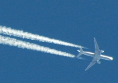
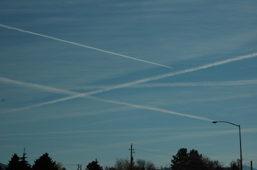
Day after day aircraft of military, corporate, and private entities use the skies as a medium of conveyance with seemingly little environmental impact… Seemingly little impact, that is until now.
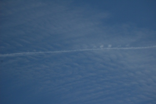
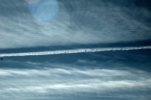
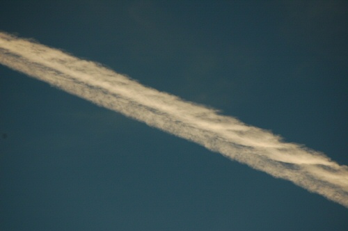
Aircraft exhaust is partially composed of condensed water that once expelled from the hot engines is then quickly exposed to the minus 30-degree atmosphere at altitudes >25,000ft or ~9,000m.
This flash frozen water vapor quickly crystallizes and can briefly form a trail, known as a condensation trail or a contrail. Dependent on the relative humidity of the surrounding environment, the trail will persist and grow into a cloud or thin ice, then sublimates back into a vapor condition returning to visual invisibility.
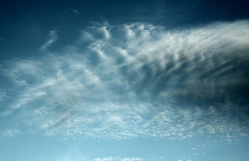
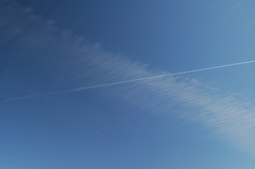
Since about 1990, but more so since about 1997, these trails are not sublimating back into vapor. Despite the dry ambient atmosphere (even at humidity values under 30% and RH of >70% which is usually required for cloud development) the trails begin to spread. Clearly something has changed.
Geometric shapes along with intelligently designed (I suppose this could be an oxymoron!) patterns have become more visible with the expansion in the high cloud cover as a result of these new, long lasting aircraft trails.
These patterns are seen most frequently within the cirrus deck and the cloud decks immediately below.
“Funny”, not “ha-ha funny”, more like that’s “just curious” and especially to a weatherman with a camera always at hand, who now says “Ha-ha I caught you.”
A lot!
The computer forecast models say the humidity is going to be very low throughout the depth/profile of the atmosphere for the coming day, and so the TV weatherman calls for sunshine, from sunrise to sundown. But then the next morning the sky is covered in lines.
The aircraft have been busy, a lot of travel to the West Coast you think to yourself. Sometimes the trails are there before the sky brightens at dawn while other times the trails don’t begin until the drive to work is underway. Ultimately, it just doesn’t matter. The weatherman got it wrong. It is now partly sunny and he is just partly right.
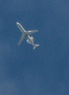
But still the planes come. They come from and go in directions where there are no commercial destinations for planes of that type. These flights don’t match up with flights of known plans that have filed flight planes with the FAA and then appear on Flight Aware.com or Flight Explorer as they traverse North American airspace in the accepted airways.
These planes generally fly one to two miles below legitimate passenger air traffic.
The lowest of these flights are planes just low and slowly working
their way back to base. Where are these bases? I would really like
to see a list and photographs with the planes present on the tarmac.
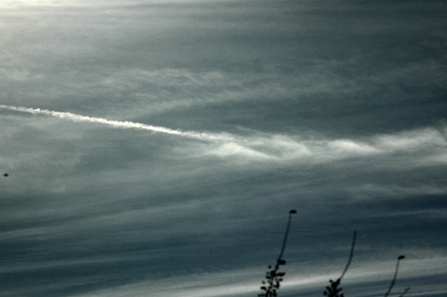
The sun still shines, the November afternoon is warm, but the sky is no longer an Indian summer blue. It is hazy, milky, and a grayish white.
Still, more planes come.
With the arrival of these planes and those previous polluting trails, now even the clouds have begun to look a little peculiar. Waves roll through the thin membrane like growing layers of clouds.
One observes that these waves are coming from opposing directions, intersecting, and splashing the thin clouds like a cold wind blows the freshly fallen snow across a rippled country road.
Something has
changed.
Even today that simple act of rotation impacts the local gravity-time fields. An additional clue came from William Cohen nearly 10 years ago when he was the United States Secretary of Defense.
While speaking at an anti-terrorism conference in Georgia, he made the following statement:
Wow, that is a pretty bold statement from the man in charge of the military of the United States. Too bad the Republicans wanted Monica Lewinski’s blue dress as the lead story that day. Too bad the press let them get their way.
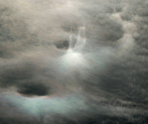
These holes are
hard to miss once you know what they look like and begin to actually
look for them. For weather purposes, their size varies from just a
few meters to several kilometers in diameter.
These holes have their own surreal beauty!
This image is one I happened to shoot here in Idaho last November 2005 on a very busy day of aircraft trailing.
Would these waves, and would these holes even be visible if it weren’t for these planes, that just keep coming?
These incessant weather engineers seem to be capable of finding and of being able to target their craft through… and precisely so… the very interesting geometry that is now appearing in and around the waves and holes that are a result of the resonance that has now been established in our atmosphere by the affect of weather manipulation.
So is this jet exhaust trail really just composed of water? Are these really still just regular condensation trails that have been around since the high flying military bombers of the 1930s and 40s?
Not any longer I’ll bet.
|