|
|
|

|
August 2003 from PaddyMcGee-TheUniversityOfAdelaide Website
This page displays some results obtained using POV-Ray to simulate
the visual effects of terraforming on Mars and Venus. Elevation maps
of these planets (obtained from the Web) were used as height-fields
in POV-Ray. A "water plane" was then added to the POV-Ray scene, and
its height varied in order to simulate different ocean levels.
Note that some liberties have been taken with the image map used for Venus; it was generated from the elevation map that was used, with a bit of green thrown in for good measure.
Mars Venus
It is to be noted that Mars has rather a southern-hemisphere bias on
the distribution of land-masses, whilst Venus has a more even
distribution for moderate ocean levels. However, Venus presents a
more broken, island-based topography, compared with Mars' somewhat
continental appearance.
This is shown below, for each planet, with three different longitudes and with a simple simulated atmosphere.
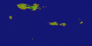
Venus Three views from above the equator.
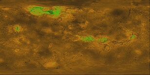
Left image: Aphrodite Terra lies roughly along the equator, with Thetis Regio (left) and Alta Regio (right) shown as green. The channels of Diana Chasma, Dali Chasma and Artemis Chasma are evident.
Meridian approx. 165º. with Maxwell Montes as a small, dark green patch. Eistla Regio lies south of Ishtar Terra, with Alpha Regio and Lada Terra being the main land masses in the south.
Meridian approx.10º. with Devana Chasma running south from it. Phoebe Regio and Themis Regio are equatorial and south, respectively. Meridian approx. 290º.
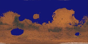
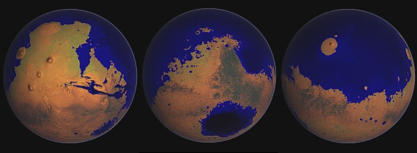
Mars View as per Venus images. For these images, the image map which provides the color information has been combined with the height-field image. Therefore, the different shades of blue in the oceans, etc., give an indication of the depth of the water.
This process also slightly modified the colors of the image map- just a hint of green.
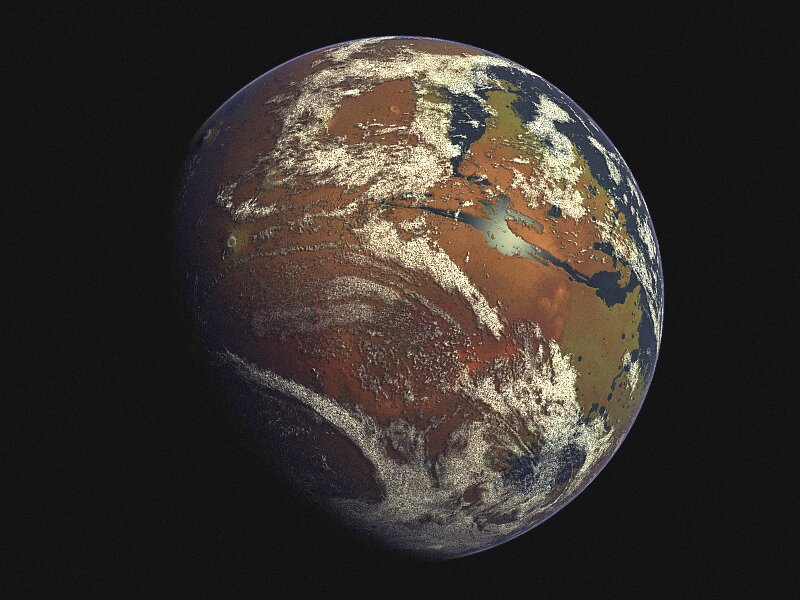
Left image: Olympus Mons to the left (west), the Tharsis Ridge with Arsia Mons, Pavonis Mons and Ascraeus Mons slightly to its east, and Valles Marineris just south of the equator.
The lake formed from Argyre Planitia is near the south-eastern limb. Meridian approx.
90º.
The inland
sea formed from Hellas Planitia is to the south. Meridian approx.
315º. Meridian approx. 200º.
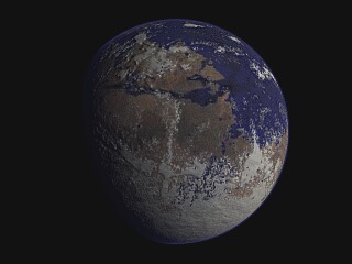
The following four images were generated using a POV-Ray scene file based on one developed by Constantine Thomas. The extra goodies are specular reflection from water surfaces and variable-transparency clouds based on a cloud map of the Earth.
I have changed the atmospheric haze code slightly, and added some small-scale variation to the cloud bump-map, and used land- and sea-maps based on the image map used for the previous three views- alas, this means that the specular reflection layer does not work on the first four images shown below...
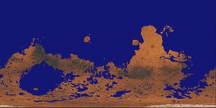
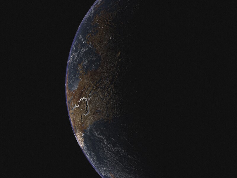
Mars 1 view from south of the equator. The south pole is under the extensive cloud cover at the bottom of the planet;
Valles Marineris
is just above the centre of the disc.
view from well north of the equator, after the northern mid-winter. An ice cap has developed over the north pole, and Elysium Mons is visible just below the centre of the disc. The northern limits of Hesperia Planum appear near the lower limb of the planet.
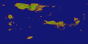
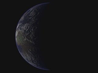
Venus 1
from above the equator. Aphrodite Terra is visible.
a crescent view.
Whilst these views are not unappealing, they can be improved.
Higher-resolution bump, image and cloud maps may be used, and specular reflection from water may be added. It is possible to wrap a height field (employing the same image as used for a bump map) around a sphere (using Gilles Tran's method for doing so in POV-Ray 3.5) and to project the planetary image map onto that, and to combine the resulting surface with an "ocean" sphere having specular reflection properties.
The ocean sphere can have an image map made
from tinting the height field image with an ocean colour, in order
to represent different depths of water. Media code can then be added
to simulate the atmosphere, and a cloud map to give cloud cover.
Medium- to high-resolution maps have been used, from various sites, including NASA's Blue Marble site, and from www.space-graphics.com.
Mars essentially the same views as on the first terraforming page. No cloud layer, but specular water reflections, atmospheric haze,
and a "translucent" water layer to reveal depth variations.
As before. The land image map is, I think, actually based on Magellan radar reflectivity data, so it does not actually represent the true pigmentation
of the surface - whatever that may turn out to
be...
including cloud maps. On Mars, Valles Marineris is just above and right of centre; the view is from south of the equator. The image map for Mars has been modified as follows: the height-field image was inverted (i.e. made negative) tinted with green, and then merged with the "standard" image map. This gives low-lying areas a hint of green... In the crescent view of Venus, reflection of sunlight is seen from lakes in the Artemis Chasma region of Aphrodite Terra.
That is, the distribution of the clouds is relevant to the topography and atmospheric dynamics of Earth- not of Mars or Venus. Applying these cloud maps to Mars and Venus, as it were, is an approximation.
One might edit the cloud maps in order to reflect,
to some degree, the topography of a wet Mars or Venus, but the
possible atmospheric circulation patterns that would apply in each
case are another matter again.
|