|

by Trisha Leigh
August 15, 2024
from
TwistedSifter Website
Source:
NASA's
Scientific Visualization Studio
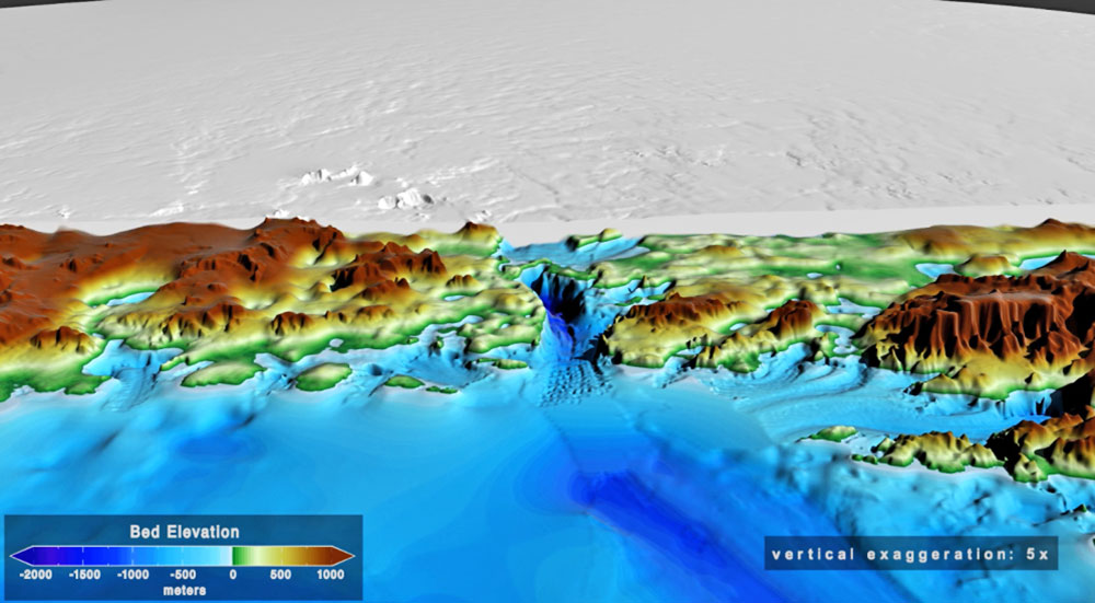
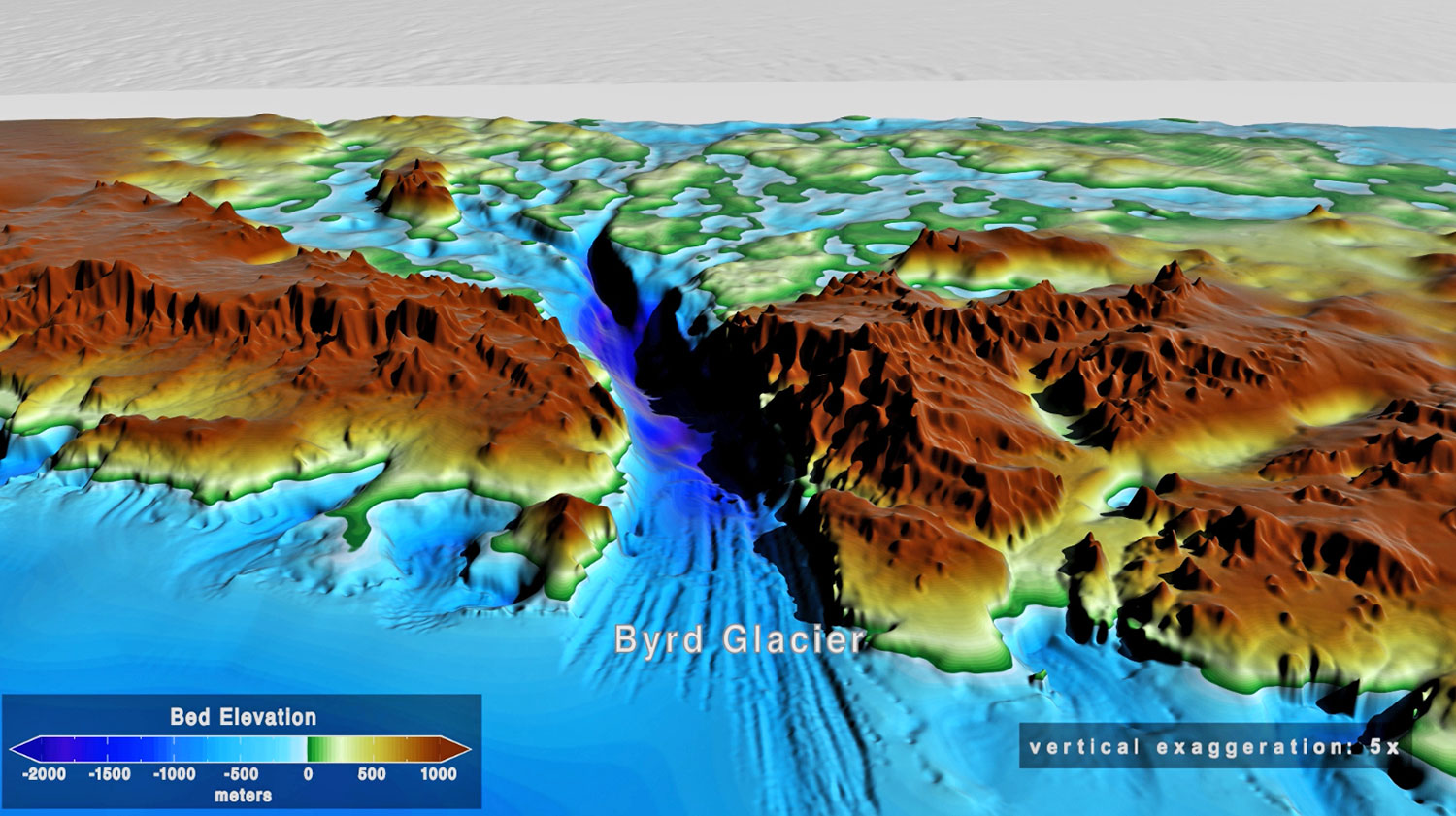
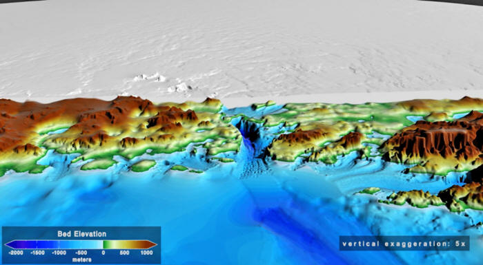
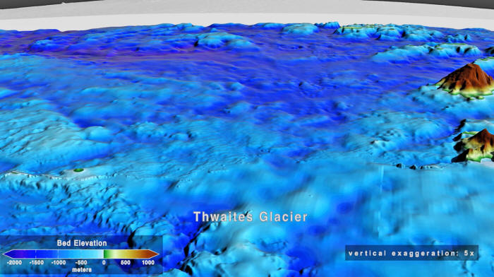
If you check out images of Antarctica today, it might seem like one
long, flat sheet of ice (except for the mountains and cliffs, of
course).
Underneath, though, it's a
whole different story.
The ice over the top of everything is an average of 1.4 miles thick,
but beneath it are rocky mountains, volcanoes, and canyons that have
been trapped there for millions of years.
Satellite data and radar surveys have made it possible to see the
topography of the bedrock with startling clarity, and we have a
pretty amazing map known as
BedMachine Antarctica:
The map was the culmination of years of research by 19 different
institutes around the world, including,
-
NASA
-
the National Science Foundation
-
Australia's Cooperative Research Centers
Program
-
the National Natural Science Foundation
of China
-
the British Antarctic Survey,
...to name a few.
Looking at it is like having x-ray vision, and the data from the map
is a gold mine for scientific communities around the world.
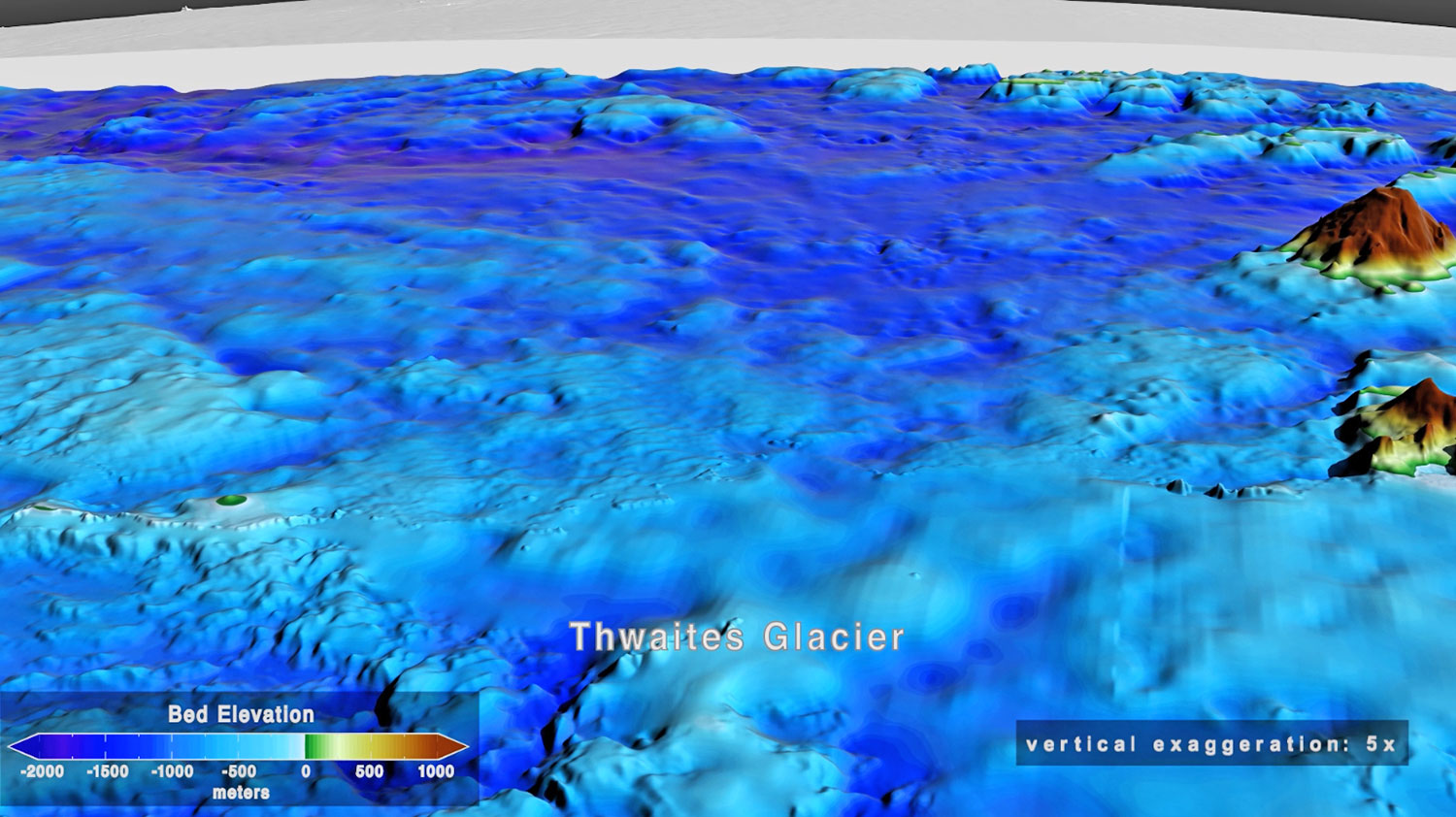
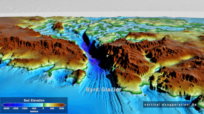
One of the biggest surprises the research uncovered was how huge the
Denman Glacier actually is:
more than 11,500 feet (~3,500 meters) below
sea level, making it the deepest point on continental Earth.
Source:
NASA's
Scientific Visualization Studio
Professor Mathieu Morlighem, an associate professor at the
University of California Irvine,
issued a statement on the finding
back in 2019.
"Older maps suggested a shallower canyon, but
that wasn't possibly; something was missing.
With conservation of mass, by combining
existing radar survey and ice motion data, we know how much ice
flows through the canyon - which, by our calculations, reaches
3,500 meters below sea level, the deepest point on land.
Since it's relatively narrow, it has to be
deep to allow that much ice mass to reach the coast."
The fact that Antarctica has volcanic tendencies
also comes as a bit of a surprise to some, even though there are,
138 volcanoes in West Antarctica
alone...!
Source:
NASA's
Scientific Visualization Studio
Most are dormant, but around 9 of them
remain active to this day.
Mount Erebus is 12,448 (3,794
meters) feet tall and is the southernmost active volcano on the
planet...
So, it's not as boring as it looks.
Which I would guess is true of a great many things in this world...
|